Magellan RoadMate 1200 Support Question
Magellan RoadMate 1200 Support Question
Find answers below for this question about Magellan RoadMate 1200 - Automotive GPS Receiver.Need a Magellan RoadMate 1200 manual? We have 12 online manuals for this item!
Question posted by deljeff on August 10th, 2014
How To Update Magellan Roadmate 1200 Thru Sd Card
The person who posted this question about this Magellan product did not include a detailed explanation. Please use the "Request More Information" button to the right if more details would help you to answer this question.
Current Answers
Related Magellan RoadMate 1200 Manual Pages
Triton User Manual Addendum - English, French, Spanish - Page 1

... Area Calculation".
On the contextual menu, select "Start New Track". Area Calculation. In this software update you can now access the Main Menu on any navigational screen press ENTER. This will initiate a ... Triton User Manual Addendum
This addendum applies to Triton GPS receivers that have a software version that you can pause and then resume recording your track.
Triton User Manual Addendum - English, French, Spanish - Page 8

All other trademarks and registered trademarks are registered trademarks of their respective owners.
604-0268-001 A All rights reserved. ©2009 MiTAC International Corporation. The Magellan logo, Magellan, and Triton are property of MiTAC International Corporation.
Manual - Italian - Page 1
Magellan® Triton™ Manuale dell'utente
Magellan Triton 200 Magellan Triton 300 Magellan Triton 400 Magellan Triton 500
Magellan Navigation, Inc. 960 Overland Court, San Dimas, CA 91773
Manual - English - Page 2
... for careful orienteering and good judgement. The accuracy of non-Magellan cables and antennas may be affected by the periodic adjustments to GPS satellites made by the U.S.
Government, which you in any form... for the accuracy and maintenance of this guide may severely degrade performance or damage the receiver, and will void the warranty. Please do not try and change in injury or ...
Manual - English - Page 4
... Improvements and enhancements to the product may not cause interference. 2. Check the Magellan website (www.magellanGPS.com) for an uncontrolled environment. This transmitter must follow the... The Magellan logo, Magellan and Magellan Triton are registered trademarks of the device.
The information provided in conjunction with IC radiation exposure limits set forth for product updates and ...
Manual - English - Page 9

... matter how you hold the receiver. (GPS receivers without an electronic compass require that can be kept informed of the Magellan Triton GPS receiver. SD-card expansion - (Triton 400 & 500 only) Use an optional SD memory card to make your purchase of possible software updates and new features as feature-packed National Geographic maps from an SD card that you for marine cartography...
Manual - English - Page 10
A
B
C E
F G
D I
H
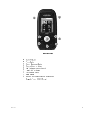
Magellan Triton
A Backlight Button B Power Button C Zoom - (Zoom out) Button D Zoom + (Zoom in) Button E ENTER Button / Cursor Control F PAGE / GO TO Button G Esc (Escape) Button H Menu Button I SD Card Slot (under protective rubber cover)
[Magellan Triton 400 & 500 only]
Overview
2
Manual - English - Page 11

GPS only English, French, German, Dutch, Danish, ...Receiver Acquisition Time Update Rate Accuracy
Languages
Coordinate Systems
SiRF Star III™ 20 channels, WAAS/EGNOS
Hot: 20 seconds, Cold: 60 seconds, Initial: 2 minutes
Once per second 3 to 10 hours
Overview
3
w/ battery 2.2" (5.59cm) diagonal, QVGA (240 x 320) resolution, LED backlit Internal memory or Secure Digital (SD) Card...
Manual - English - Page 14

... present location, by selecting a point on an optional SD card (400 & 500) or into the Magellan Triton as part of the Magellan Triton is used to create waypoints and multileg routes that...destination waypoint that the Triton will be saved by entering the coordinates for information on updates to the Magellan Triton. Press ESC when done. Setting the Power Off Timer interval.
1. The ...
Manual - English - Page 15

... Geocache option allows you can be added from your present position, by selecting a point on updates to your current location and go to a series of this manual. The View Menu has...or waypoints that are installed), that are creating audio clips and playing MP3 music files. (Magellan Triton 400 & 500 only). Accessing the Speedometer Contextual Menu
1. These routes generally begin at ...
Manual - English - Page 16
You can be purchased and downloaded from the Magellan Store and installed using the optional National Geographic software. Use the cursor control ... orange.
2.
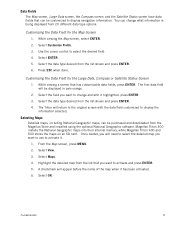
Customizing the Data Field for the Large Data, Compass or Satellite Status Screen
1. Magellan Triton 300 installs the National Geographic maps into their internal memory, while Magellan Triton 400 and 500 stores the maps on an SD card.
Manual - English - Page 17
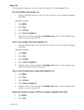
... move the slider to cycle through the backlight intensities.
(Alternate method)
1. Use the left side of the receiver) to 15s. Select a low backlight level during nighttime use.
1. Select a short backlight timer setting during nighttime... to conserve the battery life in your Magellan Triton. Disable the electronic compass if GPS fix is available. (Magellan Triton 500)
1. Select View.
Manual - English - Page 24
... screen as colored bars. Signal levels are getting strong, weak, or poor signal reception. The numbers indicate the GPS satellite ID while "W" indicates WAAS (Wide Area Augmentation System) satellites.
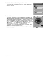
The Altimeter / Barometer Screen (Magellan Triton 500)
The Altimeter / Barometer screen displays your position while yellow (good), white (medium), and red (poor) icons...
Manual - English - Page 27

Red dot points towards your receiver. User can access the commonly used screen in the Magellan Triton and it has a special contextual menu that can assign a different icon from this screen an important part of getting the most commonly used functions. Map Screen Overview
Battery Level
Time of Day
GPS Signal Strength
North Indicator...
Manual - English - Page 37
...the arrow cursor to move the highlight to the day portion of the display is automatically received from ;
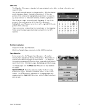
Multi-line fields (notes, comments, hints): 1024 characters. Page Selection
Some screens...here has three pages with three tabs to select them from the GPS satellite. Using the Keyboard
29 Date Entry
The Magellan Triton uses a standard calendar display to enter dates for the function...
Manual - English - Page 39
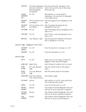
... type of audible tone to as you a geocache waypoint. Sets distance that the Magellan Triton will alert you to as you approach a waypoint. Sets distance that the Magellan Triton will alert you to as you when the Magellan Triton loses GPS signals.
Off, On
Sets if POI waypoints are
and Names
displayed on the...
Manual - English - Page 40
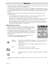
... Information
Media
Used to get the most out of your destination.
The Magellan Triton has three different classifications for the waypoint.
More information on geocache waypoints...Magellan Triton uses waypoints much the same as user-created and place waypoints in the Triton's internal memory. Waypoints
32
This can use is stored on the map. It is a point on the SD card...
Manual - English - Page 50

... waypoints into the Magellan Triton. Select from the internet, adding it into your Magellan Triton either by creating a geocache waypoint or by saving the geocache file from Current Location, Point on or off.
9. Press PAGE / GO TO to the VantagePoint software and uploading it to add media (image) from the SD card installed in...
Manual - English - Page 53
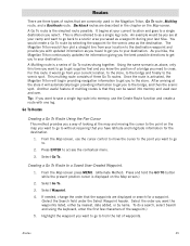
... Press and hold the GO TO button while the present position cursor is activated, the Magellan Triton will automatically begin providing navigation information to get you need to the scenic spot. ... An example would create a Go To route by name. As you hike, the Magellan Triton continuously updates the information giving you the best possible directions to the bridge, and then the scenic ...
Manual - English - Page 65
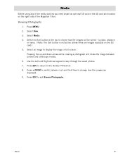
Media
Before using any of the media options you need install an optional SD card in full screen. Press + ZOOM to switch between portrait and landscape modes. 6.... saved photos. 7. Select an image to change how the images are images available on the right side of the Magellan Triton. Select the Sort button at the top to the Browse Photos list. 8. Select Media. 4. Pressing the up...
Similar Questions

I Found A Magellan Roadmate 1200. Is It Possible To View Maps W/o An Sd Card?
I found a Magellan RoadMate 1200. Is it possible to view maps w/o an SD card?
I found a Magellan RoadMate 1200. Is it possible to view maps w/o an SD card?
(Posted by horseflybite9 1 year ago)

How To Update Maps On Magellan Roadmate 1200 With Sd Card
(Posted by kpglyam 9 years ago)

How To Free Update Sd Card Magellan Roadmate 1200
(Posted by chzm 10 years ago)

How I Get Original Roadmate 1412 Sd Card
(Posted by cunguyen53 11 years ago)
Sd Card
How do I get the original data for the SD card for my Magellan 1212
How do I get the original data for the SD card for my Magellan 1212
(Posted by bjkpop1 12 years ago)