
Garmin eTrex 30 Support Question
Garmin eTrex 30 Support Question
Find answers below for this question about Garmin eTrex 30.Need a Garmin eTrex 30 manual? We have 2 online manuals for this item!
Question posted by sewinma on July 31st, 2014
How To Change The Route Colour On My Etrex 30 From Magenta To Black
The person who posted this question about this Garmin product did not include a detailed explanation. Please use the "Request More Information" button to the right if more details would help you to answer this question.
Current Answers
Related Garmin eTrex 30 Manual Pages
Owner's Manual - Page 3

...24 Calculating the Size of Contents
Getting Started 5 Device Overview 5 Using the eTrex Keys 6 Battery Information 7 Turning the Device On or Off.........8 Satellite Signals 8 Registering Your Device 8
Waypoints, Routes, and Tracks 9 Waypoints 9 Using Sight 'N Go 10 Where To? Table...Main Menu........28 Customizing Specific Pages........28 Profiles 29 System Settings 30 Display Settings...
Owner's Manual - Page 4

... Units of Measure...33 Time Settings 33 Position Format Settings 33 Heading Settings 34 Altimeter Settings 34 Geocaching Settings 35 Routing Settings 36 Marine Map Settings 37 Fitness 38 Resetting Data 38 Changing the Page Sequence.....39
Device Information 40 Adjusting the Screen 40 Updating the Software 40 Viewing Device Information..........40...
Owner's Manual - Page 9

... your current location as a waypoint.
1. Waypoints, Routes, and Tracks
Finding a Waypoint 1. Select Waypoint Manager. 2. Enter the new information. 5. eTrex Owner's Manual
9 Creating a Waypoint You can edit.... Select Done. Waypoints, Routes, and Tracks
Waypoints
Waypoints are locations you can save the waypoint without changes, select Done.
• To make changes to the waypoint, select ...
Owner's Manual - Page 10

Waypoints, Routes, and Tracks
Increasing the Accuracy of a Waypoint Location Waypoint averaging allows you to increase the accuracy ... Confidence status bar reaches 100%, select Save. Select Waypoint Averaging.
2. Using Sight 'N Go
Sight 'N Go is available on the eTrex 30. You can point the device at an object in the distance, lock in the direction, and then navigate to eight samples for ...
Owner's Manual - Page 11

.... For more information, go to .
Select a category.
3. Select Where To? > menu >
Search Near.
2. eTrex Owner's Manual
11 Finding a Location Near Another Location 1. Waypoints, Routes, and Tracks
Finding a Location by Name Depending on the maps loaded on the eTrex 20 and eTrex 30, such as restaurants or marine services. Additional Maps You can search for cities...
Owner's Manual - Page 16

...Navigate using the map or compass.
1. Select Where To?. 2.
Map
represents your route is marked with a magenta line. 5. Select a category. 3. Stopping Navigation Select Where To? > Stop ...eTrex Owner's Manual
Select one or more options:
• Use the Thumb Stick to pan the map to view different areas.
• Select ▲ and ▼ to your route marked with a magenta...
Owner's Manual - Page 17

... pointer to navigate to the destination.
3.
Navigation
Compass
The eTrex 30 has a 3-axis, electronic compass. eTrex Owner's Manual
17 Select Profile Change > Automotive.
2.
Use the map to navigate to your ...load City Navigator maps.
Navigating a Driving Route Driving route navigation is using the automotive profile, the compass displays GPS heading, not magnetic heading. You can ...
Owner's Manual - Page 19

... on the eTrex 30.
To customize the elevation plot, see page 34. Select Elevation Plot.
Resetting the Elevation Plot Select Elevation Plot > menu > Reset > Clear Current Track > Yes. Select Compass. 3.
Viewing Details about the point appear at the top of the plot. Navigating with the course pointer, you can change the pointer setting...
Owner's Manual - Page 23

... a chirp 1.
When you can find a chirp in a geocache. A chirp is available on the eTrex 30.
Select Setup > Geocaches.
2.
If available, select Go to navigate to a geocache (page 22). For... next stage of the geocache that you are within 33 feet (10 m) of the geocache. eTrex Owner's Manual
23 chirp™
chirp programming and searching is a small Garmin accessory that contains ...
Owner's Manual - Page 24

... Proximity Alarms.
2.
Follow the on-screen instructions. Select a category.
4. When you are within 10 feet (3 m) of a particular location.
1. Applications
Applications
Sharing Data
The eTrex 30 can share waypoints, geocaches, routes, and tracks. Sending and Receiving Data Wirelessly Before you can send or receive data when connected to another compatible device.
Select Done. Select...
Owner's Manual - Page 34

... the compass.
• Go To Line (Pointer)-allows you to a GPS compass when you turn the device on.
34
eTrex Owner's Manual
sets the direction to your destination.
◦◦ Course ...
◦◦ Bearing (Small or Large)- The default coordinate system is available on the eTrex 30.
Altimeter Settings
This function is WGS 84.
Heading Settings
This function is using. Select Setup...
Owner's Manual - Page 36
... for the type of geocaches found.
See the chirp Owner's Manual at http://www.garmin.com.
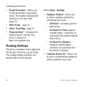
Select Setup > Routing.
• Guidance Method-allows you are shorter in order to optimize your route.
36
eTrex Owner's Manual calculates on the activity selected. This number automatically increases as you to select a transportation method in distance...
Owner's Manual - Page 37

... fishing.
• Appearance-allows you to set the appearance of marine navigation aids on the eTrex 20 and eTrex 30.
eTrex Owner's Manual
37 Customizing Your Device
Marine Map Settings
This function is available on the map....available only for some activities.
◦◦ Auto-automatically routes you to the next point.
◦◦ Manual-allows you to select the next point on the...
Owner's Manual - Page 43

... NT. Turn the D-ring counter-clockwise, and pull up , as instructed in the battery compartment.
➊➋
eTrex Owner's Manual
43 Also, some maps are available preloaded on memory cards. File Types The device supports these file types...
• GPX geocache files
Device Information
Installing a microSD Card The eTrex 20 and eTrex 30 can use microSD cards for more information.
1.
Owner's Manual - Page 46

... 3 m) of the ANT+ accessory.
2. Before you must install the accessory according to view the heart rate or cadence data (page 28).
46
eTrex Owner's Manual Select Search for the eTrex 30.
Using Optional Fitness Accessories 1. Select Setup > Fitness.
3. Customize your device. These accessories use optional fitness accessories including a heart rate monitor or a cadence...
Owner's Manual - Page 50

... next waypoint on your
current course.
Turn
The angle of sunset based on a
destination along a
route.
50
eTrex Owner's Manual
Trip Time Moving
A running tally of Day
Time to Destination Time to your
destination and your GPS position.
The direction in
degrees) between
the bearing to Next
To Course
Description
Your average speed...
Owner's Manual - Page 51

Vertical Speed Your rate of
ascent or descent
to a predetermined
altitude. Data Field Description
Vert.
The last point on
Next
your route.
Speed to your rate of altitude gain or loss over time. Waypoint at The next point on a route to The measurement
Dest. Waypoint at Dest. Appendix
eTrex Owner's Manual
51
of your destination.
Owner's Manual - Page 56

... 52 data 38 device 52 elevation plot 20 restoring default settings 39 routes 12-13 active route 13 avoidance 37 creating 12 deleting 13 editing 13 navigating 13 settings 36
S satellite signals 8, 26, 47,
49, 52 system settings 30 turning off GPS 26, 27
saving tracks 15
sharing data 24 Sight N' Go 10 software...
Quick Start Manual - Page 5

... how you are using it. eTrex 20/30 Quick Start Manual
5
Select Profile Change. 2. While the device is on -screen instructions. The eTrex 30 has a 3-axis, electronic compass.... 3.
You should calibrate the compass after moving long distances, experiencing temperature changes, or changing the batteries.
1.
Select a profile. Calibrating the Compass
Notice Calibrate the electronic...
Quick Start Manual - Page 8

... a magenta line.
5. Using the Map
1. Select Map. The position icon represents your route marked with your location on , a track log is created. As you move the map to different areas.
• Select ▲ and ▼ to record tracks more actions:
• Use the Thumb Stick to move with the Bearing Pointer The eTrex 30...
Similar Questions

How To Change Tones Of Etrex 20 When Approaching Geocaches
(Posted by meadddabd 9 years ago)

Garmin Etrex 30 Language
I have an eTrex 30 and the language not open ,could you please let me know what sall i do?
I have an eTrex 30 and the language not open ,could you please let me know what sall i do?
(Posted by mnazari123 10 years ago)

Garmin Etrex 30 Language Change
I accidentally selected the wrong language on initial start up. How do I set English as the language
I accidentally selected the wrong language on initial start up. How do I set English as the language
(Posted by vk3afw 10 years ago)

How To Change The English To Persian Language Of Garmin Gps 72h ?
how to change the english to persian language of Garmin GPS 72H ?
how to change the english to persian language of Garmin GPS 72H ?
(Posted by sirussh 11 years ago)