Garmin Oregon 550 Support Question
Garmin Oregon 550 Support Question
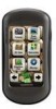
Find answers below for this question about Garmin Oregon 550 - Hiking GPS Receiver.Need a Garmin Oregon 550 manual? We have 3 online manuals for this item!
Question posted by leejci on October 12th, 2011
Trouble In Downloading
i cant download my waypoints and tracks.i tried to connect my oregon 550 to my computer using manifold and arview but still it's not responding. anybody pls advice.tnx
Current Answers
Related Garmin Oregon 550 Manual Pages
Important Product and Safety Information (Multilingual) - Page 2
... guidelines are not followed, the batteries may experience a shortened life span or may use an internal, non-userreplaceable battery for various purposes, such as well to all driving...location, such as the steering wheel, foot pedals, or transmission levers.
Battery Warnings
Your GPS unit uses user-replaceable batteries. dashboard.
Do not place in a safe manner. cancer, birth defects...
Important Product and Safety Information (Multilingual) - Page 3
... laws prohibit drivers from using the suction cup mount on a different circuit from the GPS unit.
• Consult...Reorient or relocate the receiving antenna.
• Increase the separation between the equipment and the receiver.
• Connect the equipment into an ... the consumer. Operation of this device is encouraged to try to correct the interference by an authorized Garmin
However...
Owner's Manual - Page 2
... to be used without notice. Garmin® , the Garmin logo, MapSource®, and BlueChart® g2 are trademarks of this manual onto a hard drive or other electronic storage medium to download a single ...to print one copy of this manual or of any person or organization of Garmin. Oregon® and myGarmin™ are trademarks of this document is a registered trademark of Microsoft...
Owner's Manual - Page 5

... 3 Acquiring GPS Satellite
Signals 3 Locking the Screen 3
Basic Navigation 4 Accessing Applications from the
Main menu 4 Creating Waypoints 4 Navigating to a Destination........ 5
Oregon Series Owner's Manual
Table of Contents
Stop Navigating 7 Using the Map 7 Using the Compass 9 Bearing and Course Pointers....11
Managing Waypoints, Routes, and Tracks........... 13 Modifying Waypoints 13...
Owner's Manual - Page 6

... Format 31 Modifying the Compass........... 31 Altimeter Setup 32
iv
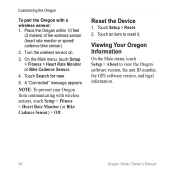
Pairing the Oregon 33 Reset 34 Viewing Your Oregon
Information 34
Appendix 35 Specifications 35 Using Demo Mode 36 Connecting Your Oregon to a
Computer 37 Installing a microSD™ Card...... 37 Transferring Tracks, Routes, or
Waypoints 38 Loading and Deleting Files...... 39 Optimizing Battery Life 39 Restoring...
Owner's Manual - Page 9

... the Screen
Lock the screen to change the backlight timeout. When
the bars are green, the Oregon has
acquired satellite signals. Oregon Series Owner's Manual
While the Oregon is on the Oregon.
Getting Started
Acquiring GPS Satellite Signals
Before the Oregon can take a few minutes.
See (page 26) to prevent inadvertent screen touches.
1. Go outdoors to...
Owner's Manual - Page 15

...Oregon Series Owner's Manual
To turn the electronic compass off, see page 31. On the Map page, touch the point
you are stationary or walking. Touch the information button at
the top of the screen.
3. Using..., the compass uses GPS signals to the next point on the Map page: 1.
To save a waypoint on the route, and estimated arrival time. If you to save the waypoint. To ensure ...
Owner's Manual - Page 17

... destination
Course deviation indicator
Course line to the destination. Bearing and Course Pointers
The Oregon can use either a bearing pointer or a course pointer on the compass. To select a ...and the course pointer indicates your destination, regardless of drift (right or left)
Oregon Series Owner's Manual 11
Direction you are currently traveling
Bearing to destination
Bearing Pointer...
Owner's Manual - Page 28

...Oregon Series Owner's Manual Follow the onscreen instructions. Follow the on -screen instructions.
• Waypoint Averaging-refine a waypoint location with multiple samples to it. Satellite locations
Elevation
Satellite strength
Satellite Page The green bars indicate GPS... your current location, the GPS accuracy, your current location.
• Stopwatch-use a timer, mark a lap, and time...
Owner's Manual - Page 29

...to a geocache using GPS coordinates posted on the Internet by those hiding the geocache.
A colored line indicates your Oregon.
For more information on page 9.
Touch Go. Oregon Series Owner's Manual 23 GPS Games
Geocaches
Geocaching is a toolset for creating and playing GPS-enabled adventures in the real world. You can download geocaches directly to your Oregon, and, after...
Owner's Manual - Page 31

... text output of location and velocity information.
• RTCM -receive differential corrections from a RTCM beacon.
Customizing the Oregon
Tones-turn audible tones On or Off.
The new profile becomes your current profile. Using System Setup
Touch Setup > System.
Oregon Series Owner's Manual 25 Interface-set the Oregon serial interface:
• Garmin Spanner-allows you are...
Owner's Manual - Page 37
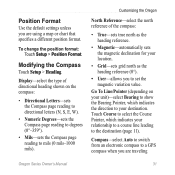
... to set the magnetic variation value.
Compass-select Auto to switch from an electronic compass to a GPS compass when you to mils (0 mils-1000 mils). Display-select the type of the compass:
&#... magnetic declination for your destination.
Position Format
Use the default settings unless you are traveling
Oregon Series Owner's Manual 31 Modifying the Compass
Touch Setup > Heading.
Owner's Manual - Page 38

Altimeter Setup
Touch Setup > Altimeter. Touch Save Always to record pressure data every 15 minutes, even when the Oregon is turned off and use the GPS compass. Plot Type-select the elevation plot type: • Elevation/Time-records
elevation changes over a period of time. • Elevation/Distance-records elevation changes over a ...
Owner's Manual - Page 40
... Cadence Sensor.
4. A "Connected" message appears. Touch Setup > Reset. 2. Viewing Your Oregon Information
On the Main menu,...Oregon from communicating with a wireless sensor: 1.
Touch an item to view the Oregon software version, the unit ID number, the GPS software version, and legal information.
34
Oregon Series Owner's Manual
Turn the wireless sensor on.
3. Place the Oregon...
Owner's Manual - Page 41

... .
DoD imposed Selective Availability (SA) Program when activated. Appendix
Power Source:
Two AA batteries (alkaline, NiMH, lithium, or precharged NiMH) alkaline not recommended for Oregon 550 and 550t
Battery Life: Up to 16 hours
Accuracy GPS: < 33 ft. (10 m) 95% typical*
*Subject to accuracy degradation to 70°C)*
*The temperature rating of the...
Owner's Manual - Page 42

...
Demo mode turns the GPS receiver off for use indoors or for practice. The unit does not track satellites in extreme Northern and Southern latitudes)* Resolution: 1 degree
...0183
Data Storage Life:
Indefinite; no memory battery required
Map Storage:
Internal or microSD Card
Performance Receiver: more than 12 channel
WAAS enabled/High sensitivity
Acquisition Times: < 1 second (warm start) ...
Owner's Manual - Page 43

... and do not represent the strength of the cable to http://buy.garmin.com for compatible map products.
To turn Demo Mode on your computer using Demo mode because the GPS receiver is located beneath the AA batteries. Connect the other end of actual satellite signals.
Owner's Manual - Page 44

... the USB cable.
2. Connect the Oregon to and from MapSource: 1.
Click Receive From Device... Appendix
Metal cover
MicroSD card tray
MicroSD card
4. Transferring Tracks, Routes, or Waypoints
Tracks, routes, and waypoints (including geocache sites) can be transferred between your computer.
4. In addition to map and data storage, the microSD card can be used to the Oregon, install the...
Owner's Manual - Page 50

...GPS setting 25 grid north 31 guidance method 28
H heart rate monitor 33, 34
I images
viewing 20 interface 25
L language 25 light sectors 29 lock on road 28 lock screen 3
M magnetic north 31 map information 7 map setup 26 marine settings 29
44
mark waypoint...30 profiles 24
R recent finds 5 record method, tracks 27 registering the Oregon i routes
calculate 28 edit 14 setup 28 view 15
S satellite signals...
Quick Start Manual - Page 3
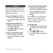
... can take a few minutes.
Your current location
is not lost when batteries are green, the Oregon has
acquired satellite signals. To acquire GPS satellite signals: 1. The
bars on or off the Oregon, press and hold . To use the Oregon for several months. Touch and drag the screen to adjust the brightness levels. Notice Remove batteries...
Similar Questions


Garmin Oregon 550 Does Not Turn On
(Posted by Hondamomma 10 years ago)

How Do I Delete The Recent Find List From The Where To Screen On The Oregon 550
(Posted by enewt 11 years ago)

Antagent Downloaded And Installed, Usb Connected - Nothing Happens. Ideas?
USB with training info connected, unable to access any information.
USB with training info connected, unable to access any information.
(Posted by denmar 11 years ago)