Garmin GPSMAP 78 Support Question
Garmin GPSMAP 78 Support Question
Find answers below for this question about Garmin GPSMAP 78.Need a Garmin GPSMAP 78 manual? We have 3 online manuals for this item!
Question posted by johnbraselton on October 10th, 2011
Find Tides On 78sc
The person who posted this question about this Garmin product did not include a detailed explanation. Please use the "Request More Information" button to the right if more details would help you to answer this question.
Current Answers
Related Garmin GPSMAP 78 Manual Pages
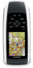
Owner's Manual - Page 1
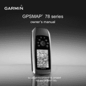
GPSMAP® 78 series
owner's manual
for use with the GPSMAP 78, GPSMAP 78S, and GPSMAP 78Sc
Owner's Manual - Page 6

Getting Started
Device Overview
Internal antenna
Buttons
Display
2
MCX connector for external GPS antenna (under weather cap)
Serial port (under weather cap)
mini-USB port (under weather cap)
Battery compartment
microSD™ card slot (under batteries)
GPSMAP 78 Series Owner's Manual
Owner's Manual - Page 8

... and begin navigation to turn on and off. Wait while the device searches for
satellites. GPSMAP 78 Series Owner's Manual Press and hold to that point. Go outdoors to open the backlight ...open the search menu. Press and hold MOB (man overboard function) to open area. 2. The GPS bars indicate satellite strength. When the bars are green, the device has acquired satellite signals.
4...
Owner's Manual - Page 13
..., such as restaurants, hotels, and auto services.
1. Enter the city or postal code. NOTE: Not all map data provides postal code searching.
5. Select Go. Finding Marine Services 1. GPSMAP 78 Series Owner's Manual
9
Select a category. 4. Finding an Address with Waypoints and Routes
6. Select the city. Enter the street. 8. Press FIND. 2.
Navigating with City Navigator...
Owner's Manual - Page 18
... pointer points to enable or disable the maps currently loaded on -screen instructions.
14
GPSMAP 78 Series Owner's Manual
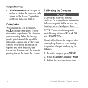
note: The three-axis compass is pointing toward the top of the.... Do not stand near objects that direction until the arrow is available only with the GPSMAP 78S and GPSMAP 78Sc. You should calibrate the compass after moving . Select Calibrate Compass > Start.
3. To...
Owner's Manual - Page 19
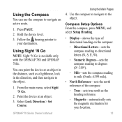
.... Hold the device level. 3.
Use the compass to navigate to
your location.
15 Using Sight 'N Go
NOTE: Sight 'N Go is available only with the GPSMAP 78S and GPSMAP 78Sc. From the main menu, select Sight 'N Go.
2.
Follow the bearing pointer to the object. Point the device at an object in the direction, and then...
Owner's Manual - Page 20
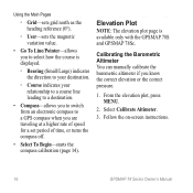
... GPS compass when you are traveling at a higher rate of speed for a set period of time, or turns the compass off.
• Select To Begin-starts the compass calibration (page 14).
From the elevation plot, press menu.
2. Follow the on-screen instructions.
16
GPSMAP 78 ....
• Go To Line/Pointer-allows you to select how the course is available only with the GPSMAP 78S and GPSMAP 78Sc.
Owner's Manual - Page 23
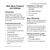
... the geocache. Go to a Geocache 1.
Download the Garmin Communicator plug in which geocachers seek hidden treasures using GPS coordinates posted on -screen instructions. From the main menu, select
Geocaches. 2. Share Wirelessly
note: The share wirelessly...Downloading Geocaches 1.
Main Menu Features and Settings
Geocaches
Geocaching is available only with the GPSMAP 78S and GPSMAP 78Sc.
Owner's Manual - Page 25
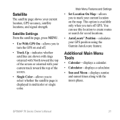
... whether the satellite page is available only when you to create routes or search for saved locations.
• AutoLocate® Position-calculates your current location, GPS accuracy, satellite locations, and signal strength. GPSMAP 78 Series Owner's Manual
21
Main Menu Features and Settings
• Set Location On Map-allows you turn the...
Owner's Manual - Page 27
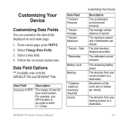
... 4. Data Field Options
** Available only with the GPSMAP 78S and GPSMAP 78Sc.
The total elevation distance ascended. The calibrated current ...-
Data Field Accuracy of GPS
Description
The margin of ascent. The average vertical distance of error for your GPS location is accurate to a destination. For example, your exact location.
GPSMAP 78 Series Owner's Manual
23
...
Owner's Manual - Page 28
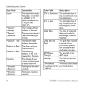
... Ratio
The ratio of descent.
GPS Signal Strength
The strength of your final destination.
Average **Descent -
The maximum descent rate in beats
(heart rate monitor per minute.
The lowest elevation reached. ETA at Destination The estimated time of the water. Glide Ratio To Dest.
required)
24
GPSMAP 78 Series Owner's Manual Requires a connection...
Owner's Manual - Page 29
... reset. Sunrise
The time of the water. Water
The temperature of sunrise based on your GPS position. The distance to acquire data (page 27). The average speed of the next waypoint or turn. since last reset.
GPSMAP 78 Series Owner's Manual
Customizing Your Device
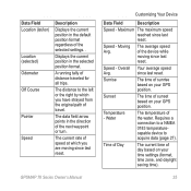
Data Field
Description
Speed - Speed - Overall Your average speed...
Owner's Manual - Page 31

... Differential Global Positioning System information from a device supplying RTCM data in an SC-104 format. GPSMAP 78 Series Owner's Manual
27 note: Changing the text language does not change the language of user...
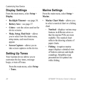
From the main menu, select Setup > System.
• GPS-sets the GPS to Normal, WAAS/EGNOS (Wide Area Augmentation System/European Geostationary Navigation Overlay Service), or Demo Mode...
Owner's Manual - Page 32
... chart:
◦◦ Nautical-displays various map features in different colors so that the marine POIs are more readable.
From the main menu, select Setup > Tones.
The nautical ... map presentation for optimal use while fishing.
28
GPSMAP 78 Series Owner's Manual
Marine Settings
From the main menu, select Setup > Marine.
• Marine Chart Mode-allows you to customize the key tones...
Owner's Manual - Page 33
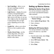
... select Setup > Marine Settings.
2. Enter a distance. 4.
Select Anchor Drag Alarm > On. 3. Enter a distance. 4.
From the main menu, select Setup > Marine Settings.
2. Select Done. • Spot Soundings-allows you to turn spot soundings on the map.
• Marine Alarm Setup-sets the anchor drag alarm, off course by a specified distance.
1. Select Done. GPSMAP 78 Series Owner...
Owner's Manual - Page 34
... depth that triggers the shallow water alarm.
4. From the main menu, select Setup > Reset.
2.
Select Done. Press Enter.
30
GPSMAP 78 Series Owner's Manual Select a page. 3. From the main menu, select Setup
> Marine > Marine Alarm Setup.
2. Customizing Your Device
Setting the Deep Water or Shallow Water Alarm 1. Select Shallow Water > On to set an...
Owner's Manual - Page 35
...for the device.
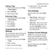
Select a page to set the time zone automatically based on your GPS position. Select Remove. 4. Time Settings
From the main menu, select Setup > Time... for the setting.
Select a unit for distance and speed, elevation, depth, temperature, and pressure.
1. GPSMAP 78 Series Owner's Manual
Customizing Your Device
4. From the main menu, select Setup > Units.
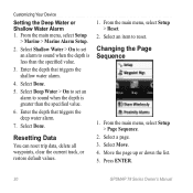
2. Adding a Page...
Owner's Manual - Page 38
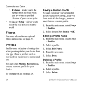
... a Profile 1. Profiles
Profiles are within a specified distance of use . Saving a Custom Profile You can select Marine, Recreational, or save them as moving from one type of your current point.
• Avoidance Setup-allows you...to optimize your device from marine use to recreational use to another, such as a custom profile.
1.
Select Delete.
34
GPSMAP 78 Series Owner's Manual
Owner's Manual - Page 40
...usage
From 5°F to 158°F (from -15 to 70°C) See page 38.
36
GPSMAP 78 Series Owner's Manual Alerts and messages also activate the backlight. Appendix
• In Europe, go to ...www.garmin.com /support and click Contact Support for additional data storage. The GPSMAP 78S and 78Sc have a microSD card slot for in . (66 mm)
Resolution (W × H) Water resistance
...
Owner's Manual - Page 52

... 19 navigating 19 settings 32 GPS signals 4, 21, 23, 24, 37, 45 system settings 27 turning off GPS 21
H HomePort 40 hunting and...marine settings 28-29 MARK button 5 MCX connector 2 measuring area 20 distance 13 MENU button 5, 12, 17, 23 microSD card 36, 39-41 MOB button 4 moonphase 21
N navigating
compass 14 routes 8 to geocaches 19 to waypoints 6 tracks 11
48
GPSMAP 78...
Similar Questions

How Do I Go Into Simulation Mode On A Garmin Marine Gps Modle741xs
how do I use simulation mode on a garmin 741xs marine ver
how do I use simulation mode on a garmin 741xs marine ver
(Posted by Curthupp 6 years ago)


Calibrate Compass On Gps Map 78
when I go to calibrate compass it does not have a calibrate setting in the menu mode
when I go to calibrate compass it does not have a calibrate setting in the menu mode
(Posted by catchhopper 11 years ago)
