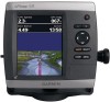
Garmin GPSMAP 531 Support Question
Garmin GPSMAP 531 Support Question
Find answers below for this question about Garmin GPSMAP 531 - GPS Receiver.Need a Garmin GPSMAP 531 manual? We have 4 online manuals for this item!
Question posted by sgp122 on August 16th, 2014
Boat Position Is Wrong At Dock And Tracking In Memory Now Show Going Over Land
The person who posted this question about this Garmin product did not include a detailed explanation. Please use the "Request More Information" button to the right if more details would help you to answer this question.
Current Answers
Related Garmin GPSMAP 531 Manual Pages
Installation Instructions - Page 4
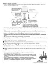
... hole on a transom: 1. Adjust the transducer assembly to the GPSMAP 400/500 series chartplotter. See page 9. notice: For cold water and heavy timber or debris areas, a metal 4-5 in . (9.5 mm) deep.
7. Position the transducer so that may degrade the boat performance and damage the propeller.
2. Position the transducer mount at the marked locations. Attach the...
Installation Instructions - Page 6
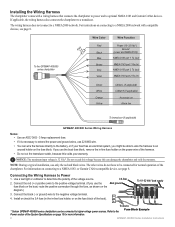
...more information. Connect the red (+ or positive) wire to the Power section of the chartplotter. Connect the black (- Refer to the positive voltage terminal. (If you use 22 AWG...the wiring harness also connects the chartplotter to determine the polarity of the boat).
+
To device
* Certain GPSMAP 400/500 series chartplotters can damage the chartplotter and void the warranty.
...
Installation Instructions - Page 10

... working properly, gradually increase the speed of the boat while
observing the operation of striking underwater objects. ...receiver
GPSMAP 421/431/441/451 (s) GPSMAP 521/531/541/551 (s): High-sensitivity 14 parallel channel WAAS-capable receiver.
GPSMAP 526/536/546/556 (s): High-sensitivity 12 parallel channel WAAS-capable receiver. Update Rate: 1/second, continuous
GPS Accuracy: Position...
Installation Instructions - Page 11
... ISO Request ISO Address Claim NMEA -
Command/Request/Acknowledge Group Function Transmit/Receive PGN List Group Function Product Information Vessel Heading Engine Parameters - Sonar Power:...Position Data Cross Track Error Navigation Data Navigation - Route/WP information GNSS DOPs GNSS Sats in View Wind Data
Compatible GPSMAP 400/500 series chartplotters are supported by the GPSMAP...
Quick Reference Guide - Page 1

...Symbol, Depth, Water Temp,
Comment, or Position).
OR From the Home screen, select Information > User Data > Waypoints. 2. Select Navigate To. 5. Select Go To.
To delete a waypoint or an .... (The Review button is only shown when more than one waypoint is in the vicinity.)
GPSMAP® 400/500 series
quick reference guide Press SELECT.
4. Follow the colored line on the...
Quick Reference Guide - Page 2

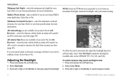
... satellite signals, the green bars disappear and the position icon displays a flashing question mark. Press and .... 5. Zooming In and Out on the unit, the GPS receiver must collect satellite data and establish the current location. From...between maximum backlight, minimum backlight, and your present location: 1.
The track memory is complete. 5.
Note: Press the Power key repeatedly to page...
Owner's Manual - Page 5

... Alarms 45 Setting the Total Fuel Onboard Alarm 47 Configuring My Boat 47 Configuring Other Vessels 48
Using Sonar 50 Understanding the Full ... List 56 Receiving Distress Calls 56 Man-Overboard Distress Calls Initiated from a VHF Radio........ 57 Man-Overboard Distress Calls Initiated from the Chartplotter.... 57 Position Tracking 57
Introduction...GPSMAP 400/500 Series Owner's Manual
iii
Owner's Manual - Page 10
...Power key. 2.
To switch between modes.
GPSMAP 400/500 Series Owner's Manual If a water speed wheel is not available if you are receiving NMEA sonar depth data. Refer to calibrate it ...No for AIS Receiver)-select the distance within which an alarm will sound if an AIS vessel is available only on track to cycle between maximum backlight, minimum backlight, and your boat (page 49...
Owner's Manual - Page 12
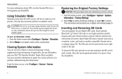
... mode because the GPS receiver is located on Simulator mode: 1. Inserting and Removing SD Cards
Your unit supports Secure Digital (SD) cards. Getting Started
For more information about GPS, visit the Garmin Web site at www.garmin.com/aboutGPS. The unit does not track satellites in until it from the chartplotter.
GPSMAP 400/500 Series...
Owner's Manual - Page 15

... Setup to configure the position of the data on the...Chart Menu To access additional settings or options for the Navigation chart, press MENU. GPSMAP 400/500 Series Owner's Manual
Using Charts
Data bars
• Cruising-turn on or... (only available while navigating). Select Auto to turn the GPS Speed, GPS Heading, Depth, and GPS Position data bar on or off .
Full Screen Map-view the ...
Owner's Manual - Page 16
... displays Wind VMG when the Route Leg data bar is available (page 68).
• Compass Tape-displayed at the top of the screen to go. 4. Press SELECT.
10
GPSMAP 400/500 Series Owner's Manual From the Home screen, select Charts. 2. Chart Setup-customize the Navigation chart settings (page 12).
Use the Rocker...
Owner's Manual - Page 18

...-resolution satellite images to a compatible marine wind sensor.
12
GPSMAP 400/500 Series Owner's Manual Service Points-turns marine service ...or apparent wind direction displays if the unit is connected to Off, Land Only, or On. To access additional object information: 1.
Using ... compass rose around your boat, indicating compass direction. On the Navigation chart, highlight an item with ...
Owner's Manual - Page 23

... or options from the boat. For settings and options related to Waypoints & Tracks, Other Vessels, and ...Data Bars, see "Navigation Chart Menu" on or off . (The Weather feature is only available if the chartplotter is highlighted. 2.
Mariner's Eye 3D (Water Hazard Colors) GPSMAP.... The On setting indicates shallow water and land with a color scale. Press SELECT to ...
Owner's Manual - Page 38

... Wrap.
• Off-does not record a track log. • Fill-records a track log until the track memory is recorded.
Follow the colored line on a variance from the true course before recording a track point. • Change-sets the value of the track plot. Select the track you want to be recorded. GPSMAP 400/500 Series Owner's Manual
Select either...
Owner's Manual - Page 39
...out of navigation (Go To, Route To, Guide To, or Follow Track), if you are...; Auto Guidance-uses the chart data and specified boat safe depth to determine the best course to help...for a three-dimensional navigation aid (page 16).
GPSMAP 400/500 Series Owner's Manual
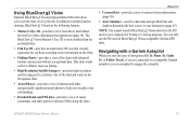
33 This chart ... realistic view of the land and water on BlueChart g2 Vision-compatible Garmin GPS units.
In addition to...
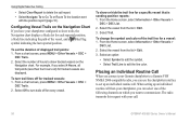
Owner's Manual - Page 62

... boat.
Select Review to delete the call .
Viewing the DSC List
The DSC list is received ...GPSMAP 400/500 Series Owner's Manual
Select DSC to edit the vessel name and add a comment. If a second call is a log of a vessel on the Navigation chart at the position sent with the distress call, that information is tracking the position of the vessel, and select Done.
Receiving...
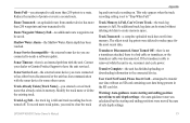
Owner's Manual - Page 64
... to set the duration of the vessel, and a Blue Flag symbol indicating the last reported position. From the Home screen, select Information > Other Vessels >
DSC List. 2. Placing an ...tracked vessels are displayed. Using Digital Selective Calling
• Select Clear Report to delete the call report. • Select Navigate To to Go To or Route To the location sent
with your call.
58
GPSMAP...
Owner's Manual - Page 78

... number is already in the "Off Course" alarm. Invalid MMSI-enter a valid MMSI. No Waypoints/Routes/Tracks/User Waypoints Found-attempted to transfer user data from an SD card that already exists in memory. DSC Position Report Received From-shows the MMSI or name associated with the unit. Deep Water Alarm-the Deep Water...
Owner's Manual - Page 79
... connected to needs a software update.
Track Memory is Full, Can't Create Track-the track log memory is a bad cable or transducer, or the transducer cable was disconnected. Transducer Disconnected, Sonar Turned Off-there is not a transducer attached, there is full. GPSMAP 400/500 Series Owner's Manual 73
Track Log Full-the track log is on . This only appears...
Owner's Manual - Page 84
... removing 6 sea conditions 66 SELECT key 5 Serial Port setup 44 Service Points 12
GPSMAP 400/500 Series Owner's Manual Index
high-pressure center 64 HOME key 5 hurricane information...threats 26 MENU key 5 messages 71
78
move a waypoint 29 My Boat 47
N
Navaid Type 14 Navigate To 11, 28, 30, 31,...21, 33 Position Format 42 position tracking 57 Posn. Precision 45 Power/Backlight key 5 power source 70 ...
Similar Questions

Gmx-200 Approach Track
I recently installed a Garmin GMX-200 to replace an older Apollo MX-20 in my Mooney Ovation 2 (steam...
I recently installed a Garmin GMX-200 to replace an older Apollo MX-20 in my Mooney Ovation 2 (steam...
(Posted by andrew52567 3 years ago)

Export Flight Logs & Tracks From Garmin 795
How can I export flight logs and tracks from my Garmin aera 795? On my previous Garmin 495 it worked...
How can I export flight logs and tracks from my Garmin aera 795? On my previous Garmin 495 it worked...
(Posted by markomajer 11 years ago)

Extracting Tracks And Waypoints From The Garmin Area 500
We have 2 years worth of tracks and waypoints stored on our GARMIN aera 500 that we cannot get off t...
We have 2 years worth of tracks and waypoints stored on our GARMIN aera 500 that we cannot get off t...
(Posted by andrea81536 11 years ago)

Storage Waypoint On Memory Card
Is there some way to storage the waypoints on memory card? Thks
Is there some way to storage the waypoints on memory card? Thks
(Posted by as532svr 12 years ago)

My Garmin Nuvi 2300 Gives Me A Wrong Home Position When Entering The House Numbe
I am staying in Tsumeb, Namibia, Southern Africa. When entering my house number on my Garmin Nuvi 23...
I am staying in Tsumeb, Namibia, Southern Africa. When entering my house number on my Garmin Nuvi 23...
(Posted by Hafeni 12 years ago)