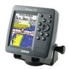
Get support for Garmin GPSMAP 292 - Marine GPS Receiver

Garmin GPSMAP 292 Support Question

Garmin GPSMAP 292 Support Question

Find answers below for this question about Garmin GPSMAP 292 - Marine GPS Receiver.
Need a Garmin GPSMAP 292 manual? We have 4 online manuals for this item!
Question posted by helge on July 20th, 2011

Garmin Gps 292 Can Not Recieve Satellite Signal

After winter pause my gps 292  garmin can not receive satellite signals. Two months ago I tried the first time and it took 24 hours but then worked fine. Now it wont find any signal.It has been kept indoor 20 degree and dry all winter, no harm done. Can I do anything? it has only been active for about 50 hours.

Current Answers

Answer #1: Posted by conventoantonio on October 10th, 2013 1:16 PM
conventoantonio

Member since:
October 10th, 2013

Points: 50
150
points
from garmin website, same problem i have, tomnorrow i will check this solution...

There could be a few causes of the device not acquiring satellites. If the device has moved a large distance since the last time it has acquired satellites or has been turned off for longer than a few weeks or months, the device may not be able to acquire the satellites correctly.

The first troubleshooting step is to perform an AutoLocate procedure. This procedure will clear the device's memory of previous satellite information, and try to download new information.

Note: This will not clear any user data like waypoints, routes, and tracks.

To perform the AutoLocate procedure, please follow these steps:

  1. Start with the device powered OFF
  2. Press and hold the Page button and Power ON the device
  3. Continue to hold both the Page and Power button until the I Agree button is highlighted in the lower right corner of the screen
  4. Press the Enter button

The device should now switch to the GPS satellite screen. Leave the device in clear view of the sky for at least 10-20 minutes to acquire satellites. If the device acquires the satellites before 20 minutes, the device can be used or powered off.

Related Garmin GPSMAP 292 Manual Pages

Owner's Manual - Page 3

... instructions for choosing the Garmin® GPSMAP® 292/298. The Main Pages section provides detailed explanations about the Sonar and Flasher Pages and how to create an unsurpassed portable GPS receiver. Before you have any pieces are missing, contact your unit. The GPSMAP 292/298 Sounder is CANet compatible. If you begin working with the packing list...
Owner's Manual - Page 8

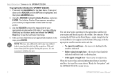
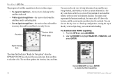
... until the GPS tab is ready for Navigation", and the GPSMAP 292/298 is highlighted, and then press ADJ/MENU once. 2. If the unit shows "Ready for the satellites indicated. • Hollow signal strength bars-the receiver has found the indicated satellite(s) and is collecting data. • Solid signal strength bars-the receiver is not necessary to use . 2 GPSMAP 292/298...
Owner's Manual - Page 9

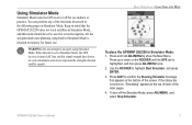
...;rm the Running Simulator message that the GPSMAP 292/298 does not track satellites in Simulator Mode. To turn off for future use indoors or practice. When the unit is retained...3. Use the ROCKER to Simulator Mode, the GPS receiver is highlighted, and then press ADJ/MENU once. 2. GPSMAP 292/298 Owner's Manual 3 Any satellite signal strength bars shown are only simulations and do not...
Owner's Manual - Page 14

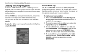
...coordinates manually. The unit must have acquired at least three satellites to mark your present position: 1. Use the ROCKER to highlight the new symbol, and press ENTER/MARK. 8 GPSMAP 292/298 Owner's Manual Use the ROCKER to enter the new... OPERATION > CREATING AND USING WAYPOINTS Creating and Using Waypoints The Garmin GPSMAP 292/298 stores up to 10 characters for the new waypoint. 2.
Owner's Manual - Page 27

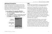
... uses marine VHF radio and Global Positioning System (GPS) technologies to "Connecting the Power/Data Cable" on page 92. For connection information, refer to transmit and receive location ...received from a Distress Call or Position Report. Information Window GPSMAP 292/298 Owner's Manual 21 When any nearby rescuer receives the DSC signal, an alarm sounds and they immediately receive...
Owner's Manual - Page 43

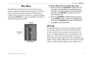
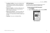
... The GPS tab provides a visual reference of what the receiver is accessed by function. GPSMAP 292/298 Owner's Manual 37 The signal strength is shown on a bar graph for additional instructions on the ROCKER, then press up or down to select individual items. 2. See page 6 for each satellite in the system, and is doing at any...
Owner's Manual - Page 44

... disable the WAAS capabilities. GPSMAP 292/298 Owner's Manual Use the ROCKER to align along your current track heading. MAIN MENU > GPS TAB The progress of satellite acquisition is shown in three stages: • No signal strength bars-the receiver is looking for the satellites indicated. • White signal strength bars-the receiver has found the satellite(s) and is collecting...
Owner's Manual - Page 45

... calculated in latitude, longitude, and elevation. • Simulating-the receiver is now being calculated in latitude, longitude, and elevation. • Ready for and collecting data from satellites visible at least three satellites have been acquired and your location is in Simulator Mode. GPS Tab Options GPSMAP 292/298 Owner's Manual 39 Using the ROCKER, highlight an...
Owner's Manual - Page 46

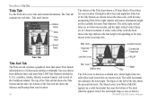
... the Tide Station and the date; The solid, light vertical lines are in 4-hour increments, and the light, dotted vertical lines are in a 24-hour span starting at midnight. level High tide curve Low tide curve Current time bar Current tide height bar MLLW Min. GPSMAP 292/298 Owner's Manual Station name Date Tide chart Event...
Owner's Manual - Page 49

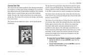
... true north.) The bottom of each chart shows a 24-hour block of a given current at the top) indicates the strength of the Caribbean islands. The solid, light vertical lines are in 4-hour increments, and the light, dotted vertical lines are in the local time box. GPSMAP 292/298 Owner's Manual 43 Highlight Current Position, and press...
Owner's Manual - Page 65

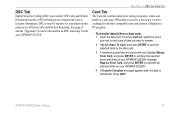
... to combine the selected items with other compatible units and Garmin's MapSource PC program. If transferring data from a data card: 1. A Transfer Complete message appears after the data is used by mariners to the data card. 3. To transfer data to transmit and receive location information. GPSMAP 292/298 Owner's Manual 59 DSC Tab Digital Selective Calling...
Owner's Manual - Page 74

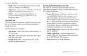
.... • None-provides no interfacing capabilities. 68 GPSMAP 292/298 Owner's Manual When you select Garmin Data Transfer, there are available: • Time Format-choose from 12 Hour, 24 Hour (military), or UTC time format. • Time Zone-choose your GPSMAP 292/298 to external NMEA devices, a PC, or another Garmin unit. • Garmin Data Transfer-is the proprietary format used to...
Owner's Manual - Page 93

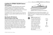
To acquire satellites, install the unit with internal antennas do not require this installation. APPENDIX > INSTALLING THE GPSMAP 292/298 EXTERNAL GPS ANTENNA Suggested locations for mounting the external antenna. The Garmin antenna screws directly onto any standard 1" x 14thread antenna mount. GPSMAP 292/298 Owner's Manual 87 The GPSMAP 292/298 with a clear view of the sky in all ...
Owner's Manual - Page 101

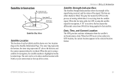
... track at the top of the signal. The gray bar means the GPS is in the process of storing orbital data it is being received, and the status of the screen. A "D" in the selected location format. Date, Time, and Current Location The GPS gets date and time information from the satellite signal. The outer ring represents the horizon...
Owner's Manual - Page 102

... on your GPSMAP 292/298 in the world. All SBAS systems use the same receiver frequency; The system is made up of WAAS in North America. therefore any location in regions that achieves the best accuracy. Currently, enabling WAAS on your Garmin GPS receiver, the receiver automatically uses the method that are not supported by GPS satellites alone. Eventually...
Owner's Manual - Page 104

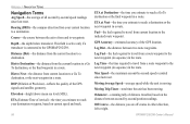
...current speed and track. 98 ETA at Next-the time you are off course in a route. GPS Accuracy-estimated accuracy of the GPS signals and satellite geometry. Dist to Destination-the distance from current location... second-by-second position readings. Off Course-the distance you estimate to the GPSMAP 292/298. APPENDIX > NAVIGATION TERMS Navigation Terms Avg Speed-the average of all second...
Owner's Manual - Page 107

...try...Satellite Reception-the unit has lost satellite signals. no additional route waypoints can be saved. Proximity Alarm-you are nearing a proximity waypoint. Shallow Water Alarm-the Shallow Water Alarm depth has been reached. No Tide Stations for the proximity waypoint indicated. Route Full-you entered a route name that already exists in Simulator Mode. GPSMAP 292...or Garmin ...
Owner's Manual - Page 109

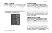
... LORAN TD SYSTEM LORAN TD Feature The LORAN TD (Time Delay) feature eases the transition from the Units tab on the LORAN signal for navigation, it simulates the operation of LORAN fi... the unit was actually receiving LORAN signals. The accuracy to Loran TD from using LORAN to the location stored in the United States by recreational vehicles. Because the GPSMAP 292/298 does not rely ...
Owner's Manual - Page 110

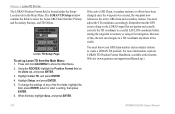
...press ENTER. 6. Using the ROCKER, highlight the Position Format field on the LORAN signal for navigation and actually converts the TD coordinate to a useful LAT/LON coordinate before storing the...the GPS is located under the Setup- For more information, read our LORAN TD Position Format Handbook, available at the Garmin Web site (www.garmin.com/support/userManual.jsp.) 104 GPSMAP 292/298...
Owner's Manual - Page 115

...Course Up 62 custom range 80 D data cards 94 data entry 6 GPSMAP 292/298 Owner's Manual date and time 95 Daylight Saving Time 68 delete DSC directory item 23 Depth Line 74 Dilution of Precision 98...nd 19 Find Key 5, 19 Fish Alarm 71 Flasher Page 84 G gain 73 Garmin Data Transfer 68 Go To 13 Distress Call 24 Position Report 24 GPS Tab 37 Options 39 H hard bottom 84 Heading Line 62 Highway Page 33 ...

Similar Questions

How Do I Go Into Simulation Mode On A Garmin Marine Gps Modle741xs
how do I use simulation mode on a garmin 741xs marine ver
(Posted by Curthupp 6 years ago)
Problem With Garmin Gpsmap 2006 C
Hello, I have this unit 2 years and i didn't have any problems. 6 months ago, for the first time it...
(Posted by georgempax 11 years ago)
Garmin 292/298 Problem.
i gets a ? mark on the screen, and when i turns it on and it searching for the satellite it says non...
(Posted by nicolaharding 11 years ago)
The Gps Will Not Pick Up The Satelite Signals.
I reinstalled the Garmin GPSMAP 292 after the winter break only to find out it will not pick up the ...
(Posted by larsburmeister 12 years ago)
No Signal From Antenna?
We feel we have wired the entenna int the gpsmap 4012 properly, but we are still not recieving a sig...
(Posted by CHRISSHELLY 12 years ago)
Ask a New Question
Use the box below to post a new question about this Garmin product .
Points & Prizes
  • You can earn points for nearly everything you do on HelpOwl.com
  • You can trade in those points for gift cards at leading retailers such as Amazon.com and Walmart
  • It's that simple!
See How it Works
Create a Free Account

Garmin Manuals

Find free Garmin GPSMAP 292 - Marine GPS Receiver manuals and user guides available at ManualOwl.com. Try out our unique manual viewer allowing you to interact with manuals from directly within your browser!

Garmin Reviews

View thousands of Garmin user reviews and customer ratings available at ReviewOwl.com.

Contact Information

Complete Garmin customer service contact information including steps to reach representatives, hours of operation, customer support links and more from ContactHelp.com.

Scoreboard Ratings

See detailed Garmin customer service rankings, employee comments and much more from our sister site.