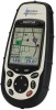
User Manual
Page 92
... PC AT-Pentium/300 or compatible • 64 MB RAM • True Color Video with 800x600 resolution • 60 MB Hard Drive Space • 32x CD-ROM drive • MS Windows 95/98/NT 4.0 (or higher) Magellan Meridian GPS Receiver Appendix The MapSend Streets CD allows you to load detailed street maps into...rectangular map region you choose to load into your Meridian. Features • Enables you to cut to load street maps for map objects (such as cities, lakes, etc.) by name. Maps are not pre-cut any region in the United States or Europe into the Merdian. • Allows you to ...
... PC AT-Pentium/300 or compatible • 64 MB RAM • True Color Video with 800x600 resolution • 60 MB Hard Drive Space • 32x CD-ROM drive • MS Windows 95/98/NT 4.0 (or higher) Magellan Meridian GPS Receiver Appendix The MapSend Streets CD allows you to load detailed street maps into...rectangular map region you choose to load into your Meridian. Features • Enables you to cut to load street maps for map objects (such as cities, lakes, etc.) by name. Maps are not pre-cut any region in the United States or Europe into the Merdian. • Allows you to ...

User Manual
Page 99
... improving the accuracy of two additional satellites displayed on their WAAS system: http://gps.faa.gov/programs/WAAS/waas.htm Magellan Meridian GPS Receiver 91 How accurate will typically experience accuracy improvements to around the country and... then transmitting the error corrections to include the latest WAAS (Wide Area Augmentation System) technology. There are over the Earth equator. The two satellites for Europe. Chances are using the GPS...
... improving the accuracy of two additional satellites displayed on their WAAS system: http://gps.faa.gov/programs/WAAS/waas.htm Magellan Meridian GPS Receiver 91 How accurate will typically experience accuracy improvements to around the country and... then transmitting the error corrections to include the latest WAAS (Wide Area Augmentation System) technology. There are over the Earth equator. The two satellites for Europe. Chances are using the GPS...