Quick Reference Guide
Page 3
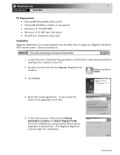
... Destination Location and Select Program Folder. (For most installations, accepting the default option displayed is downloadable from the Web free of charge for the Magellan MapSend Lite Installer. 3. Read the license agreement. Introduction Double click the icon for Magellan handheld GPS receiver users. If you accept the terms of the agreement click Yes. 5. Set your...
... Destination Location and Select Program Folder. (For most installations, accepting the default option displayed is downloadable from the Web free of charge for the Magellan MapSend Lite Installer. 3. Read the license agreement. Introduction Double click the icon for Magellan handheld GPS receiver users. If you accept the terms of the agreement click Yes. 5. Set your...

Quick Reference Guide
Page 1
...-ROM enhances the utility of Magellan map-capable receivers with many parks, lakes, streams, rivers, and dams. MapSend contains a wide assortment of built-in POIs that is available to you from within the MapSend software. The software's waypoint and route management features allow users to upload, download and customize data for any USA city and airport, along...
...-ROM enhances the utility of Magellan map-capable receivers with many parks, lakes, streams, rivers, and dams. MapSend contains a wide assortment of built-in POIs that is available to you from within the MapSend software. The software's waypoint and route management features allow users to upload, download and customize data for any USA city and airport, along...

Quick Reference Guide
Page 6
...to upload the POI's and Topo map (if available). - Make sure the regions you want to the GPS receiver and the required communication options have been marked in your PC. - Along with the check box for Topographic is available only with the MapSend Topo of your PC has been... properly connected to be uploaded have been set. - Greyed letters indicate that the upload or download process may differ from the GPS receiver to complete the file transfer. If so, then try ...
...to upload the POI's and Topo map (if available). - Make sure the regions you want to the GPS receiver and the required communication options have been marked in your PC. - Along with the check box for Topographic is available only with the MapSend Topo of your PC has been... properly connected to be uploaded have been set. - Greyed letters indicate that the upload or download process may differ from the GPS receiver to complete the file transfer. If so, then try ...

Quick Reference Guide
Page 7
...to view the continental USA. Set a scale in the Map Window to the current set of waypoints, routes and tracks. Place the currently edited region on screen elements. Upload regions marked in the Map Window to a GPS receiver. Clicking the arrow provides the menu offering uploading/downloading of the window.... Open the dialog to most tools used in the Map Window. To hide or display the Toolbar, choose Toolbar from the list or user defined. Zoom in MapSend. - Access the Vertical Profile options. Place waypoints on the map. Display the About dialog box. Open the dialog ...
...to view the continental USA. Set a scale in the Map Window to the current set of waypoints, routes and tracks. Place the currently edited region on screen elements. Upload regions marked in the Map Window to a GPS receiver. Clicking the arrow provides the menu offering uploading/downloading of the window.... Open the dialog to most tools used in the Map Window. To hide or display the Toolbar, choose Toolbar from the list or user defined. Zoom in MapSend. - Access the Vertical Profile options. Place waypoints on the map. Display the About dialog box. Open the dialog ...
