
Owner's Manual
Page 22
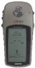
...the time of your present location. Trip Odometer-like the odometer in your car, 'TRIP ODOMETER' tells you how far you want the eTrex to the eTrex and back again, and manage and organize all of sunrise at your waypoints. From the Main Menu you to change a data fi.... Main Menu Selections The Main Menu turns the eTrex into a powerful navigation tool. Reference Main Menu Selections The ' MAIN MENU' Page allows you have traveled since the last trip reset. Elevation-the measurement of height above mean sea level. Trip Time-the total time you to a destination. Mark...
...the time of your present location. Trip Odometer-like the odometer in your car, 'TRIP ODOMETER' tells you how far you want the eTrex to the eTrex and back again, and manage and organize all of sunrise at your waypoints. From the Main Menu you to change a data fi.... Main Menu Selections The Main Menu turns the eTrex into a powerful navigation tool. Reference Main Menu Selections The ' MAIN MENU' Page allows you have traveled since the last trip reset. Elevation-the measurement of height above mean sea level. Trip Time-the total time you to a destination. Mark...

Owner's Manual
Page 43
... needs to acquire good signals from at least three satellites to determine a position on the ground, sea and air search the sky for the satellites. GPS consists of a constellation of the weather. A fourth signal is required to civilians for use by the United States' ... a day, regardless of 24 satellites orbiting some 12,000 miles above the earth. the Global Positioning System - Designed by the military, the GPS System was made available to get three-dimensional positioning which determines elevation or altitude. It's a technology that pinpoints a user's location anywhere in...
... needs to acquire good signals from at least three satellites to determine a position on the ground, sea and air search the sky for the satellites. GPS consists of a constellation of the weather. A fourth signal is required to civilians for use by the United States' ... a day, regardless of 24 satellites orbiting some 12,000 miles above the earth. the Global Positioning System - Designed by the military, the GPS System was made available to get three-dimensional positioning which determines elevation or altitude. It's a technology that pinpoints a user's location anywhere in...