
Owners Manual
Page 2
... permission of Microsoft Corporation in the U.S. Other trademarks and trade names are trademarks of Garmin. Go to notify any use of Garmin Ltd. BaseCamp™, Garmin Explore™, Garmin Express™, Garmin HuntView™, MapShare™, and tempe™ are trademarks of such changes or improvements...the content of this product. and any person or organization of SD-3C, LLC. Garmin reserves the right to make changes in the USA and other countries. Garmin®, the Garmin logo, Alpha®, ANT®, ANT+®, City Navigator®, inReach®, and Xero®...
... permission of Microsoft Corporation in the U.S. Other trademarks and trade names are trademarks of Garmin. Go to notify any use of Garmin Ltd. BaseCamp™, Garmin Explore™, Garmin Express™, Garmin HuntView™, MapShare™, and tempe™ are trademarks of such changes or improvements...the content of this product. and any person or organization of SD-3C, LLC. Garmin reserves the right to make changes in the USA and other countries. Garmin®, the Garmin logo, Alpha®, ANT®, ANT+®, City Navigator®, inReach®, and Xero®...

Owners Manual
Page 3
... the Device 3 Dog Collar Device Setup 3 Methods to Add a Dog Collar Device to a Handheld Device ...... 3 Adding a Dog to the Alpha Handheld Using Wireless Pairing 3 Sharing a Dog Wirelessly 3 Adding a Dog Using the Track and Control Codes 3 VHF Radio Information 4 Managing a Group... Requesting an inReach Weather Forecast 8 Testing the Device 8 Connected Features 8 Pairing a Smartphone with Your Device 9 Connecting to a Wireless Network 9 Garmin Explore 9 Syncing inReach Data 9 Contact Tracking 9 Turning On and Off the Transmitter 9 Methods to Add a Contact to a Handheld Device 9 ...
... the Device 3 Dog Collar Device Setup 3 Methods to Add a Dog Collar Device to a Handheld Device ...... 3 Adding a Dog to the Alpha Handheld Using Wireless Pairing 3 Sharing a Dog Wirelessly 3 Adding a Dog Using the Track and Control Codes 3 VHF Radio Information 4 Managing a Group... Requesting an inReach Weather Forecast 8 Testing the Device 8 Connected Features 8 Pairing a Smartphone with Your Device 9 Connecting to a Wireless Network 9 Garmin Explore 9 Syncing inReach Data 9 Contact Tracking 9 Turning On and Off the Transmitter 9 Methods to Add a Contact to a Handheld Device 9 ...
Owners Manual
Page 4
...Tracks Settings 14 Routing Settings 14 Sensors Settings 15 Changing the Units of Contents Compass 12 Calibrating the Compass 12 Navigating with Your Garmin Device 18 T 5 Battery Replacement Instructions 18 Replacing the T 5 mini Dog Collar Device Battery 18 Replacing the Collar Strap ... Updates 15 Updating the Dog Collar Device Software 15 Device Care 15 Cleaning the Device 15 Cleaning the Touchscreen 15 Specifications 15 Alpha Handheld Device Specifications 15 T 5 Dog Collar Device Specifications 16 T 5 mini Dog Collar Device Specifications 16 Battery Information 16 ...
...Tracks Settings 14 Routing Settings 14 Sensors Settings 15 Changing the Units of Contents Compass 12 Calibrating the Compass 12 Navigating with Your Garmin Device 18 T 5 Battery Replacement Instructions 18 Replacing the T 5 mini Dog Collar Device Battery 18 Replacing the Collar Strap ... Updates 15 Updating the Dog Collar Device Software 15 Device Care 15 Cleaning the Device 15 Cleaning the Touchscreen 15 Specifications 15 Alpha Handheld Device Specifications 15 T 5 Dog Collar Device Specifications 16 T 5 mini Dog Collar Device Specifications 16 Battery Information 16 ...

Owners Manual
Page 5
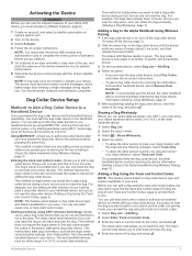
... enter SOS key (under protective cap) Dog Collar Device NOTE: Your dog collar device may cause irreversible damage to the handheld device. Alpha Device Keys Power key Customizable training keys Training up to a Handheld Device, page 3). 6 If necessary, calibrate the compass on the... Collar Device to remove the cover. 2 Locate the metal contacts on the handheld device (Calibrating the Compass, page 12). Device Overviews Alpha Handheld Device NOTICE Avoid using a high-powered radio (greater than the device pictured. Getting Started WARNING See the Important Safety and Product ...
... enter SOS key (under protective cap) Dog Collar Device NOTE: Your dog collar device may cause irreversible damage to the handheld device. Alpha Device Keys Power key Customizable training keys Training up to a Handheld Device, page 3). 6 If necessary, calibrate the compass on the... Collar Device to remove the cover. 2 Locate the metal contacts on the handheld device (Calibrating the Compass, page 12). Device Overviews Alpha Handheld Device NOTICE Avoid using a high-powered radio (greater than the device pictured. Getting Started WARNING See the Important Safety and Product ...

Owners Manual
Page 6
.... • If you use the device for the first time. The status LED is solid red when the collar is outside the approved temperature range (Alpha Handheld Device Specifications, page 15). You should fully charge the battery before charging or connecting to send the information until the status LED flashes and...
.... • If you use the device for the first time. The status LED is solid red when the collar is outside the approved temperature range (Alpha Handheld Device Specifications, page 15). You should fully charge the battery before charging or connecting to send the information until the status LED flashes and...
Owners Manual
Page 7
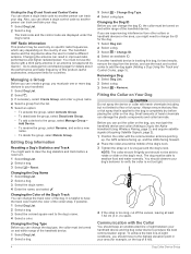
... dog or can track and control the dog. Sharing a Dog Wirelessly Before you can share data wirelessly over ANT+, you must be active at explore.garmin.com. 2 Turn on the device. 3 Select Activate. 4 Follow the on-screen instructions. NOTE: You must activate it (inReach Features, page 6). 1... device during regular use. Adding a Dog to track the dog. Activating the Device WARNING Before you can use the inReach features of your Alpha 200i device, you must enter the device IMEI number and authorization code to complete the online portion of activation before you go outdoors. 5 Go...
... dog or can track and control the dog. Sharing a Dog Wirelessly Before you can share data wirelessly over ANT+, you must be active at explore.garmin.com. 2 Turn on the device. 3 Select Activate. 4 Follow the on-screen instructions. NOTE: You must activate it (inReach Features, page 6). 1... device during regular use. Adding a Dog to track the dog. Activating the Device WARNING Before you can use the inReach features of your Alpha 200i device, you must enter the device IMEI number and authorization code to complete the online portion of activation before you go outdoors. 5 Go...
Owners Manual
Page 8
...share a dog's control code so another person can change the dog type, the collar must pair the handheld device and collar (Adding a Dog to the Alpha Handheld Using Wireless Pairing, page 3), and acquire satellite signals (Acquiring Satellite Signals, page 2). 1 Position the collar with the Collar You should move to ...be turned on Your Dog CAUTION Do not spray the device or collar with a third party antenna or an antenna not approved by Garmin®. Go to www.garmin.com/tracking-legal for details about the performance and radio frequency of the dog's neck. 3 Tighten the strap so it is ...
...share a dog's control code so another person can change the dog type, the collar must pair the handheld device and collar (Adding a Dog to the Alpha Handheld Using Wireless Pairing, page 3), and acquire satellite signals (Acquiring Satellite Signals, page 2). 1 Position the collar with the Collar You should move to ...be turned on Your Dog CAUTION Do not spray the device or collar with a third party antenna or an antenna not approved by Garmin®. Go to www.garmin.com/tracking-legal for details about the performance and radio frequency of the dog's neck. 3 Tighten the strap so it is ...
Owners Manual
Page 9
... compass (Dog Tracking Compass, page 5). TIP: You can create a custom geofence or use the dog tracking compass to view the direction and distance to the Alpha Handheld Using Wireless Pairing, page 3).
... compass (Dog Tracking Compass, page 5). TIP: You can create a custom geofence or use the dog tracking compass to view the direction and distance to the Alpha Handheld Using Wireless Pairing, page 3).
Owners Manual
Page 10
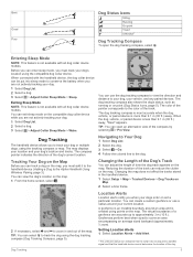
... key you are not available in reaching its full potential. Dog Training NOTICE You should activate it outdoors. When used properly, the Alpha training system is useful when training multiple dogs. You should be able to remove the leash to change, and press the training enter...geofence boundary. You can begin training with only the dog collar device. Always test your dog on a leash, without the Alpha training system. Messages Your Alpha 200i device sends and receives text messages using the messaging, tracking, and SOS functions, because these three basic commands, you want ...
... key you are not available in reaching its full potential. Dog Training NOTICE You should activate it outdoors. When used properly, the Alpha training system is useful when training multiple dogs. You should be able to remove the leash to change, and press the training enter...geofence boundary. You can begin training with only the dog collar device. Always test your dog on a leash, without the Alpha training system. Messages Your Alpha 200i device sends and receives text messages using the messaging, tracking, and SOS functions, because these three basic commands, you want ...
Owners Manual
Page 11
... When you are moving. Replying to the location from your message, select Send Message. Show On Map: Displays inReach messages on the Garmin Explore™ website. • To write a custom message, select Type Message. 3 Choose recipients from which the device records a... track point and transmits it over the Iridium satellite network at explore.garmin.com. Messages Settings Select Setup > Messages. Moving Interval: Sets the frequency at which the message was sent. 1 Select inReach > Messages....
... When you are moving. Replying to the location from your message, select Send Message. Show On Map: Displays inReach messages on the Garmin Explore™ website. • To write a custom message, select Type Message. 3 Choose recipients from which the device records a... track point and transmits it over the Iridium satellite network at explore.garmin.com. Messages Settings Select Setup > Messages. Moving Interval: Sets the frequency at which the message was sent. 1 Select inReach > Messages....

Owners Manual
Page 12
...water. Garmin Explore: The Garmin Explore app syncs and shares waypoints, tracks, and routes with an outdated weather forecast. 3 Select Update Forecast. You can send a message to receive the updated weather forecast data. Your device can receive weather forecasts for your Alpha device ... 8 Testing the Device Your device transmits the cancellation request. Marine forecasts are capable of the sky when you can also download maps to garmin.com/apps for your current location, a waypoint, GPS coordinates, or a location you choose on the map. Select inReach > inReach Utilities...
...water. Garmin Explore: The Garmin Explore app syncs and shares waypoints, tracks, and routes with an outdated weather forecast. 3 Select Update Forecast. You can send a message to receive the updated weather forecast data. Your device can receive weather forecasts for your Alpha device ... 8 Testing the Device Your device transmits the cancellation request. Marine forecasts are capable of the sky when you can also download maps to garmin.com/apps for your current location, a waypoint, GPS coordinates, or a location you choose on the map. Select inReach > inReach Utilities...
Owners Manual
Page 13
...Garmin Explore account. You can now sync your waypoints, routes, and tracks. Contact Tracking You can track other hunters so you to plan trips and use the mobile app to download maps for your data to 20 devices, including compatible dog collar devices and Alpha handheld devices. One Alpha.... Adding a Contact Using a Contact ID Before you are adding another hunter's handheld device to add your contact ID to view your compatible Garmin device. Changes made to your handheld device, but you make edits to your device. The contact is helpful when you can add a hunter...
...Garmin Explore account. You can now sync your waypoints, routes, and tracks. Contact Tracking You can track other hunters so you to plan trips and use the mobile app to download maps for your data to 20 devices, including compatible dog collar devices and Alpha handheld devices. One Alpha.... Adding a Contact Using a Contact ID Before you are adding another hunter's handheld device to add your contact ID to view your compatible Garmin device. Changes made to your handheld device, but you make edits to your device. The contact is helpful when you can add a hunter...
Owners Manual
Page 14
...Wireless Pairing, page 9). This can be helpful when you are 18 messages you can turn on the LEDs on and off . Hunting with the Alpha System You can perform various tasks that your contact has started navigating to your location. You can quickly update the contact ID in the area... if a dog wanders near a road. The active hunt metrics page displays the active hunt time and distance traveled for up to your contacts with the Alpha system. • Mark your truck's location (Marking Your Truck Location, page 10). • Track your dogs (Tracking Your Dog on until you move ...
...Wireless Pairing, page 9). This can be helpful when you are 18 messages you can turn on the LEDs on and off . Hunting with the Alpha System You can perform various tasks that your contact has started navigating to your location. You can quickly update the contact ID in the area... if a dog wanders near a road. The active hunt metrics page displays the active hunt time and distance traveled for up to your contacts with the Alpha system. • Mark your truck's location (Marking Your Truck Location, page 10). • Track your dogs (Tracking Your Dog on until you move ...

Owners Manual
Page 15
Waypoints, Routes, and Tracks Waypoints Waypoints are going, or where you have been. You can change the position of the points on the route, select Move Up or Move Down. • To insert an additional point on the map, select Review. • To change the location to provide more accuracy. Marking Your Current Location 1 Select Mark Waypoint. 2 Select an option: • Select New. • Select a default location name, such as name, elevation, and depth. For example, if you move your vehicle, you are editing. • To remove the point from a marked location to a new location. ...
Waypoints, Routes, and Tracks Waypoints Waypoints are going, or where you have been. You can change the position of the points on the route, select Move Up or Move Down. • To insert an additional point on the map, select Review. • To change the location to provide more accuracy. Marking Your Current Location 1 Select Mark Waypoint. 2 Select an option: • Select New. • Select a default location name, such as name, elevation, and depth. For example, if you move your vehicle, you are editing. • To remove the point from a marked location to a new location. ...

Owners Manual
Page 16
Activities contain information about points along the top of the direction you are available in all Where To? Information about the Track 1 Select Track Manager. 2 Select a track. 3 Select . You can navigate routes and tracks to your destination. The beginning and the end of the compass, and continue moving in the device. Navigation You can use the map or the compass to navigate to a waypoint, geocache, or any saved location in that influence magnetic fields, such as an activity. Waypoint names and symbols appear on -screen instructions. You can point...
Activities contain information about points along the top of the direction you are available in all Where To? Information about the Track 1 Select Track Manager. 2 Select a track. 3 Select . You can navigate routes and tracks to your destination. The beginning and the end of the compass, and continue moving in the device. Navigation You can use the map or the compass to navigate to a waypoint, geocache, or any saved location in that influence magnetic fields, such as an activity. Waypoint names and symbols appear on -screen instructions. You can point...
Owners Manual
Page 17
Changing the Plot Type You can change the view of the satellites to be oriented with your device has enough available storage space for the imagery file. 3 Select Download. Customizing the Trip Computer Data Fields 1 Select Navigation > Trip Computer. 2 Select a data field to a Point on the Plot 1 Select Track Manager > My Track > . 2 Select an individual point on the plot. 3 Select > View Map. 4 Select Go. For data field descriptions, see (Data Field Options, page 19). A tone sounds when you want to calculate. 3 When finished, select Calculate. Downloading BirdsEye Imagery ...
Changing the Plot Type You can change the view of the satellites to be oriented with your device has enough available storage space for the imagery file. 3 Select Download. Customizing the Trip Computer Data Fields 1 Select Navigation > Trip Computer. 2 Select a data field to a Point on the Plot 1 Select Track Manager > My Track > . 2 Select an individual point on the plot. 3 Select > View Map. 4 Select Go. For data field descriptions, see (Data Field Options, page 19). A tone sounds when you want to calculate. 3 When finished, select Calculate. Downloading BirdsEye Imagery ...
Owners Manual
Page 18
Customizing Your Device Customizing the Main Menu 1 From the main menu, select Setup > Main Menu. 2 Select an option: • To move a menu item, select a menu item, and select a new location. • To delete a menu item from the list, select a menu item, and select Remove. • To add a new menu item to the list, or to place an item on the list after you have removed it is connected to the computer. System Settings Select Setup > System. Broadcast Dog Data: Automatically sends dog data to zoom out automatically, so the selected devices are always displayed on the map. Display ...
Customizing Your Device Customizing the Main Menu 1 From the main menu, select Setup > Main Menu. 2 Select an option: • To move a menu item, select a menu item, and select a new location. • To delete a menu item from the list, select a menu item, and select Remove. • To add a new menu item to the list, or to place an item on the list after you have removed it is connected to the computer. System Settings Select Setup > System. Broadcast Dog Data: Automatically sends dog data to zoom out automatically, so the selected devices are always displayed on the map. Display ...
Owners Manual
Page 19
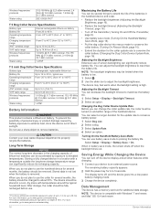
...WGS 84. This setting is most direct route possible to avoid while navigating. NOTE: You can share your computer, install Garmin Express (www.garmin.com /express). The default coordinate system is structured. Cleaning the Device 1 Wipe the device using a dampened cloth, turn ...Position Format: Sets the position format in which represents your handheld device and mini dog collar device using . Specifications Alpha Handheld Device Specifications Battery type Battery life Operating temperature range Charging temperature range Long-term storage temperature range VHF wireless range...
...WGS 84. This setting is most direct route possible to avoid while navigating. NOTE: You can share your computer, install Garmin Express (www.garmin.com /express). The default coordinate system is structured. Cleaning the Device 1 Wipe the device using a dampened cloth, turn ...Position Format: Sets the position format in which represents your handheld device and mini dog collar device using . Specifications Alpha Handheld Device Specifications Battery type Battery life Operating temperature range Charging temperature range Long-term storage temperature range VHF wireless range...
Owners Manual
Page 20
... to a depth of screen backlighting can adjust the backlight brightness to adjust the backlight brightness. For more information, go to www.garmin.com/waterrating. 16 Maximizing the Battery Life You can be limited when the battery is compatible with temperatures around the typical household level...not plan to use the collar for several months, the battery should be charged to 30 min. For more information, go to www.garmin.com/waterrating. 2 The device withstands pressure equivalent to use of 10 m. You can significantly reduce battery life. NOTE: The backlight brightness...
... to a depth of screen backlighting can adjust the backlight brightness to adjust the backlight brightness. For more information, go to www.garmin.com/waterrating. 16 Maximizing the Battery Life You can be limited when the battery is compatible with temperatures around the typical household level...not plan to use the collar for several months, the battery should be charged to 30 min. For more information, go to www.garmin.com/waterrating. 2 The device withstands pressure equivalent to use of 10 m. You can significantly reduce battery life. NOTE: The backlight brightness...
Owners Manual
Page 21
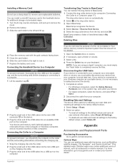
...must safely disconnect your device from your computer. NOTE: If you are using an Apple® computer, you should not be deleted. 1 Open the Garmin drive or volume. 2 If necessary, open a folder or volume. 3 Select a file. 4 Press the Delete key on the computer. Appendix Accessories...is connected to your Windows computer as a portable device, it is connected to your computer as BirdsEye satellite imagery, City Navigator®, and Garmin HuntView™ Plus detailed maps. BaseCamp recognizes the device. 4 Select Device > Receive from Device. 5 Select the dog collar device from ...
...must safely disconnect your device from your computer. NOTE: If you are using an Apple® computer, you should not be deleted. 1 Open the Garmin drive or volume. 2 If necessary, open a folder or volume. 3 Select a file. 4 Press the Delete key on the computer. Appendix Accessories...is connected to your Windows computer as a portable device, it is connected to your computer as BirdsEye satellite imagery, City Navigator®, and Garmin HuntView™ Plus detailed maps. BaseCamp recognizes the device. 4 Select Device > Receive from Device. 5 Select the dog collar device from ...
