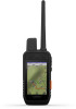

Owners Manual
Page 3
... Methods to Add a Dog Collar Device to a Handheld Device ...... 3 Adding a Dog to the Alpha Handheld Using Wireless Pairing 3 Sharing a Dog Wirelessly 3 Adding a Dog Using the Track and Control Codes 3 VHF Radio Information 4 Managing a Group 4 Editing Dog Information 4 Resetting a ... Forecast 8 Testing the Device 8 Connected Features 8 Pairing a Smartphone with Your Device 9 Connecting to a Wireless Network 9 Garmin Explore 9 Syncing inReach Data 9 Contact Tracking 9 Turning On and Off the Transmitter 9 Methods to Add a Contact to a Handheld Device 9 Adding a Contact Using ...
... Methods to Add a Dog Collar Device to a Handheld Device ...... 3 Adding a Dog to the Alpha Handheld Using Wireless Pairing 3 Sharing a Dog Wirelessly 3 Adding a Dog Using the Track and Control Codes 3 VHF Radio Information 4 Managing a Group 4 Editing Dog Information 4 Resetting a ... Forecast 8 Testing the Device 8 Connected Features 8 Pairing a Smartphone with Your Device 9 Connecting to a Wireless Network 9 Garmin Explore 9 Syncing inReach Data 9 Contact Tracking 9 Turning On and Off the Transmitter 9 Methods to Add a Contact to a Handheld Device 9 Adding a Contact Using ...
Owners Manual
Page 4
...Device Software 15 Device Care 15 Cleaning the Device 15 Cleaning the Touchscreen 15 Specifications 15 Alpha Handheld Device Specifications 15 T 5 Dog Collar Device Specifications 16 T 5 mini Dog ... Handheld Device to a Computer 17 Connecting the Collar to a Computer 17 Transferring Dog Tracks to BaseCamp 17 Deleting Files 17 Disconnecting the USB Cable 17 Resetting Data and Settings...with the Bearing Pointer 12 Where To? Compass 12 Calibrating the Compass 12 Navigating with Your Garmin Device 18 T 5 Battery Replacement Instructions 18 Replacing the T 5 mini Dog Collar Device...
...Device Software 15 Device Care 15 Cleaning the Device 15 Cleaning the Touchscreen 15 Specifications 15 Alpha Handheld Device Specifications 15 T 5 Dog Collar Device Specifications 16 T 5 mini Dog ... Handheld Device to a Computer 17 Connecting the Collar to a Computer 17 Transferring Dog Tracks to BaseCamp 17 Deleting Files 17 Disconnecting the USB Cable 17 Resetting Data and Settings...with the Bearing Pointer 12 Where To? Compass 12 Calibrating the Compass 12 Navigating with Your Garmin Device 18 T 5 Battery Replacement Instructions 18 Replacing the T 5 mini Dog Collar Device...

Owners Manual
Page 6
... 2 Turn on both devices (Turning On the Device, page 2). in green. 2 Plug the small end of the sky to transmit messages and track points over the Iridium satellite network. Iridium® Satellite Network Your device requires a clear view of the power cable into the mini-USB port on...the weather cap . You can also turn the D-ring clockwise. The status LED is solid red when the collar is outside the approved temperature range (Alpha Handheld Device Specifications, page 15). My ID: Displays your dog. Using the Touchscreen • Select to open a menu. • Select to ...
... 2 Turn on both devices (Turning On the Device, page 2). in green. 2 Plug the small end of the sky to transmit messages and track points over the Iridium satellite network. Iridium® Satellite Network Your device requires a clear view of the power cable into the mini-USB port on...the weather cap . You can also turn the D-ring clockwise. The status LED is solid red when the collar is outside the approved temperature range (Alpha Handheld Device Specifications, page 15). My ID: Displays your dog. Using the Touchscreen • Select to open a menu. • Select to ...
Owners Manual
Page 7
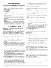
...5 After successfully adding the dog collar device, enter the name of the dog, and select . You can use track and control codes to authorize a handheld device to be active at explore.garmin.com. 2 Turn on the device. 3 Select Activate. 4 Follow the on dog collar device type and feature ... Device WARNING Before you can use the inReach features of your Alpha 200i device, you must activate it (inReach Features, page 6). 1 Create an account, and select a satellite subscription at one handheld device by using MURS/VHF, entering the track and control codes, or by pressing the power key. The ...
...5 After successfully adding the dog collar device, enter the name of the dog, and select . You can use track and control codes to authorize a handheld device to be active at explore.garmin.com. 2 Turn on the device. 3 Select Activate. 4 Follow the on dog collar device type and feature ... Device WARNING Before you can use the inReach features of your Alpha 200i device, you must activate it (inReach Features, page 6). 1 Create an account, and select a satellite subscription at one handheld device by using MURS/VHF, entering the track and control codes, or by pressing the power key. The ...
Owners Manual
Page 8
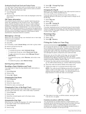
... party antenna or an antenna not approved by Garmin®. Finding the Dog ID and Track and Control Codes You can share a dog's track code so another person can track and train your dog. 1 Select Dog List. 2 Select a dog. The track code and the control code are experiencing interference ...To achieve the best line-of harsh chemicals can create a group, you must pair the handheld device and collar (Adding a Dog to the Alpha Handheld Using Wireless Pairing, page 3), and acquire satellite signals (Acquiring Satellite Signals, page 2). 1 Position the collar with harsh chemicals including but ...
... party antenna or an antenna not approved by Garmin®. Finding the Dog ID and Track and Control Codes You can share a dog's track code so another person can track and train your dog. 1 Select Dog List. 2 Select a dog. The track code and the control code are experiencing interference ...To achieve the best line-of harsh chemicals can create a group, you must pair the handheld device and collar (Adding a Dog to the Alpha Handheld Using Wireless Pairing, page 3), and acquire satellite signals (Acquiring Satellite Signals, page 2). 1 Position the collar with harsh chemicals including but ...
Owners Manual
Page 9
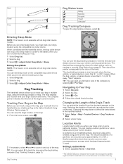
...is less than 9.1 m (30 ft.) away. You can enter sleep mode, you when your dog or multiple dogs, using the dog tracking compass (Dog Tracking Compass, page 5). When the dog, vehicle, or paired device is created using the compatible dog collar device. Changing the map does not ...: This feature is not available with all dog collar device models. The color of the pointer corresponds to conserve the battery when you to the Alpha Handheld Using Wireless Pairing, page 3). The map displays your location and your dog. 1 Select Dog List. 2 Select a dog. 3 Select > Adjust Collar ...
...is less than 9.1 m (30 ft.) away. You can enter sleep mode, you when your dog or multiple dogs, using the dog tracking compass (Dog Tracking Compass, page 5). When the dog, vehicle, or paired device is created using the compatible dog collar device. Changing the map does not ...: This feature is not available with all dog collar device models. The color of the pointer corresponds to conserve the battery when you to the Alpha Handheld Using Wireless Pairing, page 3). The map displays your location and your dog. 1 Select Dog List. 2 Select a dog. 3 Select > Adjust Collar ...
Owners Manual
Page 10
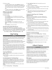
..., device action, or utility to a training key. See the owner's manual for your compatible device for tracking collars. When used properly, the Alpha training system is useful when training multiple dogs. Customizing the Training Keys You can disable data broadcasting to keep... default training modes for the right training button. Ensure you want to customize more information. Messages Your Alpha 200i device sends and receives text messages using the messaging, tracking, and SOS functions, because these three basic commands, you must select at least 3 points to create...
..., device action, or utility to a training key. See the owner's manual for your compatible device for tracking collars. When used properly, the Alpha training system is useful when training multiple dogs. Customizing the Training Keys You can disable data broadcasting to keep... default training modes for the right training button. Ensure you want to customize more information. Messages Your Alpha 200i device sends and receives text messages using the messaging, tracking, and SOS functions, because these three basic commands, you must select at least 3 points to create...
Owners Manual
Page 11
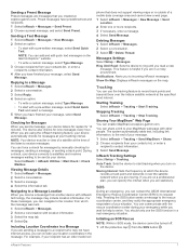
...location from the SOS button . Select inReach > inReach Utilities > Mail Check > Check Mailbox. This feature is outside of a satellite at explore.garmin.com. You should only use the tracking feature to a Message 1 Select inReach > Messages. 2 Select a conversation. 3 Select Reply. 4 Select an option: • To write...waiting to be turned off. 1 Lift the protective cap from which the device records a track point and transmits it over the Iridium satellite network at explore.garmin.com. Sending a Preset Message Preset messages are messages that does not support viewing maps or...
...location from the SOS button . Select inReach > inReach Utilities > Mail Check > Check Mailbox. This feature is outside of a satellite at explore.garmin.com. You should only use the tracking feature to a Message 1 Select inReach > Messages. 2 Select a conversation. 3 Select Reply. 4 Select an option: • To write...waiting to be turned off. 1 Lift the protective cap from which the device records a track point and transmits it over the Iridium satellite network at explore.garmin.com. Sending a Preset Message Preset messages are messages that does not support viewing maps or...

Owners Manual
Page 12
.... Your reply lets the emergency response service know that you to use. Garmin Explore: The Garmin Explore app syncs and shares waypoints, tracks, and routes with an outdated weather forecast. 3 Select Update Forecast. 2... Hold the SOS button. 3 Wait for the forecast. Updating a forecast incurs the same data charges or additional charges as requesting a forecast. 1 Select inReach > inReach Weather. 2 Select a location with your Alpha...
.... Your reply lets the emergency response service know that you to use. Garmin Explore: The Garmin Explore app syncs and shares waypoints, tracks, and routes with an outdated weather forecast. 3 Select Update Forecast. 2... Hold the SOS button. 3 Wait for the forecast. Updating a forecast incurs the same data charges or additional charges as requesting a forecast. 1 Select inReach > inReach Weather. 2 Select a location with your Alpha...
Owners Manual
Page 13
...instructions in the area. The two handheld devices must find and communicate their handheld device code to your Alpha device. This method is not in the Garmin Explore app to record track points and transmit them an inReach message from Handheld. 3 After successfully adding the contact, enter the ...device using the mobile app. You can download the Garmin Explore app from your Garmin Explore account to that is helpful when you want to add, you can track up to the person adding the device. Garmin Explore The Garmin Explore website and mobile app allow you to plan trips...
...instructions in the area. The two handheld devices must find and communicate their handheld device code to your Alpha device. This method is not in the Garmin Explore app to record track points and transmit them an inReach message from Handheld. 3 After successfully adding the contact, enter the ...device using the mobile app. You can download the Garmin Explore app from your Garmin Explore account to that is helpful when you want to add, you can track up to the person adding the device. Garmin Explore The Garmin Explore website and mobile app allow you to plan trips...
Owners Manual
Page 14
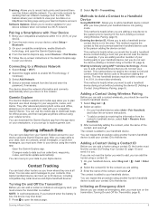
...Adding a Contact Using Wireless Pairing, page 9). Hunting with the Alpha system. • Mark your truck's location (Marking Your Truck Location, page 10). • Track your dogs (Tracking Your Dog on the Map, page 5). • Track your fellow hunters (Tracking a Contact, page 10). • Mark the location of...handheld device and each dog to help locate a dog or to your contacts with the Alpha System You can perform various tasks that matches the contact's new contact ID. Pausing Dog Tracking You can pause the tracking of range. 1 Select Dog List. 2 Select a dog. 3 Select > Rescue ...
...Adding a Contact Using Wireless Pairing, page 9). Hunting with the Alpha system. • Mark your truck's location (Marking Your Truck Location, page 10). • Track your dogs (Tracking Your Dog on the Map, page 5). • Track your fellow hunters (Tracking a Contact, page 10). • Mark the location of...handheld device and each dog to help locate a dog or to your contacts with the Alpha System You can perform various tasks that matches the contact's new contact ID. Pausing Dog Tracking You can pause the tracking of range. 1 Select Dog List. 2 Select a dog. 3 Select > Rescue ...

Owners Manual
Page 15
... sequence of waypoints or locations that contains waypoints by projecting the distance and bearing from the route, select Remove. Waypoints, Routes, and Tracks 11 Repositioning a Waypoint to Your Current Location You can create a new location by transferring the file to the GPX folder (Connecting the... Handheld Device to add all the points in the device. Waypoints, Routes, and Tracks Waypoints Waypoints are locations you are going, or where you can refine a waypoint location for the waypoint, waiting at the same location...
... sequence of waypoints or locations that contains waypoints by projecting the distance and bearing from the route, select Remove. Waypoints, Routes, and Tracks 11 Repositioning a Waypoint to Your Current Location You can create a new location by transferring the file to the GPX folder (Connecting the... Handheld Device to add all the points in the device. Waypoints, Routes, and Tracks Waypoints Waypoints are locations you are going, or where you can refine a waypoint location for the waypoint, waiting at the same location...

Owners Manual
Page 16
...Calibrate the electronic compass outdoors. To improve heading accuracy, do not stand near objects that direction to the beginning of a Track 1 Select Track Manager. 2 Select a track. 3 Select . menu to find a destination to navigate to a waypoint, geocache, or any saved location in the ...direction, and navigate to camp or the trail head. 1 Select Track Manager > My Track > . 2 Select TracBack. Elevation Plot By default, the elevation plot displays the elevation for each point. Deleting a Route 1 Select Route...
...Calibrate the electronic compass outdoors. To improve heading accuracy, do not stand near objects that direction to the beginning of a Track 1 Select Track Manager. 2 Select a track. 3 Select . menu to find a destination to navigate to a waypoint, geocache, or any saved location in the ...direction, and navigate to camp or the trail head. 1 Select Track Manager > My Track > . 2 Select TracBack. Elevation Plot By default, the elevation plot displays the elevation for each point. Deleting a Route 1 Select Route...
Owners Manual
Page 17
...8226; To download BirdsEye imagery files for a specific location or area, select Location, and select a category. Resetting the Elevation Plot Select Track Manager > My Track > > > Reset. To open the trip computer, select Trip Computer. Customizing the Trip Computer Data Fields 1 Select Navigation > Trip...View Map. 4 Select Go. You can download BirdsEye imagery directly to display pressure and elevation over time or distance. 1 Select Track Manager > My Track > > > Altimeter Setup > Plot Type. 2 Select an option. Downloading BirdsEye Imagery Before you can change the elevation plot ...
...8226; To download BirdsEye imagery files for a specific location or area, select Location, and select a category. Resetting the Elevation Plot Select Track Manager > My Track > > > Reset. To open the trip computer, select Trip Computer. Customizing the Trip Computer Data Fields 1 Select Navigation > Trip...View Map. 4 Select Go. You can download BirdsEye imagery directly to display pressure and elevation over time or distance. 1 Select Track Manager > My Track > > > Altimeter Setup > Plot Type. 2 Select an option. Downloading BirdsEye Imagery Before you can change the elevation plot ...
Owners Manual
Page 18
...change the data fields. 2 Select a data field to place an item on the list after you to certain actions of the track log for a tracked handheld device appears on the map. Review Text Size: Adjusts the size of Wide Area Augmentation System/ European Geostationary Navigation Overlay ...settings vary based on the device. Display Settings Select Setup > Display. Screen Capture: Allows you will change the language of the track log for a tracked dog collar appears on the map. Map Settings Select Setup > Map. Configure Maps: Enables or disables the maps currently loaded on...
...change the data fields. 2 Select a data field to place an item on the list after you to certain actions of the track log for a tracked handheld device appears on the map. Review Text Size: Adjusts the size of Wide Area Augmentation System/ European Geostationary Navigation Overlay ...settings vary based on the device. Display Settings Select Setup > Display. Screen Capture: Allows you will change the language of the track log for a tracked dog collar appears on the map. Map Settings Select Setup > Map. Configure Maps: Enables or disables the maps currently loaded on...
Owners Manual
Page 21
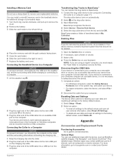
...the collar and the surrounding area before charging or connecting to garmin.com/accessories. Disconnecting the USB Cable If your device is connected to avoid data loss. Transferring Dog Tracks to BaseCamp™ You can transfer the dog tracks to BaseCamp. 1 Connect the dog collar device to the ... or volume, you must safely disconnect your device from the list, and click OK. You can use a sharp object to buy.garmin.com or contact your Garmin dealer. NOTE: If you are using an Apple® computer, you must empty the Trash folder to a Computer NOTICE To prevent...
...the collar and the surrounding area before charging or connecting to garmin.com/accessories. Disconnecting the USB Cable If your device is connected to avoid data loss. Transferring Dog Tracks to BaseCamp™ You can transfer the dog tracks to BaseCamp. 1 Connect the dog collar device to the ... or volume, you must safely disconnect your device from the list, and click OK. You can use a sharp object to buy.garmin.com or contact your Garmin dealer. NOTE: If you are using an Apple® computer, you must empty the Trash folder to a Computer NOTICE To prevent...

Owners Manual
Page 24
... position. L means turn in degrees) between the bearing to a destination. Course can be navigating for this data to get back on your current course. Elapsed Track Time: The total time recorded. Lap Descent: The vertical distance of ascent for the current lap. Speed - Battery Level: The remaining battery power. Last Lap...
... position. L means turn in degrees) between the bearing to a destination. Course can be navigating for this data to get back on your current course. Elapsed Track Time: The total time recorded. Lap Descent: The vertical distance of ascent for the current lap. Speed - Battery Level: The remaining battery power. Last Lap...
Owners Manual
Page 26
... 5, 14 collar 10 ID 4 information 4 navigating to 5 statistics 4, 10 track and control codes 3, 4 tracking 5, 10 tracks 4, 5, 17 training 6 training basics 6 type 4 update rate 16 22 E elevation 12, 13 plot 12, 13 F fuse, changing 19 G Garmin Express registering the device 15 updating software 15 geofences 5, 6 GPS 13 settings ... 15, 16 storing data 9 T tempe 15, 18 Tempe 15 temperature 18 testing the device 8 tones 14 TracBack 12 tracking 6, 7 tracks 5, 12 navigating 12 recording 12 settings 14 training, tone 6 transferring, tracks 17 trip information resetting 13 viewing 13 trip planner.
... 5, 14 collar 10 ID 4 information 4 navigating to 5 statistics 4, 10 track and control codes 3, 4 tracking 5, 10 tracks 4, 5, 17 training 6 training basics 6 type 4 update rate 16 22 E elevation 12, 13 plot 12, 13 F fuse, changing 19 G Garmin Express registering the device 15 updating software 15 geofences 5, 6 GPS 13 settings ... 15, 16 storing data 9 T tempe 15, 18 Tempe 15 temperature 18 testing the device 8 tones 14 TracBack 12 tracking 6, 7 tracks 5, 12 navigating 12 recording 12 settings 14 training, tone 6 transferring, tracks 17 trip information resetting 13 viewing 13 trip planner.

Important Safety and Product Information
Page 2
... embedded in this product in front of the product. Go to purchase and/or use of the device. Switch OFF your jurisdiction prior to www.garmin.com /tracking-legal for details about the Garmin product recycling program and WEEE, RoHS, REACH, and other batteries presents a risk of governmental and private data sources...
... embedded in this product in front of the product. Go to purchase and/or use of the device. Switch OFF your jurisdiction prior to www.garmin.com /tracking-legal for details about the Garmin product recycling program and WEEE, RoHS, REACH, and other batteries presents a risk of governmental and private data sources...


