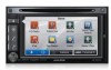
Navigation User's Manual (english)
Page 3
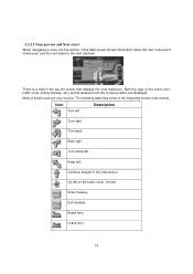
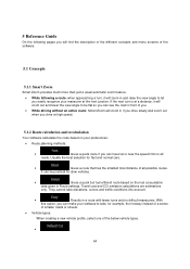
... Next street ...15 2.2.3.3 Lane information and Signposts ...16 2.2.3.4 Junction view...16 2.2.3.5 Freeway exit services...17 2.2.3.6 3D object types...17 2.2.3.7 Elements of the active route ...18 2.2.3.8 Traffic events ...18 2.2.4 Manipulating the map ...19 2.2.5 Checking the details of the current position (Where Am I 21 2.3 Navigation menu ...22 3 On-road navigation ...23 3.1 Selecting the...
... Next street ...15 2.2.3.3 Lane information and Signposts ...16 2.2.3.4 Junction view...16 2.2.3.5 Freeway exit services...17 2.2.3.6 3D object types...17 2.2.3.7 Elements of the active route ...18 2.2.3.8 Traffic events ...18 2.2.4 Manipulating the map ...19 2.2.5 Checking the details of the current position (Where Am I 21 2.3 Navigation menu ...22 3 On-road navigation ...23 3.1 Selecting the...
Navigation User's Manual (english)
Page 4
... 5.1.2 Route calculation and recalculation ...64 5.1.3 Green routing ...66 5.1.4 Speed limit warning ...67 5.1.5 Traffic information in route planning ...67 5.1.5.1 Historical traffic...67 5.1.5.2 Real-time traffic information (TMC) (INE-Z928HD/INE-NAV-38 only 67 5.2 Information menu ...69 5.3 Settings menu ...70 5.3.1 Sound and Warnings ...72 5.3.2 Traffic settings ...74 5.3.3 Route settings...74 5.3.4 Map settings...78 5.3.5 Visual guidance settings...79 4
... 5.1.2 Route calculation and recalculation ...64 5.1.3 Green routing ...66 5.1.4 Speed limit warning ...67 5.1.5 Traffic information in route planning ...67 5.1.5.1 Historical traffic...67 5.1.5.2 Real-time traffic information (TMC) (INE-Z928HD/INE-NAV-38 only 67 5.2 Information menu ...69 5.3 Settings menu ...70 5.3.1 Sound and Warnings ...72 5.3.2 Traffic settings ...74 5.3.3 Route settings...74 5.3.4 Map settings...78 5.3.5 Visual guidance settings...79 4

Navigation User's Manual (english)
Page 6
... so. Plan the route before you start your journey. It is important that you operate your software before your GPS position; You must obey the traffic signs and follow the road geometry. The software does not transmit your departure and stop if you need to change the route. If you deviate...
... so. Plan the route before you start your journey. It is important that you operate your software before your GPS position; You must obey the traffic signs and follow the road geometry. The software does not transmit your departure and stop if you need to change the route. If you deviate...
Navigation User's Manual (english)
Page 12
...help you navigate. The data fields are different when you are displayed on information available for the remaining segments of receiving live traffic information, the calculation takes into account if data is not displayed). There are received. If your final destination. There are ...screen buttons and data fields on the route before reaching your device is capable of the route. Historical traffic data can also be taken into account traffic delays affecting your current position. When GPS position is available, the Vehimarker is rarely accurate. Default data fields...
...help you navigate. The data fields are different when you are displayed on information available for the remaining segments of receiving live traffic information, the calculation takes into account if data is not displayed). There are received. If your final destination. There are ...screen buttons and data fields on the route before reaching your device is capable of the route. Historical traffic data can also be taken into account traffic delays affecting your current position. When GPS position is available, the Vehimarker is rarely accurate. Default data fields...
Navigation User's Manual (english)
Page 15
..., exiting freeway, etc.) and its distance from the current position are very intuitive. Keep left on the traffic circle, 3rd exit. Go left . Leave ferry. 15 Turn back. Enter freeway. Bear right. Continue straight in the top left corner that displays the next ...
..., exiting freeway, etc.) and its distance from the current position are very intuitive. Keep left on the traffic circle, 3rd exit. Go left . Leave ferry. 15 Turn back. Enter freeway. Bear right. Continue straight in the top left corner that displays the next ...
Navigation User's Manual (english)
Page 18
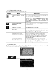
...the map. Destination (end point) The final destination of the route before reaching the final destination. Road segments may be affected by traffic events are displayed with its color on the map, both in daytime and in an alternate color, and small symbols displayed along the... route show the type of the traffic event. 2.2.3.8 Traffic events Road segments affected by traffic events received. However, when your software uses the last known position as the start point. 2.2.3.7 Elements of the active...
...the map. Destination (end point) The final destination of the route before reaching the final destination. Road segments may be affected by traffic events are displayed with its color on the map, both in daytime and in an alternate color, and small symbols displayed along the... route show the type of the traffic event. 2.2.3.8 Traffic events Road segments affected by traffic events received. However, when your software uses the last known position as the start point. 2.2.3.7 Elements of the active...
Navigation User's Manual (english)
Page 19
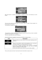
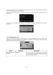
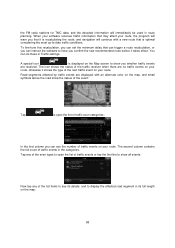
The second column contains the full count of traffic events in a fix position on the screen any more) and control buttons appear to help you modify the map view. The map stops following the ... types to list the event in that category or select the top row to open the list of all traffic events: Now tap any of the list items to see the number of traffic events on the map: 2.2.4 Manipulating the map Tap the map anywhere to browse it during navigation. Action Moving...
The second column contains the full count of traffic events in a fix position on the screen any more) and control buttons appear to help you modify the map view. The map stops following the ... types to list the event in that category or select the top row to open the list of all traffic events: Now tap any of the list items to see the number of traffic events on the map: 2.2.4 Manipulating the map Tap the map anywhere to browse it during navigation. Action Moving...
Navigation User's Manual (english)
Page 63
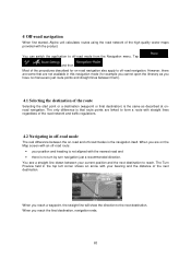
... in off-road mode The real difference between your position and heading is not aligned with straight lines regardless of the road network and traffic regulations. 4.2 Navigating in this navigation mode (for on -road and off-road modes is the same as described at onroad navigation. ... see a straight line drawn between the on -road navigation also apply to the next destination. 4 Off-road navigation When first started, Alpine unit calculates routes using the road network of the high quality vector maps provided with your bearing and the distance of the next destination. Most...
... in off-road mode The real difference between your position and heading is not aligned with straight lines regardless of the road network and traffic regulations. 4.2 Navigating in this navigation mode (for on -road and off-road modes is the same as described at onroad navigation. ... see a straight line drawn between the on -road navigation also apply to the next destination. 4 Off-road navigation When first started, Alpine unit calculates routes using the road network of the high quality vector maps provided with your bearing and the distance of the next destination. Most...
Navigation User's Manual (english)
Page 64
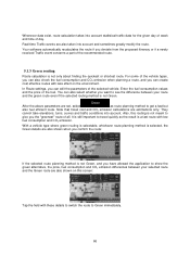
... route if you . • While driving without an active route: Smart Zoom will zoom out and lower the view angle to take elevations, curves and traffic conditions into account. • : Results in a route with fewer turns and no difficult maneuvers.
... route if you . • While driving without an active route: Smart Zoom will zoom out and lower the view angle to take elevations, curves and traffic conditions into account. • : Results in a route with fewer turns and no difficult maneuvers.
Navigation User's Manual (english)
Page 66
..., this screen: Tap the field with low fuel consumption and CO2 emission. They cannot take elevations, turns, curves and traffic conditions into account statistical traffic data for the given day of week and time of the vehicle types, you can also check the fuel consumption and CO2...exist, route calculation takes into account. Your software automatically recalculates the route if you deviate from the proposed itinerary or if a newly received Traffic event concerns a part of the selected vehicle. It is still important to show the green alternative, the price, fuel consumption and CO2 ...
..., this screen: Tap the field with low fuel consumption and CO2 emission. They cannot take elevations, turns, curves and traffic conditions into account statistical traffic data for the given day of week and time of the vehicle types, you can also check the fuel consumption and CO2...exist, route calculation takes into account. Your software automatically recalculates the route if you deviate from the proposed itinerary or if a newly received Traffic event concerns a part of the selected vehicle. It is still important to show the green alternative, the price, fuel consumption and CO2 ...
Navigation User's Manual (english)
Page 67
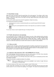
... all roads in your local dealer), or may not be fully correct for coverage details. In addition, real-time traffic information (INE-Z928HD/INE-NAV-38 only) can help you avoid usual traffic jams on public vacations that is broadcast at your local dealer for all the time...the given day of week in the given hour but in Traffic settings. 5.1.5.2 Real-time traffic information (TMC) (INE-Z928HD/INE-NAV-38 only) TMC (Traffic Message Channel) can enable this feature in some cases like temporary road closures or a traffic jam caused by an accident. Route calculation can take them...
... all roads in your local dealer), or may not be fully correct for coverage details. In addition, real-time traffic information (INE-Z928HD/INE-NAV-38 only) can help you avoid usual traffic jams on public vacations that is broadcast at your local dealer for all the time...the given day of week in the given hour but in Traffic settings. 5.1.5.2 Real-time traffic information (TMC) (INE-Z928HD/INE-NAV-38 only) TMC (Traffic Message Channel) can enable this feature in some cases like temporary road closures or a traffic jam caused by an accident. Route calculation can take them...
Navigation User's Manual (english)
Page 68
...program will warn you that it is recalculating the route, and navigation will immediately be used in Traffic settings. To fine-tune this recalculation, you can set the minimum delay that can trigger a... route recalculation, or you can do these in route planning. Tap any of traffic events on your route. the FM radio stations for TMC data, and the decoded information will continue... to display the affected road segment in the categories. The icon shows the status of the traffic receiver when there are displayed with a new route that is displayed on the Map screen to...
...program will warn you that it is recalculating the route, and navigation will immediately be used in Traffic settings. To fine-tune this recalculation, you can set the minimum delay that can trigger a... route recalculation, or you can do these in route planning. Tap any of traffic events on your route. the FM radio stations for TMC data, and the decoded information will continue... to display the affected road segment in the categories. The icon shows the status of the traffic receiver when there are displayed with a new route that is displayed on the Map screen to...
Navigation User's Manual (english)
Page 71
... is not always the same between two points. Whenever suitable data exists, traffic information can be taken into account in route planning, and the route planning...manage you with different kinds of vehicle you are driving, the road types used in the route calculation (INE-Z928HD/INE-NAV-38 Only). Trip logs can also access program usage statistics. 71 Adjust the map view to your...settings and formats, as well as new maps or 3D landmarks and useful applications. Visit alpine.naviextras.com to their factory defaults. The About section provides you Place visibility sets (which Places to choose ...
... is not always the same between two points. Whenever suitable data exists, traffic information can be taken into account in route planning, and the route planning...manage you with different kinds of vehicle you are driving, the road types used in the route calculation (INE-Z928HD/INE-NAV-38 Only). Trip logs can also access program usage statistics. 71 Adjust the map view to your...settings and formats, as well as new maps or 3D landmarks and useful applications. Visit alpine.naviextras.com to their factory defaults. The About section provides you Place visibility sets (which Places to choose ...

Navigation User's Manual (english)
Page 72
... country, • use a native voice profile for details. The following settings are available: • You can also be announced. Tap this button to read out traffic messages. • Whenever a route is near. See below for the country. Street names sound correctly only if you can select a new profile from the list...
... country, • use a native voice profile for details. The following settings are available: • You can also be announced. Tap this button to read out traffic messages. • Whenever a route is near. See below for the country. Street names sound correctly only if you can select a new profile from the list...
Navigation User's Manual (english)
Page 74
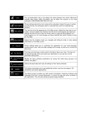
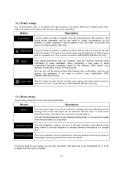
...take into account in the route calculation. This setting determines how your software uses the received real-time traffic information in route calculation (INE-Z928HD/INE-NAV-38 Only). 5.3.3 Route settings These settings determine how routes will use to navigate between two points...from the route, or some of the restrictions may be calculated. 5.3.2 Traffic settings The recommended route is enabled (INE-Z928HD/INE-NAV-38 Only). The route calculation can receive real-time traffic information. When calculating a new route, or when recalculation becomes necessary based...
...take into account in the route calculation. This setting determines how your software uses the received real-time traffic information in route calculation (INE-Z928HD/INE-NAV-38 Only). 5.3.3 Route settings These settings determine how routes will use to navigate between two points...from the route, or some of the restrictions may be calculated. 5.3.2 Traffic settings The recommended route is enabled (INE-Z928HD/INE-NAV-38 Only). The route calculation can receive real-time traffic information. When calculating a new route, or when recalculation becomes necessary based...

Navigation User's Manual (english)
Page 77
..., the freeway instead of a series of the speed, this option, you can travel . Gives a short route to minimize the distance to take elevations, curves and traffic conditions into account when planning a route. • Roads are used only if access for fast and normal cars. Results in Route settings (page 74).
..., the freeway instead of a series of the speed, this option, you can travel . Gives a short route to minimize the distance to take elevations, curves and traffic conditions into account when planning a route. • Roads are used only if access for fast and normal cars. Results in Route settings (page 74).
Navigation User's Manual (english)
Page 80
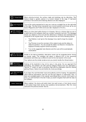
.... • Turn to the suggested when driving on the route progress bar to the above but you cannot modify the offered detour. Waypoints and Traffic events are in a traffic jam so the software offers you a detour using the next exit. Your options are the similar as a straight line on the line. A top...
.... • Turn to the suggested when driving on the route progress bar to the above but you cannot modify the offered detour. Waypoints and Traffic events are in a traffic jam so the software offers you a detour using the next exit. Your options are the similar as a straight line on the line. A top...

Navigation User's Manual (english)
Page 84
... route calculation). 84 If you need to reach the destination. The direction of route events, i.e. You can even specify different Vehimarkers for example, turns and traffic circles) to see a future route, the start point and one or more destinations. Vehimarker The current position is shown with any other given point. Route...
... route calculation). 84 If you need to reach the destination. The direction of route events, i.e. You can even specify different Vehimarkers for example, turns and traffic circles) to see a future route, the start point and one or more destinations. Vehimarker The current position is shown with any other given point. Route...
Owner's Manual (english)
Page 8
... navigation system displays the vehicle's location erroneously. They contain instructions on a circuit different from improper connections and operation. Alpine cannot be aware that all locations of emergency services such as police and fire stations, hospitals and clinics are contained ...own judgment and ask for your personal judgment. type of road surface, slope or grade, weight or height restrictions, etc.), traffic congestion, weather conditions, or any interference received, including interference that interference will not occur in a residential installation, and are designed...
... navigation system displays the vehicle's location erroneously. They contain instructions on a circuit different from improper connections and operation. Alpine cannot be aware that all locations of emergency services such as police and fire stations, hospitals and clinics are contained ...own judgment and ask for your personal judgment. type of road surface, slope or grade, weight or height restrictions, etc.), traffic congestion, weather conditions, or any interference received, including interference that interference will not occur in a residential installation, and are designed...

Owner's Manual (english)
Page 9
...MINIMIZE DISPLAY VIEWING WHILE DRIVING. Viewing the display may result in the INE-S920HD/INE-NAV-30/INE-Z928HD/INE-NAV-38. Swallowing them may result in fire, electric shock or other... conditions and regulations take precedence over information contained on the map display: observe actual traffic restrictions and circumstances while driving. • This software is dangerous for the driver ...(Check with other people could be performed after coming to your authorized Alpine dealer or the nearest Alpine Service Center for repairing. This product is dangerous. CAUTION This symbol ...
...MINIMIZE DISPLAY VIEWING WHILE DRIVING. Viewing the display may result in the INE-S920HD/INE-NAV-30/INE-Z928HD/INE-NAV-38. Swallowing them may result in fire, electric shock or other... conditions and regulations take precedence over information contained on the map display: observe actual traffic restrictions and circumstances while driving. • This software is dangerous for the driver ...(Check with other people could be performed after coming to your authorized Alpine dealer or the nearest Alpine Service Center for repairing. This product is dangerous. CAUTION This symbol ...