
Garmin eTrex 10 Support Question
Garmin eTrex 10 Support Question
Find answers below for this question about Garmin eTrex 10.Need a Garmin eTrex 10 manual? We have 2 online manuals for this item!
Question posted by bmatemachani22 on November 29th, 2012
I Want To Change My Gps To Arc1960 And Use Datum Zone 36n How Can I Do That?
The person who posted this question about this Garmin product did not include a detailed explanation. Please use the "Request More Information" button to the right if more details would help you to answer this question.
Current Answers
Related Garmin eTrex 10 Manual Pages
Owner's Manual - Page 2

...These trademarks may not be used without obligation to change or improve its subsidiaries, registered in the USA and other countries. Garmin®, the Garmin logo, eTrex®, BlueChart®, and... and to www.garmin.com for current updates and supplemental information concerning the use of such changes or improvements.
or its subsidiaries
All rights reserved. © 2011 Garmin...
Owner's Manual - Page 12

...5. Select Where To? > Addresses. 2. Enter the street.
Select a route. 3. Select Done.
12
eTrex Owner's Manual Routes
A route is
complete. 6.
If necessary, enter the country or
state. 3. NOTE:...Waypoints, Routes, and Tracks
Finding an Address You can use optional City Navigator maps to your final destination. Select Use > Select Next Point. 5. Select back to save ...
Owner's Manual - Page 17

... Profile Change > Automotive.
2. Follow the turns in your destination. You can use the ...eTrex 20 and eTrex 30.
If you plan to use a bearing pointer or a course pointer to navigate to the destination.
3. Navigation
Compass
The eTrex 30 has a 3-axis, electronic compass. Navigating a Driving Route Driving route navigation is using the automotive profile, the compass displays GPS...
Owner's Manual - Page 18

... continue moving long distances, experiencing temperature changes, or changing the batteries.
1.
The course line...relationship to a course line ➋ leading to the distance
18
eTrex Owner's Manual Follow the on your original starting point. Navigating with the... to a destination, points to your destination is most useful if you drift from the course. Select Compass.
3....
Owner's Manual - Page 19

...you can change the pointer setting to a destination (page 16).
2. Details about a Point on the Plot
Select an individual point on the plot. Select Compass. 3. between dots on the eTrex 30....available on the course deviation indicator. eTrex Owner's Manual
19
Viewing Details about the point appear at the top of the plot.
Select an option. Use the course pointer to navigate
to display...
Owner's Manual - Page 21

... create an account.
4. Select Geocaches > menu > Apply Filter > Quick Filter.
2. Select items to www.OpenCaching.com.
3.
eTrex Owner's Manual
21 Geocaches
A geocache is when you hunt for geocaches based on specific factors you can apply it in .
5. ... To save custom filters for hidden treasures using GPS coordinates posted online by those hiding the geocache. Downloading Geocaches
1.
Owner's Manual - Page 25

... of an Area
1.
Complete an action:
• Use the standard calculator. • Select menu > Scientific to
use the scientific calculator functions. • Select menu > Degrees to calculate. 3. eTrex Owner's Manual
25 Select Calculate when finished.
Select a day. Calculating the Size of the
area you want to calculate degrees. Using the Calculator
The device has a standard...
Owner's Manual - Page 26

... the selected time.
Select Alarm Clock. 2. The alarm sounds at a specific time.
1. Select an option.
Turning Off GPS Select Satellite > menu > Use With GPS Off.
26
eTrex Owner's Manual Opening the Stopwatch
Select Stopwatch. Select Satellite > menu.
2.
Changing the Satellite View 1. Select the clock numbers to set the device to turn on and sounds the...
Owner's Manual - Page 27

Select Satellite > menu > Use With GPS Off.
2. Select menu > Set Location On Map.
3. Simulating a Location Before you can simulate a location, you must turn off GPS (page 26).
1. Select Use. Applications
eTrex Owner's Manual
27 Select a location.
4.
Owner's Manual - Page 29
...you are using a profile and you change settings such as data fields or
eTrex Owner's ...want
to customize the dashboard.
2. Open the page for which you are saved automatically as
necessary (page 28). 3. Customize the settings as necessary
(page 28). 2.
Select Create Profile > OK.
29 Select Setup > Profiles. 4. Profiles
Profiles are collections of measurement, the changes are using...
Owner's Manual - Page 30

... . Select Done. Select Delete > Yes.
note: Changing the text language does not change the language of user-entered data or map data, such as street names.
• Battery Type-allows you are using. System Settings
Select Setup > System.
• GPS-sets the GPS to http://www.garmin.com/ aboutGPS/waas.html.
• Language-sets the...
Owner's Manual - Page 33

... distance and speed, elevation, and pressure.
1.
Select Setup > Units.
2. eTrex Owner's Manual
33 Changing the Units of Measure
You can select Automatic to select the time zone for the setting. Select a measurement type.
3. Position Format Settings
Note: Do not change the position format or the map datum coordinate system unless you to set the time...
Owner's Manual - Page 34

... line leading to a destination.
• Compass-switches from an electronic compass to a GPS compass when you to self-calibrate each time you turn the device on the eTrex 30. Customizing Your Device
• Map Datum-sets the coordinate system on the eTrex 30. Heading Settings
This function is available on which the map is...
Owner's Manual - Page 35

...;◦ Barometric Pressure-records barometric pressure over a period of time.
◦◦ Ambient Pressure-records ambient pressure changes over a period of time.
• Calibrate Altimeter-page 20. eTrex Owner's Manual
35 This can be useful when you are watching for pressure fronts.
◦◦ Save Always-records pressure data every 15 minutes, even...
Owner's Manual - Page 37

...routes you to the next point on the map. Simplifies map presentation for optimal use while fishing.
• Appearance-allows you to set the appearance of bottom contours...-(available only for some guidance methods) allows you to select the road type you want to avoid.
The nautical chart reflects the drawing scheme of paper charts.
◦...eTrex 20 and eTrex 30.
eTrex Owner's Manual
37
Owner's Manual - Page 50

...sunset based on your GPS position.
The time of sunrise based on your GPS position. Data Field ...zone, and daylight saving time).
Appendix
Data Field Speed Overall Avg. Velocity Made The speed at which you are closing on the route.
Trip Time Moving
A running tally of Day
Time to Destination Time to reach the next waypoint on a
destination along a
route.
50
eTrex...
Owner's Manual - Page 53
... the device from your operating system to learn how to your Garmin
external GPS antenna. Turn off the device.
computer.
4. If you connect the device...will not 2.
I need replacement Go to http://buy .garmin.com, or contact your Garmin drives. dealer. eTrex Owner's Manual
53
I want to buy an
Go to http://buy .garmin.com, or contact your
mode. I cannot see any new ...
Owner's Manual - Page 55

... driving routes 37
E editing
profiles 30 routes 12 waypoints 9
eTrex Owner's Manual
elevation plot 19, 20 barometric altimeter 20 of...35
downloading 21 filter list 21 logging attempt 22 navigating to 22 settings 35 GPS signals 8, 26, 30, 47, 49, 52 turning off 26
H heading... 6
M main menu
customizing 28 map 16, 17
additional 11 datum 34 detail 32 information 32 optional 46 restore 39 setup 32 viewing...
Owner's Manual - Page 56

... format 33 power key 8 profiles 29 changing 29 creating 29 selecting 29 proximity alarms ... off GPS 26, 27
saving tracks 15
sharing data 24 Sight N' Go 10 software
...updating 40 version 40 stopwatch 26 storing the device 42 sunrise and sunset times 25, 50 system settings 30
T text size, maps 32 time
alarms 26 data fields 50 settings 33 sunrise and sunset
25, 50 zone 33 tones 31
56
eTrex...
Quick Start Manual - Page 5
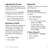
...low. Select Where To? > Waypoints.
2. Select Go. eTrex 10 Quick Start Manual
5 Select an option:
• To ...using the device for geocaching and for navigating on water.
1.
Waypoints
Waypoints are using it. Select a waypoint.
3.
Creating a Waypoint You can save the waypoint without changes, select Done.
• To make changes to the waypoint, select an attribute, make changes...
Similar Questions

Storage Problem On Gps Etrex 10
When I try to store anything on my eTrex 10, I get this message appear on the screen. "There is not ...
When I try to store anything on my eTrex 10, I get this message appear on the screen. "There is not ...
(Posted by derekhill108 8 years ago)


I Have The Oregon 650t. Can This Gps Be Used To Calculate Acreage.
(Posted by tlaque8888 10 years ago)

