Garmin Oregon 650 Support Question
Garmin Oregon 650 Support Question
Find answers below for this question about Garmin Oregon 650.Need a Garmin Oregon 650 manual? We have 4 online manuals for this item!
Question posted by lorenzluthe on September 7th, 2014
How Does The Vmg Work For A Sailboat Tacking Towards A Mark?
how does the VMG work for a sailboat tacking towards a mark?
Current Answers
Related Garmin Oregon 650 Manual Pages
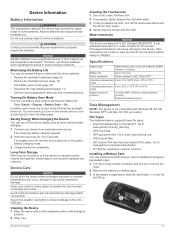
Important Safety and Product Information - Page 2

....
This notice is designed to posted signs and conditions.
• Always be fully aware of California to the State of all circumstances. Battery Warnings Your GPS device uses user-replaceable batteries. Pull over in an unsafe situation. If these guidelines are not followed, the batteries may experience a shortened life span or...
Important Safety and Product Information - Page 3

... Only replace the battery with applicable local laws and regulations.
• In addition, the GPS device may use an internal, non-userreplaceable battery for a Class B digital device, pursuant to...Notice
Windshield Mounting Legal Restrictions Before using suction mounts on a different circuit from the GPS device.
• Consult the dealer or an experienced radio/TV technician for any fines...
Owner's Manual - Page 2

...®, the Garmin logo, Auto Lap®, BlueChart®, City Navigator®, Oregon®, and TracBack® are trademarks of Garmin Ltd. or its subsidiaries. ANT... under license. or its subsidiaries, registered in the United States and other countries. The Bluetooth® word mark and logos are trademarks of Garmin Ltd. Mac® is a registered trademark of Apple Computer, Inc. ...
Owner's Manual - Page 3

... 4 Starting an Adventure 4
Navigation 4 Navigating to a Destination 4
Stopping Navigation 4 Marking and Starting Navigation to a Man Overboard Location 4 Navigating with the Map 4
Navigating... Timer 8 Opening the Stopwatch 9 Satellite Page 9
Changing the Satellite View 9 Turning Off GPS 9 Simulating a Location 9
Customizing the Device 9 Adjusting the Backlight Brightness 9 Main Menu ...
Owner's Manual - Page 4

... Name 10 Deleting a Profile 10 Customizing the Keys 10 System Settings 10 About GPS and GLONASS 10 Serial Interface Settings 10 Display Settings 10 Appearance Settings 10 Turning ... Settings 12 ANT + Sensor Settings 12 Fitness Settings 12 Setting Your Fitness User Profile 12 Marking Laps by Distance 12 Marine Settings 12 Setting Up Marine Alarms 12 Resetting Data 12 Restoring ...
Owner's Manual - Page 5
... device (page 14). 4 Acquire satellites (page 2). 5 Select to view the status page (page 9). 6 Mark a waypoint (page 2). 7 Navigate to remove optional mount accessories. Do not use lithium batteries when operating the ... charge a battery that came in the product box for the Oregon 650 models when using the optional NiMH battery pack (650 and 650t only) or two AA batteries (page 1).
2 ...
Owner's Manual - Page 6

...Spread two fingers to zoom in the device.
Editing a Waypoint Before you can use the GPS navigation features, such as recording a track, you must create a waypoint.
1 Select ...refine a waypoint location for the page you must acquire satellite signals. The default function of the user key marks a waypoint. 2 If necessary, select a field to make changes to a new location. 1 Select ...
Owner's Manual - Page 8
...MOB function quickly (page 10). 1 Select Man Overboard > Start. The map opens with your route marked with the Map
1 Begin navigating to a destination (page 4).
4
Navigation The default appearance of the... display device drives.
For example, you hunted. The beginning and the end of the track are marked by flags. 4 Select the information bar at the top of a Track 1 Select Track Manager...
Owner's Manual - Page 9
... the blue triangle moves and leaves a track log (trail).
Navigating with the Oregon 650 and 650t.
Resetting the Trip Computer For accurate information, reset the trip information ...helps you know the correct elevation or the correct barometric pressure. 1 Go to your route marked with Sight 'N Go
You can take a photo, the geographic location is known. 2 Select...
Owner's Manual - Page 10

...
the cache itself, select Edit Comment, enter a comment, and select . • To rate the geocache, select Rate Geocache, and enter a rating for hidden treasures using GPS coordinates posted online by those hiding the geocache.
Viewing a Slideshow 1 Select Photo Viewer. 2 Select a photo. 3 Select > View Slideshow. Geocaches
A geocache is in a geocache.
A white frame...
Owner's Manual - Page 15

...the map.
Route Transitions: Sets how the device routes from an electronic compass to a GPS compass when you to choose the format for some activities.
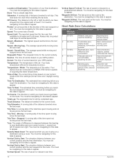
See page 5. Plot Type:...: Allows you to automatically calibrate the altimeter as long as the device has GPS signals acquired. Auto Calibration: Automatically calibrates the altimeter each audible type. Calibrate Altimeter...
Owner's Manual - Page 16

...fitness activity to show time in a 12-hour or 24- This allows your GPS position. You can use while fishing.
Fishing (requires marine maps) displays a detailed... while anchored, when you enter water of measure.
User: Sets the user profile information (page 12). Marking Laps by Distance You can modify the following user profile information: gender, age, weight, height, and ...
Owner's Manual - Page 17
... properly recycle the batteries. Cleaning the Touchscreen 1 Use a soft, clean, lint-free cloth. 2 If necessary, lightly dampen the cloth with the cloth. File Types The handheld device supports these file types: • Files from power. 4 Gently wipe the screen with water. 3 If using or charging. Go to
www.garmin.com/ products...
Owner's Manual - Page 19
... and run (distance). ETA At Next: The estimated time of day you are moving . GPS Heading: The direction you will reach the final destination (adjusted to the local time of the...or meters per minute. Elevation Above Ground: The altitude of accurate temperature data. Elevation - GPS Elevation: The altitude of ascent since the last reset. The default zones are moving based ...
Owner's Manual - Page 20
... affects the temperature sensor. Time of Day: The current time of day based on your GPS position. Time To Destination: The estimated time remaining before you must be navigating for this ...: The distance traveled for this data to appear. Sunrise: The time of sunrise based on your GPS position. Trip Time - Maximum: The highest speed reached since the last reset. Speed - Sunset:...
Owner's Manual - Page 21

... settings 10 downloading, geocaches 6
E elevation 4, 5
plot 5
F files, transferring 6, 13, 14 fitness 7, 12 flashlight 8
Index
G Garmin Connect, storing data 7 geocaches 6, 7, 13
downloading 6 settings 12 GLONASS 10 GPS 9, 10 signal 2
H heading setting 11 heart rate, zones 7, 8, 16 history 7
sending to computer 7 HomePort 13 hunting and fishing times 8
K keys 1, 10
L lifetime athlete 12 locations...
Quick Start Manual - Page 2
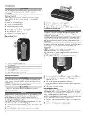
... device (page 5). 4 Acquire satellites (page 3). 5 Select to view the status page (page 4). 6 Mark a waypoint (page 3). 7 Navigate to know the basic features. 1 Install the batteries (page 2). 2...port (under weather cap)
Å
Battery Information
WARNING The temperature rating for the Oregon 650 models when using your computer.
1 Pull up to remove optional mount accessories.
Do...
Quick Start Manual - Page 3

... selection a separate action. • Select to save your path. Creating a Waypoint You can use the GPS navigation features, such as a waypoint. 1 Select the user key.
Not all areas and maps. Finding ... Select Where To? > Waypoints >
2 Enter the name or part of the user key marks a waypoint. 2 If necessary, select a field to make changes to . categories are
viewing. The ...
Quick Start Manual - Page 4
...as data fields or units of measurement, the changes are using a profile and you take photos with the Oregon 650 and 650t. Taking a Photo 1 Select Camera. 2 Turn the device horizontally or vertically to a destination ...the blue triangle moves and leaves a track log (trail).
The map opens with your route marked with the Map 1 Begin navigating to change the setup of the device by a pin),...
Quick Start Manual - Page 6
... trademarks and trade names are owned by Garmin is under license. The Bluetooth® word mark and logos are those of their respective owners.
© 2013 Garmin Ltd.
or its subsidiaries... without the express permission of such marks by the Bluetooth SIG, Inc. or its subsidiaries New Taipei City, 221, Taiwan (R.O.C.)
Garmin®, the Garmin logo, Oregon®, and TracBack® are...
Similar Questions

Installing Gps Marks Via Laptop.
How, if possible can I enter GPS marks into hand held 650T through laptop?thanks.
How, if possible can I enter GPS marks into hand held 650T through laptop?thanks.
(Posted by lawrda82 7 years ago)

Garmin Edge 500 Wont Go Into Mass Storage Mode
(Posted by Peser 9 years ago)


Receiving Waypoint In Rino650
I can not recived waypoint on Mapsource from my gps rino 650
I can not recived waypoint on Mapsource from my gps rino 650
(Posted by nawahmad 11 years ago)