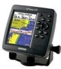
Garmin GPSMAP 492 Support Question
Garmin GPSMAP 492 Support Question
Find answers below for this question about Garmin GPSMAP 492 - Marine GPS Receiver.Need a Garmin GPSMAP 492 manual? We have 3 online manuals for this item!
Question posted by bamajo2 on April 28th, 2016
Garmin Gpsmap 492 How To Set The Gps Accuracy Alarm In A 429gpsmap.
I have Garmin gpsmap 492 chartplotter and I can't find the system sub tab to adjust the GPS Accuracy alarm setting. Thank you in [email protected]
Current Answers
Related Garmin GPSMAP 492 Manual Pages
Owner's Manual - Page 12
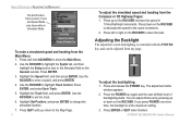
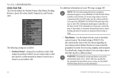
... backlight is controlled with the POWER key, and can adjust this level by pressing up on the General sub tab. Adjusting the Backlight
The adjustable screen backlighting is at the maximum setting. 3.
To adjust the backlighting: 1. Press and release the POWER key. The adjustment slider
window appears. 2. GPSMAP 392/398/492/498 Owner's Manual Press and hold ADJ/MENU to...
Owner's Manual - Page 19
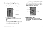
... highlight the waypoint on the map or from the User or Proximity sub tabs. 2. The Waypoint Edit Page is available for the selected waypoint. Sub tabs
BASIC OPERATION > REVIEWING AND EDITING WAYPOINTS
3.
Highlight the waypoint name field, and press ENTER. 2. GPSMAP 392/398/492/498 Owner's Manual
11 OR Press and hold ADJ/MENU, highlight...
Owner's Manual - Page 23
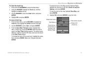
.... To change the name of track line
GPSMAP 392/398/492/498 Owner's Manual
15
Default track name
Total distance
Check this box to show track on the map, highlight Show Map, and press ENTER.
4. Using the ROCKER, highlight the Track tab, and then highlight the Active sub tab.
3. To save the track. From the...
Owner's Manual - Page 29
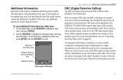
... marine VHF radio and GPS technologies to transmit position coordinates for a Map item: 1.
When the Coast Guard receives the
Information Window
GPSMAP 392/398/492/498 Owner's Manual
21
When any nearby rescuer receives the DSC signal, an alarm sounds and they immediately receive the location of information in a single transmission or call or position report. The chartplotter...
Owner's Manual - Page 45
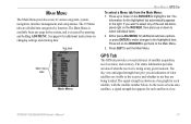
.../MENU. GPS Tab
The GPS tab provides a visual reference of the sub tab items, press right on the ROCKER, then press up or down to select any of satellite acquisition, receiver status, and accuracy. The sky view and signal strength bars give you want to select individual items.
2. Sub tabs
Main menu tabs
Main Menu
MAIN MENU > GPS TAB
To select a Menu tab from...
Owner's Manual - Page 48
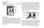
...Tide curve is zero or below).
Station name
Date
Tide chart
Event times
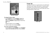
Tide Tab
Tide Sub Tab The Tide sub tab contains a graphical chart that shows Tide Station information in a 24-hour span ...from different dates and more than 3,000 Tide Stations around the U.S.A. GPSMAP 392/398/492/498 Owner's Manual The top of the Tide sub tab shows the Tide Station, the date, and the distance and bearing ...
Owner's Manual - Page 51
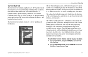
...when the current is heading away from different dates and Current Stations around the U.S.A.
GPSMAP 392/398/492/498 Owner's Manual
43 The top of the Caribbean islands.
Day (yellow bar)... press ENTER to open the Find
Currents Page.
2. Current Sub Tab The Current sub tab contains graphical charts showing information for direction. coastline, Alaska, Hawaii, western Canada, and several ...
Owner's Manual - Page 54
... ADJ/MENU, use the ROCKER to highlight Use Current Date and Time, and press ENTER.
46
Points Tab GPSMAP 392/398/492/498 Owner's Manual The sub tabs also provide continuously updated proximity waypoint alarms that can be used to exit. Enter a new date or time, and press ENTER. Press QUIT to define items...
Owner's Manual - Page 57

... alarm circle around a stored waypoint. Highlight OK, and press ENTER to delete all waypoints or the entire waypoint list: 1. GPSMAP 392/398/492/498 Owner's Manual
49 MAIN MENU > POINTS TAB...of the waypoint(s) to proximity alarms with an existing alarm circle, a "Proximity Overlaps Another Proximity Waypoint" message appears. From the User sub tab, press ADJ/MENU. To delete waypoints by ...
Owner's Manual - Page 58
...GPSMAP 392/398/492/498 Owner's Manual
To clear all proximity waypoints from the Proximity sub tab:
• New Waypoint-creates a waypoint and adds it to confirm. On the Points tab, highlight the Proximity sub tab...ROCKER to highlight the field below Proximity
Alarm, and press ENTER. 2. To select a waypoint from the User or Nearest tab.
4. Use the ROCKER to highlight OK, ...
Owner's Manual - Page 65
... and Saved. GPSMAP 392/398/492/498 Owner's Manual
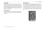
Active Track Tab 57 See page 14 for TracBack activation, and Map Page of the saved tracks on the criteria specified in the Track settings. Refer to approximately 10,000 track log points, based on this tab. Active Sub Tab The Active sub tab is recorded, or save...
Owner's Manual - Page 69
... press ENTER. MAIN MENU > PAGES AND MAP TABS
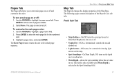
Map Tab
The Map tab changes the display properties of the Map tab's six sub tabs. The following pages contain descriptions of the Map Page. This field is only available when Warn Depth is now turned off : 1.
GPSMAP 392/398/492/498 Owner's Manual
61 Press ENTER to show...
Owner's Manual - Page 70

...Sub Tab
• AutoZoom-On, Off: when on, the map automatically adjusts the map zoom range to a lower range as you approach you destination point.
• Accuracy Circle-On, Off: toggles the circle on or off are unaffected by this setting...AIS.
62
GPSMAP 392/398/492/498 Owner's Manual You can choose from the end of the boat icon in the direction of the listed feature. AIS Sub Tab Refer to ...
Owner's Manual - Page 74
...) TAB
Units Sub Tab The Unit tab defines the Position Format, Map Datum, Heading, Distance, Speed, Elevation, Depth, Temperature, and Pressure units.
The following settings are familiar with your chosen position format. For additional information on the GPSMAP 392/398/492/498. You should appear somewhere on your GPS, make sure the settings under the Units tab of...
Owner's Manual - Page 76
... (military), or UTC time format.
• Time Zone-choose your GPSMAP 392/398/492/498 to show correct local time or select Other.
• Daylight Saving...adjust for use with a PC or another Garmin unit.
• Garmin Data Transfer-the proprietary format used when connecting your correct time zone to external NMEA devices, a PC, or another Garmin unit.
Time Sub Tab The Time tab...
Owner's Manual - Page 78
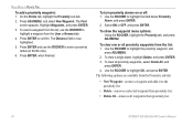
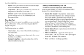
... or local) you are using for your system. Nav Sub Tab • Anchor Drag-sets an alarm to sound when you to sound when the power reaches a user-determined voltage.
• GPS Accuracy-the accuracy alarm sounds when the GPS position accuracy falls outside the user-set value. Advanced NMEA Output Setup Page
Alarm Tab
The Alarm tab allows you have exceeded a specified drift...
Owner's Manual - Page 79
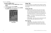
... start, and press ENTER. 4.
Press QUIT to highlight the Alarm tab and a sub tab. 3. GPSMAP 392/398/492/498 Owner's Manual
71 Enter a distance in the distance fields and use the control fields to turn the off course alarm on and off .
• Water Temperature-sets an alarm to sound when the transducer reports a temperature either above...
Owner's Manual - Page 87
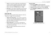
... Using the ROCKER, highlight the sub tab and then the field,
and press ENTER. 3. Highlight the setting, and press ENTER. 4. Keel...TAB OPTIONS
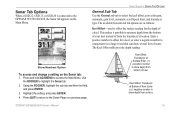
General Sub Tab Use the General sub tab to show depth from the transducer's location.
The Keel Offset reflects in the depth reading. Keel Offset: Transducer at Bottom of keel. GPSMAP 392/398/492/498 Owner's Manual
79 Sonar Tab...
Owner's Manual - Page 89

... SONAR > UNDERSTANDING SONAR
Graph Sub Tab The available Graph sub tab options are hollow.
If the new speed is used instead.
Suspended targets appear as symbols. Same as previous with target depth shown. Note your top water speed? field. If you select a fish symbol, the GPSMAP 392/398/492/498 identifies some...
Quick Reference Guide - Page 2
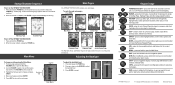
..., Highway Page, and other range-related functions. When the screen is receiving sonar information. Use the ROCKER to select a sub tab.
3.
Adjusting the Backlight
To adjust the backlight level: 1. Press and release the POWER key.
2. Press up , down on or off the GPSMAP 392/398/492/498: 1.
QUIT-press to return to move through main pages: Press...
Similar Questions

Gpsmap 492 Stopped Recieveing Satelite . Changed Antenna. No Help .any Ideas ?
(Posted by josie187 2 years ago)

Vmg How Do I Set Up Vmg On My Nav Charts And/or Home Setting? Thanks. Greg
(Posted by grnggreen 9 years ago)
Sometimes And Very Slowly Finds Satillites
i have 2 gps antennas mounted on the top of my center console bimani top or what ever the hell you c...
i have 2 gps antennas mounted on the top of my center console bimani top or what ever the hell you c...
(Posted by mrcrizzo 11 years ago)

Can The Software Be Updated
Can a Garmin GPSmap 492 be connected to a computer to upgrade software
Can a Garmin GPSmap 492 be connected to a computer to upgrade software
(Posted by mzgodny 12 years ago)