Manual - English, French, German and Spanish
Page 7
... memory in a new place. Note: Maps you define with MapSend DirectRoute are for France, Germany, Austria, and Switzerland. MapSend DirectRoute also includes basic, automated street routing and guidance functions. You can view the map on the GPS Receiver 17 Troubleshooting 25 Contacting Magellan 25 Overview MapSend DirectRoute Europe provides detailed Navtech® street maps and points of interest for use...
... memory in a new place. Note: Maps you define with MapSend DirectRoute are for France, Germany, Austria, and Switzerland. MapSend DirectRoute also includes basic, automated street routing and guidance functions. You can view the map on the GPS Receiver 17 Troubleshooting 25 Contacting Magellan 25 Overview MapSend DirectRoute Europe provides detailed Navtech® street maps and points of interest for use...
Manual - English, French, German and Spanish
Page 8
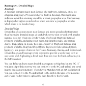
...Magellan mapping GPS receivers have a Meridian with smaller regions, close-up. The basemap is no detailed map. Detailed Map Detailed maps contain more map features and more specialized information than basemaps. Depending on the PC. Detailed Maps Basemap A basemap contains major map features like highways, railroads, cities, etc. Uploading a detail map...to upload the map directly to a broad geographic area. MapSend DirectRoute Europe provides detailed streets, highways, and points of optional MapSend detailed products available, including street maps, topographic maps, and marine charts....
...Magellan mapping GPS receivers have a Meridian with smaller regions, close-up. The basemap is no detailed map. Detailed Map Detailed maps contain more map features and more specialized information than basemaps. Depending on the PC. Detailed Maps Basemap A basemap contains major map features like highways, railroads, cities, etc. Uploading a detail map...to upload the map directly to a broad geographic area. MapSend DirectRoute Europe provides detailed streets, highways, and points of optional MapSend detailed products available, including street maps, topographic maps, and marine charts....