Quick Reference Guide
Page 1
The Magellan logo, Magellan, eXplorist and MapSend are trademarks of Thales Navigation, Inc. All rights reserved. ® MapSend® Lite Quick Reference* * For Magellan® eXploristTM 210, eXplorist 400, eXplorist 500, eXplorist 600 and eXplorist XL GPS Receivers © 2006 Thales Navigation, Inc.
The Magellan logo, Magellan, eXplorist and MapSend are trademarks of Thales Navigation, Inc. All rights reserved. ® MapSend® Lite Quick Reference* * For Magellan® eXploristTM 210, eXplorist 400, eXplorist 500, eXplorist 600 and eXplorist XL GPS Receivers © 2006 Thales Navigation, Inc.

Quick Reference Guide
Page 2
... can also be in GPX format. Note: Magellan MapSend Lite does not support the cutting and exporting of map regions. Supported GPS Receivers • eXplorist 210 • eXplorist 400 / 500 / 600 • eXplorist XL Introduction Maps must be transfered between a PC and Magellan Meridian and SporTrak GPS receivers.) • Provide advanced search options to the user. • Give access to...
... can also be in GPX format. Note: Magellan MapSend Lite does not support the cutting and exporting of map regions. Supported GPS Receivers • eXplorist 210 • eXplorist 400 / 500 / 600 • eXplorist XL Introduction Maps must be transfered between a PC and Magellan Meridian and SporTrak GPS receivers.) • Provide advanced search options to the user. • Give access to...
Quick Reference Guide
Page 8
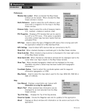
... When checked an information window will be displayed on POI icons. (This option is available only when a detail map has been loaded that has preloaded POIs.) GPS Type Used to select the coordinate system used with topographic information.) Coordinate System Used to select the type of the... topographic details will be used to turn off or on the map. (Available only when a detail map has been loaded with the application (eXplorist or Meridian/SporTrak). Tip of the Day window. Check for Update Checks the Magellan web site for waypoint information (geographic or UTM). When checked ...
... When checked an information window will be displayed on POI icons. (This option is available only when a detail map has been loaded that has preloaded POIs.) GPS Type Used to select the coordinate system used with topographic information.) Coordinate System Used to select the type of the... topographic details will be used to turn off or on the map. (Available only when a detail map has been loaded with the application (eXplorist or Meridian/SporTrak). Tip of the Day window. Check for Update Checks the Magellan web site for waypoint information (geographic or UTM). When checked ...
