
User Manual
Page 3
Any reference to the MAP 330 in this User Manual applies to the MAP 330M will be noted. User Manual MAP 330/MAP 330M This User Manual provides the instructions for using the Magellan MAP 330 and the Magellan MAP 330M GPS receivers. Those areas that apply only to both receivers.
Any reference to the MAP 330 in this User Manual applies to the MAP 330M will be noted. User Manual MAP 330/MAP 330M This User Manual provides the instructions for using the Magellan MAP 330 and the Magellan MAP 330M GPS receivers. Those areas that apply only to both receivers.
User Manual
Page 4
... Department of GPS. All rights reserved. Never rely solely on the MAP 330 while driving. The SOFTWARE is protected by Magellan Corporation. All rights not expressly granted are trademarks of Magellan Corporation. © 2000 by United States copyright laws and international treaty provisions; Magellan™, MAP 330™, MAP 330M™ and MapSend™ are reserved by MAGELLAN and/or...
... Department of GPS. All rights reserved. Never rely solely on the MAP 330 while driving. The SOFTWARE is protected by Magellan Corporation. All rights not expressly granted are trademarks of Magellan Corporation. © 2000 by United States copyright laws and international treaty provisions; Magellan™, MAP 330™, MAP 330M™ and MapSend™ are reserved by MAGELLAN and/or...
User Manual
Page 11
User Mode 60 Turning the Simulator Off 60 Help ...61 About...61 Frequently Asked Questions General 62 Waypoints/Database 63 Navigation Screens 64 Routes 64 Alarms 64 Output Data 65 Appendix Troubleshooting 66 Waypoint Icons 67 Features of the MAP 330M 68 Contacting Magellan 69 Specifications 70 Accessories 71 MapSend Streets 72 Connecting to External Devices 73 Glossary 75 Index ...78 Magellan MAP 330 GPS Receiver v Auto Mode 60 Turning on the Simulator - Using the Simulator 60 Turning on the Simulator -
User Mode 60 Turning the Simulator Off 60 Help ...61 About...61 Frequently Asked Questions General 62 Waypoints/Database 63 Navigation Screens 64 Routes 64 Alarms 64 Output Data 65 Appendix Troubleshooting 66 Waypoint Icons 67 Features of the MAP 330M 68 Contacting Magellan 69 Specifications 70 Accessories 71 MapSend Streets 72 Connecting to External Devices 73 Glossary 75 Index ...78 Magellan MAP 330 GPS Receiver v Auto Mode 60 Turning on the Simulator - Using the Simulator 60 Turning on the Simulator -
User Manual
Page 13
...MAP 330M has all the features of the box. Setting Up the MAP 330: This chapter will show you begin, make sure that your location on the side panel of the MAP 330, and has navaids (fixed navaids, buoys, lighthouses and marinas) preloaded into six chapters; Magellan MAP 330 GPS... Receiver 1 Before you how to prepare the MAP 330 for use the MAP 330 for most things you . Knowing these features, the MAP 330 offers the ability to initialize the MAP 330. Each of the Magellan MAP 330 GPS receiver. A glossary and index...
...MAP 330M has all the features of the box. Setting Up the MAP 330: This chapter will show you begin, make sure that your location on the side panel of the MAP 330, and has navaids (fixed navaids, buoys, lighthouses and marinas) preloaded into six chapters; Magellan MAP 330 GPS... Receiver 1 Before you how to prepare the MAP 330 for use the MAP 330 for most things you . Knowing these features, the MAP 330 offers the ability to initialize the MAP 330. Each of the Magellan MAP 330 GPS receiver. A glossary and index...
User Manual
Page 80
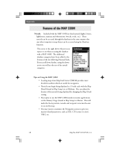
... screens to steer), VMG, etc. 68 Magellan MAP 330 GPS Receiver If you marine-related parameters, such as XTE, CTS (course to give you scroll down arrow, you will make the boat's position, navaids and waypoint icons much easier to see on Using the MAP 330M • Loading maps from MapSend Streets CDROM provides more detailed coastlines...
... screens to steer), VMG, etc. 68 Magellan MAP 330 GPS Receiver If you marine-related parameters, such as XTE, CTS (course to give you scroll down arrow, you will make the boat's position, navaids and waypoint icons much easier to see on Using the MAP 330M • Loading maps from MapSend Streets CDROM provides more detailed coastlines...


