Garmin echoMAP 50s Support Question
Garmin echoMAP 50s Support Question
Find answers below for this question about Garmin echoMAP 50s.Need a Garmin echoMAP 50s manual? We have 10 online manuals for this item!
Question posted by masillo on June 2nd, 2014
How to get the measures in meters with echomap 50
How to set the units of measurement in meters with echomap and 50s, audible fish presence
Current Answers
Related Garmin echoMAP 50s Manual Pages
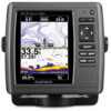
Quick Reference Guide - Page 1

...3. Use the map pointer ( ) to select the location you want to view the 50 nearest destinations that contain your current location as a waypoint or as an MOB: 1. Select...edit > Move.
4. OR From the Home screen, select Information > User Data > Waypoints. 2. Finding a Marine Service and Navigating to select characters and spell at least a portion of the name of your
destination. 3. Searching...
Important Safety and Product Information - Page 2
... have the battery removed and recycled. Battery Warnings Your GPS unit may damage plastic components. Virtually all available navigation sources,... result in an accident or collision resulting in 1 meter of high quality materials and does not require user ... precise measurement of authorized government charts. We use of direction, distance, location, or topography. • If your unit has ...
Important Safety and Product Information - Page 3
... is encouraged to try to correct the interference by anyone who is subject to the following measures:
• Reorient or relocate the receiving antenna.
• Increase the separation between the...customer for parts or labor, provided that may cause harmful interference to be free from the GPS unit.
• Consult the dealer or an experienced radio/TV technician for help.
SOME STATES...
Declaration of Conformity - Page 1
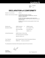
.../09/2009 Revised: Page: 1 of 1
DECLARATION of CONFORMITY
Application of Equipment: Model Number(s):
Marine Navigation Equipment (Global Positioning System Receiver) GPSMAP 5x6 (X may be any numeral 0-9)
The undersigned .... Radio disturbance characteristics. Methods of measurement
EN 60945: 2002 Maritime navigation and radio communication equipment and systems. General Requirements.
Installation Instructions - Page 11
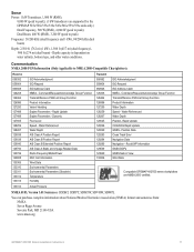
...are supported by the GPSMAP 525s/526s/535s/536s/545s/546s/555s/556s units only.) Dual Frequency, 500 W (RMS), 4,000 W (peak to...SDVHW, SDWPL
You can purchase complete information about National Marine Electronics Association (NMEA) format and sentences from: ...
11 Communication NMEA 2000 PGN Information (Only Applicable to peak)
Frequency: 50/200 kHz (dual frequency and 1 kW), 80/200 kHz (dual beam...
Owner's Manual - Page 4
... 2 Initializing Unit Settings 2 Adjusting the Backlight 3 Using the Keypad 4 Acquiring GPS Satellite Signals 5 Using Simulator Mode 5 Inserting and Removing SD Cards 5 Understanding the Home Screen 6
Using Charts 7 Using the Navigation Chart 7 Changing the Navigation Chart Settings 11 Using the Split Navigation Chart 14 Using Perspective 3D 14 Using Mariner's Eye 3D 15 Using Fish Eye...
Owner's Manual - Page 5
... Viewing System Information 48 Configuring System Settings 48 Configuring Units of Measure 49 Changing the System Language 49 Configuring Navigation Preferences 50 Configuring Communications Settings 51 Setting Alarms 53 Setting the Total Fuel Onboard Alarm 54 Configuring My Boat 55 Configuring Other Vessels 56 Restoring the Original Factory Settings 56
Using Sonar 57 Understanding the...
Owner's Manual - Page 21
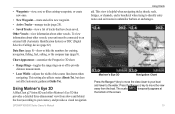
... fishing, fuel, sailing, or the compass tape (page 9). This setting also affects routes (Route To), but does not affect automatic guidance (Guide To). Using Mariner's Eye 3D
A BlueChart g2 Vision SD card offers Mariner's... off to provide distance measurement.
• Lane Width-adjusts the width of the screen.
15 Press the Range (-) key to move the view closer to your unit must be connected to...
Owner's Manual - Page 22

... the Rocker to point to view details about navaids such as seen from the Mariner's Eye 3D screen, press MENU. Mariner's Eye 3D Settings To access additional settings or options from the water. For settings and options related to provide distance measurement. Using Charts To view details about the navaid. When the cursor is over 3D...
Owner's Manual - Page 25
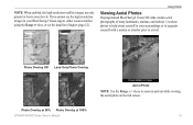
...SD cards contain aerial photographs of many landmarks, marinas, and harbors. Photo Overlay Off Land Only Photo Overlay
Photo Overlay at 50% Photo Overlay at lower zoom levels. Note: When enabled, the high-resolution satellite images are only present at 100% GPSMAP ... yourself with a marina or a harbor prior to zoom in further using the Range (+) key, or set the detail level higher (page 12).
Owner's Manual - Page 27
... as restaurants, lodging, local attractions and more knots
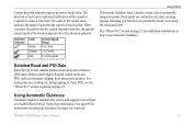
Using Charts
If Automatic Guidance must calculate a route close to 2 knots
2 or more .
See page 50 for
instructions on setting up Automatic Guidance for , and navigating to use Automatic Guidance.
The direction of each arrow indicates the direction of the current at the location...
Owner's Manual - Page 30
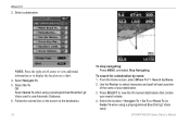
Follow the colored line on a chart. 4. Use the Rocker to view the 50 nearest destinations that contain your destination.
3.
OR Select Guide To when using a preprogrammed BlueChart g2 Vision card).
Press SELECT to select characters and spell at ...
Owner's Manual - Page 36
... to the information on BlueChart g2 Vision-compatible Garmin GPS units. The BlueChart g2 Vision Mariner's Eye 3D is more detailed than the preloaded data (page 15).
• Fish Eye 3D-provides an underwater 3D view that visually represents the sea floor according to your unit. You can only use the SD card on the...
Owner's Manual - Page 51

...Mariner's Eye 3D. 3. Select the length of an external AIS device and active transponder signals from your built-in map supports Fishing charts.
1. The display range configured for one chart or one 3D chart view is reported about AIS-activated vessels. • Proj. The details, projected heading, and trails settings...AIS signal status, MMSI, GPS speed, GPS heading, and other vessels ...
Owner's Manual - Page 56
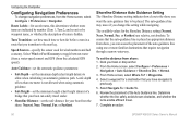
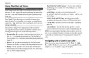
...from the calculated GPS speed). From the Home screen, select Configure > Preferences > Navigation > Auto Guidance > Shoreline Dist. > Normal.
3. Route Labels-for the Shoreline Distance setting (Nearest, Near,...6.
Review the placement of turns is not allowed when using one meter is hidden. Turn Transition-set the distance from the Home screen, select Configure > Preferences > ...
Owner's Manual - Page 74
... 38 seconds
GPSMAP 526/526s GPSMAP 556/556s
Warm*: Approximately 15 seconds Cold**: Approximately 45 seconds
*Warm: your unit is at or near the last location where you recently acquired satellites. **Cold: your unit has moved by more than about 500 mi. (800 km) since it was turned off. Update Rate: once...
Owner's Manual - Page 80

...GPS accuracy 54 navigation 53 off course 53 safe-zone 56 shallow water 54 sonar 54 water temp 54 Animated 11 apparent wind 36
74
Appearance 60 arrival alarms 53 Auto Magnetic 49 automatic guidance 21, 50...22 Chart Borders 13 chart data 9 charts
detail 12 fish eye 3D 17 fishing 17
mariner's eye 3D 15 navigation 7 settings 11 Clear User Data 39 collision alarm 56 colors, ...
Owner's Manual - Page 81
Fishing 9 fishing chart 17 Fish Symbols 17, 60 frequency 61 Fuel Capacity 56 fuel gauge 35 full screen, sonar 57 fuse 68
G
gain 61 Garmin Data Transfer 51 go to 23 GPS 5, 48, 68 GPS... datum 49 MapSource data 39 mariner's eye 3D 15
colors 16 mark current location 25 measuring distance 26 MENU key 5 ...settings 56 Rocker key 4 Roses 12 routes
creating 26 deleting 28 editing ...
Owner's Manual - Page 82
... speed 60 SD cards
inserting 5 removing 5 SELECT key 4 Serial Port setup 51 Service Points 11 settings alarms 53 chart 11 communications 51 fish eye 3D 17 initializing 2 language 49 navigation preferences 50 system 48
76
units of measure 49 Shoreline Distance 50 simulator 48
mode 5 Skyview 48 software license agreement 73 software version 48 sonar
advanced...
Technical Reference for Garmin NMEA 2000 Products - Page 12

... drop cable to a NMEA 2000 device is 6 m (20 ft). • No more than 50 NMEA 2000 devices can be connected to power to power? Drop Cable-Cable connecting a NMEA 2000 device... power at more terminators to 6 m (20 ft.) maximum length.
To estimate this distance, measure between any of these considerations, contact your boat manufacturer or a certified NMEA 2000 technician for assistance...
Similar Questions

There Is No Map On My Echomap 50s. Everything Else Works Including Speedometer.
(Posted by dave66232 3 years ago)

Blinking Garmin?
my echo map 50s will cut on and just blink Garmin and nothing else. I have cheacked connection and t...
my echo map 50s will cut on and just blink Garmin and nothing else. I have cheacked connection and t...
(Posted by groomesgreg 6 years ago)
How Do I Go Into Simulation Mode On A Garmin Marine Gps Modle741xs
how do I use simulation mode on a garmin 741xs marine ver
how do I use simulation mode on a garmin 741xs marine ver
(Posted by Curthupp 6 years ago)


541s Marine Gps. Depth Not Reading Out.
Depth has been working since installed. Now blank. Is there an on off control for this that may have...
Depth has been working since installed. Now blank. Is there an on off control for this that may have...
(Posted by therad50 11 years ago)