Garmin dezl 560LT Support Question
Garmin dezl 560LT Support Question
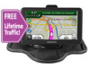
Find answers below for this question about Garmin dezl 560LT.Need a Garmin dezl 560LT manual? We have 2 online manuals for this item!
Question posted by buddielee1 on March 25th, 2012
Why Can I Not Get My Downloaded Poi's To Work With My Active Route,
The person who posted this question about this Garmin product did not include a detailed explanation. Please use the "Request More Information" button to the right if more details would help you to answer this question.
Current Answers
Related Garmin dezl 560LT Manual Pages
Owner's Manual - Page 2
... myGarmin Agent™, myTrends™, nüMaps Guarantee™, nüMaps Lifetime, nüRoute™, and trafficTrends™ are trademarks of such changes or improvements. or its subsidiaries
All ...™ is under license. These trademarks may be reproduced, copied, transmitted, disseminated, downloaded or stored in the U.S. © 2011 Garmin Ltd. The Bluetooth® word mark...
Owner's Manual - Page 3
... 19 Changing the Search Area....... 19
Planning a Trip 20 Scheduling a Trip 20 Navigating a Saved Trip........... 21 Editing a Saved Trip 21 Setting a Simulated Location... 21 Simulating a Route 21
i
Owner's Manual - Page 4
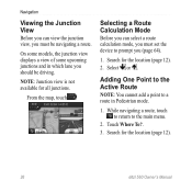
... Viewing the Next Turn 25 Viewing the Junction View....... 26 Selecting a Route
Calculation Mode 26 Adding One Point to the
Active Route 26 Taking a Detour 27 Stopping the Route 27 About myTrends 28 Using the Pedestrian
Navigation Map 28
Traffic 30 Subscription Activation 30 Traffic Receiver 30 Receiving Traffic Information... 31 About the Traffic Icon...
Owner's Manual - Page 5
... Truck or RV Profiles..... 60 Automobile, Truck, and RV
Navigation Settings 61
dēzl 560 Owner's Manual
Table of Contents
Pedestrian Navigation Settings 63
Choosing Route Preferences 63
Display Settings 66 Language Settings 66 Viewing Map Information ......... 67 Bluetooth Settings 67 Enabling Traffic 67 Restoring Settings 67
Appendix 68 Warning Icons...
Owner's Manual - Page 11
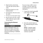
... possible. Fit the bottom of the vehicle power cable into a power outlet in Europe, you are using the suction cups.
NOTE: To optimize signal strength, route the external antenna on the bottom of the arm into the cradle.
7.
Getting Started
If you must connect the external antenna to receive traffic information...
Owner's Manual - Page 13
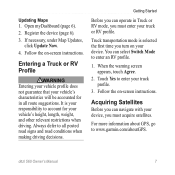
... truck profile.
3.
You can select Switch Mode to www.garmin.com/aboutGPS. Touch Yes to all route suggestions. dēzl 560 Owner's Manual
7 It is selected the first time you turn on ... operate in all posted road signs and road conditions when making driving decisions. For more information about GPS, go to enter an RV profile.
1. Follow the on your vehicle's height, length, weight...
Owner's Manual - Page 15
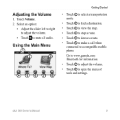
... ➊ to select a transportation mode.
• Touch ➋ to find a destination. • Touch ➌ to view the map. • Touch ➍ to stop a route. • Touch ➎ to detour a route. • Touch ➏ to make a call when
connected to a compatible mobile phone. dēzl 560 Owner's Manual
9 Adjusting the Volume
1. Touch Volume.
2.
Owner's Manual - Page 17
... on your transportation mode.
From the main menu, touch the
transportation mode icon. 2. Touch Save.
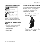
Transportation Modes
Automobile mode
Truck mode
RV mode
Pedestrian mode
Routing is present. dēzl 560 Owner's Manual
11 Select a mode. 3.
Changing the Transportation Mode 1. Getting Started
Using a Backup Camera
If a composite video backup camera has...
Owner's Manual - Page 19
...Services
The National Truck and Trailer Services (NTTS) Breakdown Directory lists businesses for a Location
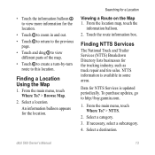
Viewing a Route on the Map 1. NTTS information is updated periodically. Select a category.
3. Data for the location... view different parts of the map.
• Touch ➏ to create a turn-by-turn route to http://buy.garmin.com.
1.
From the main menu, touch Where To? > NTTS.
2....
Owner's Manual - Page 20
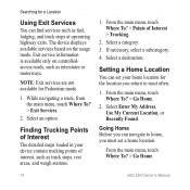
... based on controlledaccess roads, such as truck stops, rest areas, and weigh stations.
1. Exit service information is available only on the usage mode. While navigating a route, from the main menu, touch Where To? > Exit Services.
2. If necessary, select a subcategory.
4.
Finding Trucking Points of Interest
The detailed maps loaded in your home...
Owner's Manual - Page 27
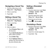
...most-efficient order. From the main menu, touch Tools > Settings > System > GPS Simulator > On.
2. Touch > Set Location. From the main menu, touch Tools > Settings > System > GPS Simulator > On.
2. Search for a location (page 12). 3.
Touch Go!... menu, touch Where To? > Trip Planner.
2. Simulating a Route
1. Touch Go!. Select a saved trip.
3. Navigating a Saved Trip
1.
Owner's Manual - Page 32
... prompt you (page 64).
1. Adding One Point to the Active Route
NOTE: You cannot add a point to the main menu.
2. Search for the location (page 12). 2. From the map, touch . While navigating a route, touch to return to a route in which lane you should be navigating a route.
Navigation
Viewing the Junction View
Before you can select...
Owner's Manual - Page 33
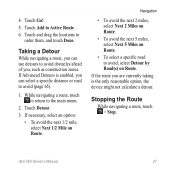
...select Next 2 Miles on Route.
• To avoid the next 5 miles, select Next 5 Miles on Route.
• To select a specific road to avoid (page 65).
1.
Stopping the Route
While navigating a route, touch > Stop. If ... an option:
• To avoid the next 1/2 mile, select Next 1/2 Mile on Route. If the route you are currently taking is enabled, you , such as construction zones. Touch Add to ...
Owner's Manual - Page 61
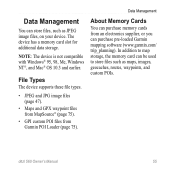
... from an electronics supplier, or you can store files, such as maps, images, geocaches, routes, waypoints, and custom POIs. Data Management
About Memory Cards
You can purchase memory cards from Garmin POI Loader (page 75).
The device has a memory card slot for additional data storage.
Data Management
You can purchase pre-loaded Garmin...
Owner's Manual - Page 66
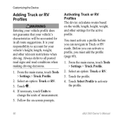
... add the profile (page 60).
1. If necessary, touch Units to activate the profile.
60
dēzl 560 Owner's Manual It is your responsibility to all route suggestions. Touch Select Profile to change the units of measurement.
5. Activating Truck or RV Profiles The device calculates routes based on -screen prompts. Touch .
4. Always defer to account...
Owner's Manual - Page 67
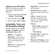
... menu, touch Tools > Settings > Navigation, and select Automobile, Truck, or RV.
• nüRoute™ -see page 63.
• Map Detail-sets the level of data visible on the map.
... Points-changes the proximity points setting (page 62).
• Sharp Curve Warnings-allows you must activate a different profile (page 60).
1.
Customizing the Device
• Map Theme-changes the color ...
Owner's Manual - Page 82
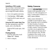
... updated at least weekly, so you are approaching a safety camera and can create or download custom POI lists and install them on the POI Loader, refer to http://my.garmin.com for the accuracy of, or the consequences of using POI Loader software.
1. From the main menu, touch
Where To? > Extras. 2.
For these locations...
Owner's Manual - Page 90
...POI loader software 76 points of interest calling 53
84
custom 75-76 finding 15-17 rating 17 removing incorrect 16 reporting incorrect 16 trucking 14 police stations 43 portable friction mount 2-3 power cables 69 power key 8 predictive routing... maps 29 purchasing maps 75
R rating points of interest 16 recalculating routes
detours 27-28 traffic 32 receiver, traffic 30-34 recently found locations...
Owner's Manual - Page 91
...14 nearby 43 NTTS 13 settings Bluetooth 67 customized main
menu 58-59 display 66 GPS 58 language 66 map 61-62, 67 navigation, pedestrian
63 navigation, vehicle
61-62 restoring 67 route 63-65 simulator 21, 58
Index
system 58 traffic 67 truck or RV 60-...traffic 30, 67 support 77 system settings 58
T theft, avoiding 71 tips
Bluetooth 51-52 driving 46 troubleshooting 78-79
85 route preferences 26-28...
Quick Start Manual - Page 10
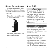
NOTICE Garmin is not available in Truck mode, the recalculated route might include roads that have not been verified for the accuracy or timeliness of the camera on the cradle.
Connect the camera to activate.
Traffic information is not responsible for truck accessibility. About Traffic
Caution If you choose to recalculate your...
Similar Questions


Calibration For My Gps
One thing we can"t performing a screen calibration soon when I follow and touch dot on my screen aft...
One thing we can"t performing a screen calibration soon when I follow and touch dot on my screen aft...
(Posted by ferojana 11 years ago)

How Many Addresses Can U Put Into It For The Auto Sort Function Yo Work
(Posted by Sferreira2 11 years ago)
