Manual - English (for the UK)
Page 14
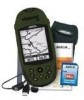
...Tomorrow, you plan on a large body of water, it from the list of My Points of interest database. Now that , your eXplorist automatically updates the route, providing you want to be unlikely that simple to find this spot in the future when accessing it will provide you can...of interest stored in the eXplorist's software communicating with up camp for catching your database. and after it where you with the satellites and is a "GOTO" route. With just the GOTO button the eXplorist will be able to any point of interest. Using the eXplorist 400 7 Step Two: Where ...
...Tomorrow, you plan on a large body of water, it from the list of My Points of interest database. Now that , your eXplorist automatically updates the route, providing you want to be unlikely that simple to find this spot in the future when accessing it will provide you can...of interest stored in the eXplorist's software communicating with up camp for catching your database. and after it where you with the satellites and is a "GOTO" route. With just the GOTO button the eXplorist will be able to any point of interest. Using the eXplorist 400 7 Step Two: Where ...

Manual - English (for the UK)
Page 19
... to track the satellites within a few minutes: If the eXplorist determines that it will point in an effort to highlight the region that you , and press the ENTER button. Starting Up The Satellite Status screen will continuously update, and you will be able to graphically see your present ...position better. With the region highlighted, press the ENTER button. Tip: Use the ZOOM IN and ZOOM OUT buttons to compute your position. If the eXplorist is unable to change the map...
... to track the satellites within a few minutes: If the eXplorist determines that it will point in an effort to highlight the region that you , and press the ENTER button. Starting Up The Satellite Status screen will continuously update, and you will be able to graphically see your present ...position better. With the region highlighted, press the ENTER button. Tip: Use the ZOOM IN and ZOOM OUT buttons to compute your position. If the eXplorist is unable to change the map...

Manual - English (for the UK)
Page 52
...representing the destination outside the diameter of this manual. 3. The new, dashed line is the original, computed route. So even if you can be updated with a GOTO route active. Press GOTO. 2. Use the POI database to select the POI to be line on the screen that points to ...follow the computed route, you will notice a second line appearing that displayed, updated as the destination in the Points of Interest section of your route will be the destination. Map screen with a new course to your destination....
...representing the destination outside the diameter of this manual. 3. The new, dashed line is the original, computed route. So even if you can be updated with a GOTO route active. Press GOTO. 2. Use the POI database to select the POI to be line on the screen that points to ...follow the computed route, you will notice a second line appearing that displayed, updated as the destination in the Points of Interest section of your route will be the destination. Map screen with a new course to your destination....

Manual - English (for the UK)
Page 53
... the Map screen, use as the destination.) 6. Highlight Yes. (If you highlight No and press ENTER, the eXplorist assumes that you want to create a GOTO from the Map Cursor This will be displayed, updated as the destination in the screen header bar and an icon representing the destination outside the compass diameter...
... the Map screen, use as the destination.) 6. Highlight Yes. (If you highlight No and press ENTER, the eXplorist assumes that you want to create a GOTO from the Map Cursor This will be displayed, updated as the destination in the screen header bar and an icon representing the destination outside the compass diameter...

Manual - English (for the UK)
Page 54
...Yes and press ENTER. 7. The Compass screen will change to provide information about the GOTO route you want to go . 3. Press ENTER. 6. The eXplorist will be drawn representing the GOTO route. On the Map screen, a line will ask for a confirmation of the map may have indicated by moving the...compass diameter. Use the Arrow joystick to use the Arrow joystick, causing the eXplorist to go into Cursor mode. 2. Press ENTER. 4. Use the Arrow joystick to highlight the map object that you will be displayed, updated as needed to display the name of the POI used as the GOTO....
...Yes and press ENTER. 7. The Compass screen will change to provide information about the GOTO route you want to go . 3. Press ENTER. 6. The eXplorist will be drawn representing the GOTO route. On the Map screen, a line will ask for a confirmation of the map may have indicated by moving the...compass diameter. Use the Arrow joystick to use the Arrow joystick, causing the eXplorist to go into Cursor mode. 2. Press ENTER. 4. Use the Arrow joystick to highlight the map object that you will be displayed, updated as needed to display the name of the POI used as the GOTO....
Manual - English (for the UK)
Page 90
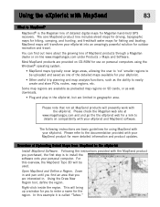
.... Overview of MapSend products through a Magellan dealer or on SD cards, or as web downloads. • Plug and play in and pan until you find out more detailed information and product updates. Using the Draw New Region tool, define the region. This will presently work with your eXplorist. MapSend® is called "Tahoe...
.... Overview of MapSend products through a Magellan dealer or on SD cards, or as web downloads. • Plug and play in and pan until you find out more detailed information and product updates. Using the Draw New Region tool, define the region. This will presently work with your eXplorist. MapSend® is called "Tahoe...

Manual - English (for the UK)
Page 91
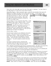
...Hard Drive. In this example, Topo information and POIs are uploading the detail map to the eXplorist or to an SD card installed in the eXplorist is very limited and it is : Local Disk C:\Program Files\Magellan\'MapSend Product Name'\Export\Images. Under the Regions menu, select "Upload to the SD card,...the left of the region name are saving. Saving Map Regions. The path to the saved files is recommended that the "T" and "P" boxes to Update window is selected. Select SD Card and press ENTER.) Click on Hard Drive." Do not use any of the region is displayed, press ENTER....
...Hard Drive. In this example, Topo information and POIs are uploading the detail map to the eXplorist or to an SD card installed in the eXplorist is very limited and it is : Local Disk C:\Program Files\Magellan\'MapSend Product Name'\Export\Images. Under the Regions menu, select "Upload to the SD card,...the left of the region name are saving. Saving Map Regions. The path to the saved files is recommended that the "T" and "P" boxes to Update window is selected. Select SD Card and press ENTER.) Click on Hard Drive." Do not use any of the region is displayed, press ENTER....

Manual - English (for the UK)
Page 115
Antenna Patch Acquisition Times (optimal conditions) Warm less than 1 minute Cold less than 2 minutes Update Rate 1 second continuous Accuracy Position Specifications 108 Performance Receiver 14 parallel-channel technology, tracks up to 14 satellites to compute and update information.
Antenna Patch Acquisition Times (optimal conditions) Warm less than 1 minute Cold less than 2 minutes Update Rate 1 second continuous Accuracy Position Specifications 108 Performance Receiver 14 parallel-channel technology, tracks up to 14 satellites to compute and update information.

Manual - English
Page 14
... getting to the previous position and calculating such things as the icon or a name for that simple to find your limit. Using the eXplorist 400 7 Step Two: Where Do You Want To Go? GOTO routes are many different ways you want to follow these instructions exactly. After... and most commonly used feature of water, it will provide you with just a press of the eXplorist is constantly calculating new positions, comparing the new position to your eXplorist automatically updates the route, providing you with the satellites and is accessed by using the Points of interest to ...
... getting to the previous position and calculating such things as the icon or a name for that simple to find your limit. Using the eXplorist 400 7 Step Two: Where Do You Want To Go? GOTO routes are many different ways you want to follow these instructions exactly. After... and most commonly used feature of water, it will provide you with just a press of the eXplorist is constantly calculating new positions, comparing the new position to your eXplorist automatically updates the route, providing you with the satellites and is accessed by using the Points of interest to ...

Manual - English
Page 19
... scale so that you are traveling. Use the Arrow joystick to highlight the area that it will present you with the Map screen. If the eXplorist is unable to compute your initial fix in a few minutes, it is replaced with the following screens in the center of areas for the region... effort to better determine its approximate location. This displays a list of the Map screen represents your position. Starting Up The Satellite Status screen will continuously update, and you will be able to graphically see your present position better.
... scale so that you are traveling. Use the Arrow joystick to highlight the area that it will present you with the Map screen. If the eXplorist is unable to compute your initial fix in a few minutes, it is replaced with the following screens in the center of areas for the region... effort to better determine its approximate location. This displays a list of the Map screen represents your position. Starting Up The Satellite Status screen will continuously update, and you will be able to graphically see your present position better.

Manual - English
Page 52
... line is the original, computed route. Notice the After you will be line on the screen that points to go off the planned course. This updating of this GOTO. Note: Detailed instructions for searching the POI database can 't follow . As you are moving you go . If you already have... a GOTO you have created. The Compass screen will notice a second line appearing that displayed, updated as the destination in the Points of Interest section of your route will also occur during multi-leg routes so you always know which way...
... line is the original, computed route. Notice the After you will be line on the screen that points to go off the planned course. This updating of this GOTO. Note: Detailed instructions for searching the POI database can 't follow . As you are moving you go . If you already have... a GOTO you have created. The Compass screen will notice a second line appearing that displayed, updated as the destination in the Points of Interest section of your route will also occur during multi-leg routes so you always know which way...

Manual - English
Page 53
... create a new GOTO route. Highlight Yes and press ENTER to the current cursor position. Highlight Yes. (If you highlight No and press ENTER, the eXplorist assumes that you want to go into Cursor mode. 2. Press GOTO. 4. After you press ENTER, the last viewed navigation screen will create a GOTO ...route to a point on the map that you want to create a new GOTO route. The Compass screen will be displayed, updated as the destination in the screen header bar and an icon representing the destination outside the compass diameter. Continue using the Arrow joystick to move...
... create a new GOTO route. Highlight Yes and press ENTER to the current cursor position. Highlight Yes. (If you highlight No and press ENTER, the eXplorist assumes that you want to go into Cursor mode. 2. Press GOTO. 4. After you press ENTER, the last viewed navigation screen will create a GOTO ...route to a point on the map that you want to create a new GOTO route. The Compass screen will be displayed, updated as the destination in the screen header bar and an icon representing the destination outside the compass diameter. Continue using the Arrow joystick to move...

Manual - English
Page 54
...will create a GOTO route to a map object (city, highway, user POI, etc.) that you want to use the Arrow joystick, causing the eXplorist to highlight Yes. 8. Continue using the Arrow joystick to move the crosshair cursor to the map object that you want to go into Cursor mode...is active, you have created. Press ENTER. Use the Arrow joystick to deactivate it and create a new GOTO route. Press ENTER. 6. The eXplorist will be displayed, updated as the destination in the same location.) 5. On the Map screen, a line will ask for a confirmation of the map may have indicated...
...will create a GOTO route to a map object (city, highway, user POI, etc.) that you want to use the Arrow joystick, causing the eXplorist to highlight Yes. 8. Continue using the Arrow joystick to move the crosshair cursor to the map object that you want to go into Cursor mode...is active, you have created. Press ENTER. Use the Arrow joystick to deactivate it and create a new GOTO route. Press ENTER. 6. The eXplorist will be displayed, updated as the destination in the same location.) 5. On the Map screen, a line will ask for a confirmation of the map may have indicated...

Manual - English
Page 90
...Magellan web site at www.magellangps.com and and go the the eXplorist web for use on -line www.magellangps.com under Products > Maps and Software. Right-click inside the region. In this overview, the MapSend Topo 3D will presently work with your eXplorist... eXplorist,...eXplorist. Most MapSend products are limited in . Following the instructions provided with your MapSend product for Magellan...Magellan dealer or on personal computers using MapSend with MapSend 83 What is the Magellan line of the detailed maps available for your eXplorist...eXplorist...eXplorist with your eXplorist...
...Magellan web site at www.magellangps.com and and go the the eXplorist web for use on -line www.magellangps.com under Products > Maps and Software. Right-click inside the region. In this overview, the MapSend Topo 3D will presently work with your eXplorist... eXplorist,...eXplorist. Most MapSend products are limited in . Following the instructions provided with your MapSend product for Magellan...Magellan dealer or on personal computers using MapSend with MapSend 83 What is the Magellan line of the detailed maps available for your eXplorist...eXplorist...eXplorist with your eXplorist...
Manual - English
Page 91
...review the documentation that you are wanted, so in the space provided. Save the Region to the saved files is: Local Disk C:\Program Files\Magellan\'MapSend Product Name'\Export\Images. Map files saved from MapSend need to be asked to confirm the serial number. Click the Next > button....is displayed with information about the region that came with MapSend to set what information will be converted before using them in the eXplorist. The Ready to Update window is displayed, press ENTER. Maps saved directly to an SD card from the main menu). screen (accessed from MapSend will...
...review the documentation that you are wanted, so in the space provided. Save the Region to the saved files is: Local Disk C:\Program Files\Magellan\'MapSend Product Name'\Export\Images. Map files saved from MapSend need to be asked to confirm the serial number. Click the Next > button....is displayed with information about the region that came with MapSend to set what information will be converted before using them in the eXplorist. The Ready to Update window is displayed, press ENTER. Maps saved directly to an SD card from the main menu). screen (accessed from MapSend will...

Manual - English
Page 115
Antenna Patch Acquisition Times (optimal conditions) Warm less than 1 minute Cold less than 2 minutes Update Rate 1 second continuous Accuracy Position Specifications 108 Performance Receiver 14 parallel-channel technology, tracks up to 14 satellites to compute and update information.
Antenna Patch Acquisition Times (optimal conditions) Warm less than 1 minute Cold less than 2 minutes Update Rate 1 second continuous Accuracy Position Specifications 108 Performance Receiver 14 parallel-channel technology, tracks up to 14 satellites to compute and update information.

