
User Manual
Page 1
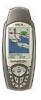
User Manual SporTrak Series of the functions described in this manual apply to both the SporTrak™ Map and the SporTrak™ Pro GPS receivers. The SporTrak Pro has a 9MB basemap and 23MB for data downloaded from MapSend products. All of GPS Mapping Receivers . The SporTrak Map has a 2MB basemap with an additional 4MB for data downloaded from MapSend™ products. This manual covers both receivers.
User Manual SporTrak Series of the functions described in this manual apply to both the SporTrak™ Map and the SporTrak™ Pro GPS receivers. The SporTrak Pro has a 9MB basemap and 23MB for data downloaded from MapSend products. All of GPS Mapping Receivers . The SporTrak Map has a 2MB basemap with an additional 4MB for data downloaded from MapSend™ products. This manual covers both receivers.
User Manual
Page 9
... Routes 63 Alarms 63 Output Data 63 Appendix Troubleshooting 65 Waypoint Icons 66 Contacting Magellan 67 Specifications 68 Accessories 69 MapSend™ Streets 70 Connecting to External Devices 71 Connecting to External Power Source 72 WAAS 73 Glossary 74 Magellan SporTrak GPS Receiver v Accessing the Fish/Hunt Screen 57 Changing the Fish/Hunt Date 57 Changing...
... Routes 63 Alarms 63 Output Data 63 Appendix Troubleshooting 65 Waypoint Icons 66 Contacting Magellan 67 Specifications 68 Accessories 69 MapSend™ Streets 70 Connecting to External Devices 71 Connecting to External Power Source 72 WAAS 73 Glossary 74 Magellan SporTrak GPS Receiver v Accessing the Fish/Hunt Screen 57 Changing the Fish/Hunt Date 57 Changing...

User Manual
Page 33
... select POI Magellan SporTrak GPS Receiver 23 From the MAP Screen Highlight Map Setup Use L/R Use U/D arrows to arrows to select select "Track "Display" tab Lines" Turning On/Off Topographic Lines - [Available only if a map has been uploaded from a Magellan MapSend Streets and Destinations or MapSend Topo for the...select select "Topo "Display" tab Lines" Turning On/Off Displayed POI's - [Available only if a map has been uploaded from a Magellan MapSend Topo for your track history is On. The Map screen can select what is being displayed on the map screen represented by a dashed...
... select POI Magellan SporTrak GPS Receiver 23 From the MAP Screen Highlight Map Setup Use L/R Use U/D arrows to arrows to select select "Track "Display" tab Lines" Turning On/Off Topographic Lines - [Available only if a map has been uploaded from a Magellan MapSend Streets and Destinations or MapSend Topo for the...select select "Topo "Display" tab Lines" Turning On/Off Displayed POI's - [Available only if a map has been uploaded from a Magellan MapSend Topo for your track history is On. The Map screen can select what is being displayed on the map screen represented by a dashed...
User Manual
Page 34
... go back and just select the POIs that are not clear on a map object, the name of the map to the cursor is displayed. 24 Magellan SporTrak GPS Receiver Inversely, to be extremely lengthy. If you press the ESC key and the display changes to see them. Default is to another Nav Screen you... States CD-ROM, the elevation at the cursor's location is displayed; To turn off all of the map items, you have uploaded map data from Magellan's MapSend Topo for more of the object is shown in the cursor mode, press the ESC key and the display will also turn off waypoints, track...
... go back and just select the POIs that are not clear on a map object, the name of the map to the cursor is displayed. 24 Magellan SporTrak GPS Receiver Inversely, to be extremely lengthy. If you press the ESC key and the display changes to see them. Default is to another Nav Screen you... States CD-ROM, the elevation at the cursor's location is displayed; To turn off all of the map items, you have uploaded map data from Magellan's MapSend Topo for more of the object is shown in the cursor mode, press the ESC key and the display will also turn off waypoints, track...

User Manual
Page 36
... is displayed above the graph, next to the map scale indicator. (This function requires that map data has been uploaded from Magellan MapSend Topo for the United States and that your present position as well as the projected horizon falls within the area uploaded.) You... Projection Description - If you change Orientation to something other then Track Up while viewing the 26 Magellan SporTrak GPS Receiver Reference function requires that map data has been uploaded from Magellan MapSend Topo for the United States and that your present position as well as the projected horizon falls ...
... is displayed above the graph, next to the map scale indicator. (This function requires that map data has been uploaded from Magellan MapSend Topo for the United States and that your present position as well as the projected horizon falls within the area uploaded.) You... Projection Description - If you change Orientation to something other then Track Up while viewing the 26 Magellan SporTrak GPS Receiver Reference function requires that map data has been uploaded from Magellan MapSend Topo for the United States and that your present position as well as the projected horizon falls ...

User Manual
Page 38
...topographic map has been uploaded, you have the additional options of selecting Path Check, Route or Highlighted Road. See the information on the profile. 28 Magellan SporTrak GPS Receiver The vertical dashed line in a straight line, only a few track points are Auto (default) and Auto Detailed. You will notice two of ...you can be taken, while at the same time saving memory over a fixed rate. Only Track History is available for this function if MapSend Topo for the United States map data is not uploaded. (Path Check is highly recommended that point on Path Check for that you ...
...topographic map has been uploaded, you have the additional options of selecting Path Check, Route or Highlighted Road. See the information on the profile. 28 Magellan SporTrak GPS Receiver The vertical dashed line in a straight line, only a few track points are Auto (default) and Auto Detailed. You will notice two of ...you can be taken, while at the same time saving memory over a fixed rate. Only Track History is available for this function if MapSend Topo for the United States map data is not uploaded. (Path Check is highly recommended that point on Path Check for that you ...

User Manual
Page 39
...you want to lay out your path. Continue moving the cursor and pressing [GOTO] until your track, either with map data uploaded from Magellan MapSend Topo for the United States.) If you can also save this path's vertical profile (assuming that is on a road and you have... the vertical profile of creating a route. After selecting Path Check from Magellan MapSend Topo for the United States.) If the cursor or your present position is stored in memory, you can view the vertical profile for the road you have cleared your path is displayed. Magellan SporTrak GPS Receiver 29
...you want to lay out your path. Continue moving the cursor and pressing [GOTO] until your track, either with map data uploaded from Magellan MapSend Topo for the United States.) If you can also save this path's vertical profile (assuming that is on a road and you have... the vertical profile of creating a route. After selecting Path Check from Magellan MapSend Topo for the United States.) If the cursor or your present position is stored in memory, you can view the vertical profile for the road you have cleared your path is displayed. Magellan SporTrak GPS Receiver 29

User Manual
Page 52
...") or view it on the address you have uploaded one or more detailed maps from the MapSend Streets software. If you to record this waypoint. NOTE: The option is based upon the map that range. 42 Magellan SporTrak GPS Receiver Highlight "Save" and press ENTER to search an uploaded map database for a Street Address - This..." or "View" Mark. Selecting "View" and pressing ENTER returns you can now change any of the attributes for this waypoint into the memory of the SporTrak.
...") or view it on the address you have uploaded one or more detailed maps from the MapSend Streets software. If you to record this waypoint. NOTE: The option is based upon the map that range. 42 Magellan SporTrak GPS Receiver Highlight "Save" and press ENTER to search an uploaded map database for a Street Address - This..." or "View" Mark. Selecting "View" and pressing ENTER returns you can now change any of the attributes for this waypoint into the memory of the SporTrak.

User Manual
Page 70
From Any Screen Highlight Help Select Topic Use the "Next" and "Prev" buttons to scroll the SporTrak Help Files. 60 Magellan SporTrak GPS Receiver screen displays the current status of tips available that can be viewed. Reference About... Using the About... screen you can view help tips for Nav ... is, the version and memory size of the base map, the number of and total memory size of detailed maps you may have installed using MapSend Streets™, and how much free memory is available. Each topic has a number of your...
From Any Screen Highlight Help Select Topic Use the "Next" and "Prev" buttons to scroll the SporTrak Help Files. 60 Magellan SporTrak GPS Receiver screen displays the current status of tips available that can be viewed. Reference About... Using the About... screen you can view help tips for Nav ... is, the version and memory size of the base map, the number of and total memory size of detailed maps you may have installed using MapSend Streets™, and how much free memory is available. Each topic has a number of your...
User Manual
Page 79
... detailed street maps, topographic data as well as POI's to your receiver to connect your SporTrak receiver. (Available only with Cigarette Lighter Adapter: Allows you to connect the receiver to a PC. External Power Cable with United States topographic information.) MapSend™ Streets and Destinations - Magellan SporTrak GPS Receiver 69 Power/Data Cable (Bare Wires): Allows you to external power...
... detailed street maps, topographic data as well as POI's to your receiver to connect your SporTrak receiver. (Available only with Cigarette Lighter Adapter: Allows you to connect the receiver to a PC. External Power Cable with United States topographic information.) MapSend™ Streets and Destinations - Magellan SporTrak GPS Receiver 69 Power/Data Cable (Bare Wires): Allows you to external power...

User Manual
Page 80
... load detailed street maps into your SporTrak. Appendix The MapSend Streets CD allows you choose to load into the receiver. Features • Enables you to load street maps for any region in the United States, Canada or Europe into the SporTrak. • Allows you to cut...upload/download of North American or European cities. The maps supplied on the MapSend Streets CD contain full street detail of waypoints and routes. • Allows straight line distance computation on the map. • Search for map objects (such as cities, lakes, etc.) by name. 70 Magellan SporTrak GPS Receiver
... load detailed street maps into your SporTrak. Appendix The MapSend Streets CD allows you choose to load into the receiver. Features • Enables you to load street maps for any region in the United States, Canada or Europe into the SporTrak. • Allows you to cut...upload/download of North American or European cities. The maps supplied on the MapSend Streets CD contain full street detail of waypoints and routes. • Allows straight line distance computation on the map. • Search for map objects (such as cities, lakes, etc.) by name. 70 Magellan SporTrak GPS Receiver