
Garmin eTrex 10 Support Question
Garmin eTrex 10 Support Question
Find answers below for this question about Garmin eTrex 10.Need a Garmin eTrex 10 manual? We have 2 online manuals for this item!
Question posted by Dcgeearne on December 28th, 2013
How To Download A Topo Map On Etrex 10
The person who posted this question about this Garmin product did not include a detailed explanation. Please use the "Request More Information" button to the right if more details would help you to answer this question.
Current Answers
Related Garmin eTrex 10 Manual Pages
Owner's Manual - Page 3

...Navigating to a Destination..........16 Map 16 Compass 17 Elevation Plot 19 Trip Computer 20
eTrex Owner's Manual
Table of Contents
Geocaches 21 Downloading Geocaches 21 Filtering the ... the eTrex Keys 6 Battery Information 7 Turning the Device On or Off.........8 Satellite Signals 8 Registering Your Device 8
Waypoints, Routes, and Tracks 9 Waypoints 9 Using Sight 'N Go 10 Where To...
Owner's Manual - Page 11

... restaurants or marine services. Waypoints, Routes, and Tracks
Finding a Location by Name Depending on the maps loaded on the eTrex 20 and eTrex 30, such as BirdsEye™ satellite imagery, BlueChart® g2, TOPO, and City Navigator® detailed maps. eTrex Owner's Manual
11 Select menu > Spell Search.
4. Select Where To? > menu >
Search Near.
2. Enter all...
Owner's Manual - Page 17

... pointer to navigate to your vehicle.
1. Use the map to navigate to use the map, you must purchase and load City Navigator maps. Navigation
Compass
The eTrex 30 has a 3-axis, electronic compass.
Navigating a Driving Route Driving route navigation is using the automotive profile, the compass displays GPS heading, not magnetic heading.
You can use an...
Owner's Manual - Page 21

... Follow the on-screen instructions to find and download geocaches to www.OpenCaching.com.
3. Creating and... select Search.
• To save custom filters for hidden treasures using GPS coordinates posted online by those hiding the geocache. Geocaches
A geocache is ... based on specific factors you select. eTrex Owner's Manual
21 Geocaches
Filtering the Geocache List
You can apply it in...
Owner's Manual - Page 31
eTrex Owner's Manual
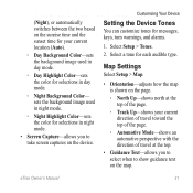
31 sets the background image used in day mode.
◦◦ Day Highlight Color-sets the color for... in night mode.
• Screen Capture-allows you to select when to take screen captures on the device. Map Settings
Select Setup > Map.
• Orientation-adjusts how the map is shown on the page.
◦◦ North Up-shows north at the top of travel at the top...
Owner's Manual - Page 34

... the altimeter to self-calibrate each time you to a GPS compass when you are traveling at a higher rate of speed for a set period of the compass.
• Go To Line (Pointer)-allows you turn the device on the eTrex 30. Customizing Your Device
• Map Datum-sets the coordinate system on which the...
Owner's Manual - Page 37

...
This function is available on the eTrex 20 and eTrex 30. eTrex Owner's Manual
37 Simplifies map presentation for optimal use while fishing.
• Appearance-allows you to set the appearance of bottom contours and depth soundings. Select Setup > Marine.
• Marine ...
Owner's Manual - Page 40
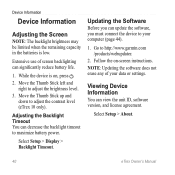
...must connect the device to http://www.garmin.com /products/webupdater.
2. Select Setup > About.
40
eTrex Owner's Manual Extensive use of your computer (page 44).
1. Viewing Device Information
You can significantly ...or settings.
Move the Thumb Stick up and
down to adjust the contrast level (eTrex 10 only). While the device is low. note: Updating the software does not erase any...
Owner's Manual - Page 43

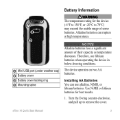
..., and pull up , as instructed in the battery compartment.
➊➋
eTrex Owner's Manual
43 Remove the batteries or battery.
3. Slide the card holder ... Information
Installing a microSD Card The eTrex 20 and eTrex 30 can use microSD cards for more information.
1. It is not compatible with Mac® OS 10.3 and earlier. Also, some maps are available preloaded on memory cards...
Owner's Manual - Page 46

...device within range (10
ft. Select Search for the eTrex 30.
You can ...use the fitness accessory with your data fields to the device. or 3 m) of the ANT+ accessory.
2. Customize your device. Appendix
Appendix
Optional Accessories
Optional accessories, such as BirdsEye satellite imagery, Garmin custom maps, Inland Lakes, TOPO, BlueChart g2, and City Navigator maps...
Owner's Manual - Page 55

...display backlight timeout 30 screen capture 30 settings 30 downloading geocaches 21 software 40 driving routes 37
E editing
profiles 30 routes 12 waypoints 9
eTrex Owner's Manual
elevation plot 19, 20 barometric altimeter...GPS signals 8, 26, 30, 47, 49, 52 turning off 26
H heading settings 34 HomePort 43
Index
hunting times 25
K keys 5, 6
L language 30 locking ring 6
M main menu
customizing 28 map...
Owner's Manual - Page 56

...bearing pointer 18 with course pointer 19 north up 31
O orientation, map 31
P pages 39
adding 39 removing 39 position format 33 power ...52 system settings 30 turning off GPS 26, 27
saving tracks 15
sharing data 24 Sight N' Go 10 software
updating 40 version 40 ...stopwatch 26 storing the device 42 sunrise and sunset times 25, 50 system settings 30
T text size, maps...
Quick Start Manual - Page 2
... a track (page 7).
➊
➋
➌
➍
➎
➊ Zoom keys ➋ Back key ➌ Thumb Stick™ ➍ Menu key
➎ Power and backlight key
2
eTrex 10 Quick Start Manual
Quick Start Manual - Page 3
... for best results.
1.
Turn the D-ring counter-clockwise, and pull up to 70°C) may exceed the usable range of their capacity as temperature decreases.
eTrex 10 Quick Start Manual
3
Therefore, use alkaline, NiMH, or lithium batteries. Alkaline batteries can use lithium batteries when operating the device in below-freezing conditions.
The...
Quick Start Manual - Page 4
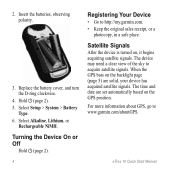
2. Hold (page 2). 5. Turning the Device On or Off
Hold (page 2).
4
Registering Your Device
• Go to acquire satellite signals. When the GPS bars on , it begins acquiring satellite signals. eTrex 10 Quick Start Manual Replace the battery cover, and turn the D-ring clockwise.
4. Select Setup > System > Battery
Type. 6. Select Alkaline, Lithium, or
Rechargeable NiMH...
Quick Start Manual - Page 5
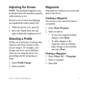
Select an option:
• To save your device based on how you are using the device for geocaching and for navigating on water.
1. Select a waypoint.
3. eTrex 10 Quick Start Manual
5 Move the Thumb Stick left and right to the attribute, and select Done. Select a profile. Select Where To? > Waypoints.
2. Selecting a Profile
Profiles ...
Quick Start Manual - Page 6
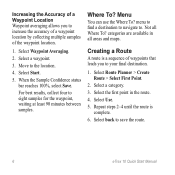
...best results, collect four to the location.
4.
menu to find a destination to navigate to save the route.
6
eTrex 10 Quick Start Manual Select a category. 3. Select the first point in all Where To? Creating a Route
A route....
1. Select Waypoint Averaging.
2. Not all areas and maps. categories are available in the route. 4. When the Sample Confidence status bar reaches 100%, select...
Quick Start Manual - Page 7
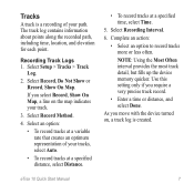
...elevation for each point.
Select Recording Interval.
6. Use this setting only if you select Record, Show On Map, a line on , a track log is a recording of your path.
If you require a very precise... to record tracks more or less often.
eTrex 10 Quick Start Manual
7 Tracks
A track is created. Select Record, Do Not Show or Record, Show On Map. Select Record Method.
4. As you move...
Quick Start Manual - Page 8
... zoom in My Computer on Windows computers and as a mounted volume on the map.
Select a destination. 4. As you travel, the position icon moves.
2.
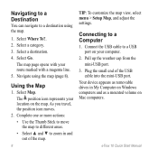
Select Map. Connecting to a destination using the map (page 8). The map page opens with your location on Mac computers.
eTrex 10 Quick Start Manual The position icon represents your route marked with a magenta...
Quick Start Manual - Page 9
... Accessories Optional accessories, such as mounts, maps, and replacement parts, are available at http://buy.garmin.com or from www.garmin .com. If necessary, create an account. 4. note: This does not erase any of the owner's manual from your data or settings. eTrex 10 Quick Start Manual
9 Downloading Geocaches
1. Remove the batteries. 2.
Sign in...
Similar Questions

Mapping And Topo Mapping
I just bought a striker 7cv with the understanding that it had mapping on the unit , it just shows a...
I just bought a striker 7cv with the understanding that it had mapping on the unit , it just shows a...
(Posted by davidgrubb85 7 years ago)

Storage Problem On Gps Etrex 10
When I try to store anything on my eTrex 10, I get this message appear on the screen. "There is not ...
When I try to store anything on my eTrex 10, I get this message appear on the screen. "There is not ...
(Posted by derekhill108 8 years ago)

Unable To Download Gps Co-ordinates To My Etrex 10
I am now longer able to download co-ordinates to my Etrx 10 from the Geocaching website. When I try ...
I am now longer able to download co-ordinates to my Etrx 10 from the Geocaching website. When I try ...
(Posted by annbeattie 10 years ago)

Can't See Topo Maps
I recently purchased TOPO U.S. 24K West. I always see the base maps but no topo/relief maps. The TOP...
I recently purchased TOPO U.S. 24K West. I always see the base maps but no topo/relief maps. The TOP...
(Posted by AAM421 13 years ago)