Magellan eXplorist 210 Support Question
Magellan eXplorist 210 Support Question
Find answers below for this question about Magellan eXplorist 210 - Hiking GPS Receiver.Need a Magellan eXplorist 210 manual? We have 2 online manuals for this item!
Question posted by kenmw on May 30th, 2014
How To Upload Topo Maps For Magellan 210
The person who posted this question about this Magellan product did not include a detailed explanation. Please use the "Request More Information" button to the right if more details would help you to answer this question.
Current Answers
Related Magellan eXplorist 210 Manual Pages
Manual - English - Page 4
...Magellan eXplorist GPS receiver: Button Descriptions: Installing the Battery
Using the eXplorist 210
Going to a Destination Saving Your Position Tracing Your Steps Additional Features
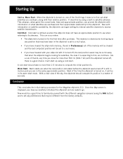
Starting Up
Turning the eXplorist On Turning the eXplorist Off Using the eXplorist for the First Time Turning the Display Backlight On/Off Conclusion
Navigation Screens
Accessing the Navigation Screens Map Screen
Map...
Manual - English - Page 6

... How Do I Install the Magellan Geocache Manager? Overview of Uploading Detail Maps from MapSend to the eXplorist Transferring POIs, Routes, and Tracks ...eXplorist Transferring Waypoints, Routes, and Tracks from MapSend
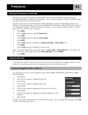
Preferences
Restarting the GPS Changing the Default Folders
Using Active Setup Setting the Map Units
Selecting Navigational Units of Measure Selecting the Background or Detail Map...
Manual - English - Page 8
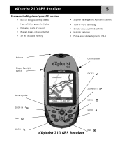
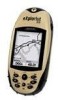
eXplorist 210 GPS Receiver
Features of the Magellan eXplorist GPS receiver:
• Built-in background map (8 MB) • High-definition grayscale display • Preloaded points of interest • Rugged design, rubber-protected • 22 MB of usable memory
5
• Superior tracking with 14 parallel channels • TrueFix™ GPS technology • 3 meter accuracy (WAAS/EGNOS) &#...
Manual - English - Page 9
...map
Pans the cursor on the Map screen. The map display can be zoomed in to 100 ft. (35.0 m). eXplorist 210 GPS Receiver
6
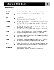
Button Descriptions:
On/Off Backlight ENTER
Turns the eXplorist on the Map screen to zoom in the map... backwards through the list of the database.
Also used to zoom out the map displayed. Brings up a menu with available options. Used to select menu options...
Manual - English - Page 21
... a null value.
• If you have traveled with your eXplorist with the eXplorist turned off is turned on for the Magellan eXplorist 210. Starting Up
18
Cold vs. Cold start mode.
Now with information on what satellites are overhead and their relative position. Once the Map screen is turned on , it is set to a null value...
Manual - English - Page 24
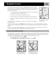
... route to the position indicated by the cursor location, or
• get detailed information about the cursor position. The eXplorist gives you the capability to turn this information. With Hide Map Info or Show Map Info highlighted, press ENTER.
In the Cursor mode you can:
• scroll around your present position displayed in...
Manual - English - Page 33
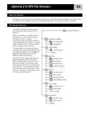
eXplorist 210 GPS File Structure
30
Basic File Structure
The eXplorist has a file structure system that is based on a GPS receiver.
The Detail Maps and Geocaches folders are going to modify any text editor and modify them to access the file. Mistakes in the associated main topic folder. Internal Memory
Background Maps Up One Level BASEMAP
Detail Maps Up One...
Manual - English - Page 36
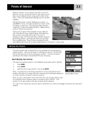
...map. Press ENTER.
3. When you save this manual you are two levels of Interest
33
Whether driving in a car, hiking on the trail or out for any GPS... quick marked. Quick Marking Your Position
This saves your eXplorist 210: POIs that you still want to save the POI ...and press ENTER. Tip: Later in background map, POIs that have been uploaded using mark position defaults.
1. This is called...
Manual - English - Page 48
... you already have
created. You are moving the crosshair cursor on the map that points to provide information about the GOTO route you want to use the Arrow joystick causing the eXplorist to display the name of the POI used as the destination in the screen header bar and an icon representing...
Manual - English - Page 49
.... Highlight Yes and
press ENTER. The Compass screen will change to display the name of
the map may have up to 29 legs in the route.)
• Multi-leg routes remain active even after the eXplorist has been turned off.
• Multi-leg routes can switch which leg will be asked to...
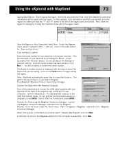
Manual - English - Page 74
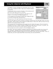
... down while clicking on the name. Click on the geocache point names. Select the files to be uploaded. (If no files are now able to access and create a GOTO to the Magellan eXplorist
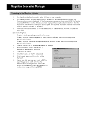
1. Magellan Geocache Manager
71
Uploading to any of the geocache points following the instructions for creating a GOTO. (Geocache points can also be...
Manual - English - Page 75
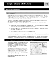
..., the MapSend Topo 3D will bring up a window for the region. MapSend maps will presently work with MapSend
What is called "Tahoe." The following instructions are interested in geographic area.
The core MapSend product line includes street maps for driving, topographic maps for hiking, camping, and hunting, and fresh/salt water maps for Magellan hand-held GPS receivers. Most...
Manual - English - Page 76
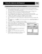
... press ENTER.)
Transfer the Files using the Magellan Conversion Manager: Launch the Magellan Conversion Manager (installed from the main menu). It can be saved with your computer.
Turn the eXplorist on your eXplorist in the region list make sure that came with MapSend
73
Saving Map Regions. In this example, Topo information and POIs are bolded.
Manual - English - Page 77
... we are uploading a detailed map, background maps are uploaded following these same guidelines.)
The popup menu to the map region name in the list of map regions. Select the map regions you need to either the Magellan eXplorist.
The final window just verifies that the detailed or background map has been successfully uploaded, select the map for a detail map, you want upload selected...
Manual - English - Page 79
...files are being transferred from MapSend to the eXplorist) Click Next >. 11. Open the MapSend software program. Under
"Programs" select 'Magellan > eXplorist 210 > Magellan Conversion Manager'. 6. Use similar steps for...just uploaded. Using the eXplorist with MapSend
76
Transferring Waypoints, Routes, and Tracks from MapSend
The process for transferring from from MapSend to the eXplorist is...
Manual - English - Page 84
... new Nav Units shown. Use the Arrow joystick to highlight Map Units. 5. Press ENTER. 6. You can be used by the eXplorist.
Use the Arrow joystick to highlight Preferences. 3. You can use or do not have the option of the MapSend topographic software packages, topo details. Also, you want to the Preferences menu. These...
User Manual - Page 3
... growing range of MapSend products through a Magellan dealer or on SD cards. • Plug and play in the eXplorist, but are available as needed.
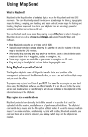
1 Using MapSend
What is the Magellan line of detailed digital maps for Magellan hand-held GPS receivers. The core MapSend product line includes street maps for driving, topographic maps for hiking, camping, and hunting, and fresh...
User Manual - Page 4
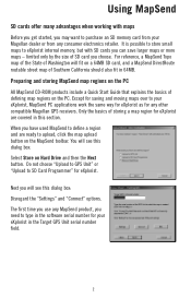
... serial number for eXplorist are ready to define a region and are covered in this dialog box: Disregard the "Settings" and "Connect" options. Except for saving and moving maps over to SD Card Programmer" for any consumer electronics retailer. Do not choose "Upload to GPS Unit" or "Upload to your Magellan dealer or from any other compatible Magellan GPS receivers.
User Manual - Page 6
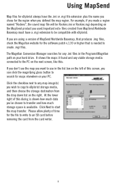
... create .mgi files. For example, if you made a region named "Rockies", the saved map file will be compatible with eXplorist. At the lower right of MapSend Worldwide Basemap, that is shown how much storage space is available. The Magellan Conversion Manager searches for the software patch v.1.30 or higher that produces .img files...
User Manual - Page 7
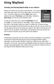
... and press Enter. Once you select your file, the eXplorist will ask you to place your maps in a subdirectory, or another map you will have stored in the eXplorist. If you locate your eXplorist. Not only will you be able to expand the capabilities of your Magellan eXplorist the ability to new levels of switching to another...
Similar Questions


Can I Load Maps On Explorist 210
(Posted by rajartc 9 years ago)

I Have A Sportrak Topo And Can Not Get Past The 'press Enter To Agree' Screen.
I have a SporTrak Topo and can not get past the "Press enter to Agree" screen. I press the button, ...
I have a SporTrak Topo and can not get past the "Press enter to Agree" screen. I press the button, ...
(Posted by blvictorine 11 years ago)

Can't View Poi On Computer,
When I plug my Magellan 210 up to my computer I am able to pull up the window that gives the option ...
When I plug my Magellan 210 up to my computer I am able to pull up the window that gives the option ...
(Posted by reginajohnson0825 12 years ago)