STC GTN 6XX/7XX AFMS
Page 9
..., KS 66062 USA AIRPLANE FLIGHT MANUAL SUPPLEMENT or SUPPLEMENTAL AIRPLANE FLIGHT MANUAL for STC SA02019SE-D GARMIN GTN NAVIGATION SYSTEM 1.4 Definitions The following terminology is used within this document: ADF: Automatic Direction Finder APR: Approach CDI: Course Deviation Indicator DME: Distance Measuring Equipment EFB: Electronic Flight Bag EHSI: Electronic Horizontal Situation Indicator GNSS: Global...
..., KS 66062 USA AIRPLANE FLIGHT MANUAL SUPPLEMENT or SUPPLEMENTAL AIRPLANE FLIGHT MANUAL for STC SA02019SE-D GARMIN GTN NAVIGATION SYSTEM 1.4 Definitions The following terminology is used within this document: ADF: Automatic Direction Finder APR: Approach CDI: Course Deviation Indicator DME: Distance Measuring Equipment EFB: Electronic Flight Bag EHSI: Electronic Horizontal Situation Indicator GNSS: Global...
STC GTN 6XX/7XX AFMS
Page 22
... DATE: _M__A_R_C_H__1_8__,_2_0_1_1__ Page 22 of 31 or its Subsidiaries, c/o Garmin International 1200 E. 151st Street Olathe, KS 66062 USA AIRPLANE FLIGHT MANUAL SUPPLEMENT or SUPPLEMENTAL AIRPLANE FLIGHT MANUAL for STC SA02019SE-D GARMIN GTN NAVIGATION SYSTEM If Alternate Navigation Sources (ILS, LOC, VOR, DME, ADF) Are Available: Navigation USE ALTERNATE SOURCES If No Alternate Navigation...
... DATE: _M__A_R_C_H__1_8__,_2_0_1_1__ Page 22 of 31 or its Subsidiaries, c/o Garmin International 1200 E. 151st Street Olathe, KS 66062 USA AIRPLANE FLIGHT MANUAL SUPPLEMENT or SUPPLEMENTAL AIRPLANE FLIGHT MANUAL for STC SA02019SE-D GARMIN GTN NAVIGATION SYSTEM If Alternate Navigation Sources (ILS, LOC, VOR, DME, ADF) Are Available: Navigation USE ALTERNATE SOURCES If No Alternate Navigation...

Cockpit Reference Guide
Page 34
C SYMBOLS Map Symbols Symbol Description Unknown Airport Non-towered, Non-serviced Airport Towered, Non-serviced Airport Non-towered, Serviced Airport Towered, Serviced Airport Soft Surface, Serviced Airport Soft Surface, Non-serviced Airport Private Airport Heliport Intersection LOM (compass locator at outer marker) NDB (Non-directional Radio Beacon) VOR VOR/DME ILS/DME or DME-only VORTAC TACAN Symbols 28 GTN 625/635/650 Cockpit Reference Guide (CRG) 190-01004-04 Rev.
C SYMBOLS Map Symbols Symbol Description Unknown Airport Non-towered, Non-serviced Airport Towered, Non-serviced Airport Non-towered, Serviced Airport Towered, Serviced Airport Soft Surface, Serviced Airport Soft Surface, Non-serviced Airport Private Airport Heliport Intersection LOM (compass locator at outer marker) NDB (Non-directional Radio Beacon) VOR VOR/DME ILS/DME or DME-only VORTAC TACAN Symbols 28 GTN 625/635/650 Cockpit Reference Guide (CRG) 190-01004-04 Rev.

Pilot's Guide
Page 12
... Approaches with Procedure Turns 6-10 6.6 Flying the Missed Approach 6-10 6.7 Flying an Approach with a Hold 6-11 6.8 Flying a DME Arc Approach 6-12 6.11 ILS Approaches (GTN 650 Only 6-13 6.12 RNAV Approach Procedures 6-14 6.13 Points to Remember for All Procedures 6-15 6.14 Points to Remember for Localizer...7-17 7.7.3 Waypoint Location Based on Radial and Distance 7-18 8 Map 8-1 8.1 Map Menu 8-3 8.1.1 Map Overlays 8-4 8.1.1.1 Topo 8-4 8.1.1.2 Airways 8-4 8.1.1.3 Terrain 8-5 8.1.1.4 NEXRAD (Optional 8-5 x Garmin GTN 625/635/650 Pilot's Guide 190-01004-03 Rev.
... Approaches with Procedure Turns 6-10 6.6 Flying the Missed Approach 6-10 6.7 Flying an Approach with a Hold 6-11 6.8 Flying a DME Arc Approach 6-12 6.11 ILS Approaches (GTN 650 Only 6-13 6.12 RNAV Approach Procedures 6-14 6.13 Points to Remember for All Procedures 6-15 6.14 Points to Remember for Localizer...7-17 7.7.3 Waypoint Location Based on Radial and Distance 7-18 8 Map 8-1 8.1 Map Menu 8-3 8.1.1 Map Overlays 8-4 8.1.1.1 Topo 8-4 8.1.1.2 Airways 8-4 8.1.1.3 Terrain 8-5 8.1.1.4 NEXRAD (Optional 8-5 x Garmin GTN 625/635/650 Pilot's Guide 190-01004-03 Rev.
Pilot's Guide
Page 95
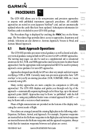
...and Arrival waypoints Appendix are more accurately using GPS. Index 190-01004-03 Rev. 6 Procedures Foreword The GTN 6XX allows you fly an existing procedure (VOR, VOR/DME, NDB, etc.) more complex (in comparison to GPS-only approaches). All available approaches are stored on ... used for primary Traffic approach course guidance for GPS or RNAV approaches. Selections are provided on the Home FPL page. B Garmin GTN 625/635/650 Pilot's Guide 6-1 Terrain Approaches designed specifically for NavData cards is displayed by touching the PROC key on the bottom of flight...
...and Arrival waypoints Appendix are more accurately using GPS. Index 190-01004-03 Rev. 6 Procedures Foreword The GTN 6XX allows you fly an existing procedure (VOR, VOR/DME, NDB, etc.) more complex (in comparison to GPS-only approaches). All available approaches are stored on ... used for primary Traffic approach course guidance for GPS or RNAV approaches. Selections are provided on the Home FPL page. B Garmin GTN 625/635/650 Pilot's Guide 6-1 Terrain Approaches designed specifically for NavData cards is displayed by touching the PROC key on the bottom of flight...

Pilot's Guide
Page 106
... of the flight plan) System and "vtf" appears as a reminder that contain DME arcs are supported by the GTN. Com/Nav FPL Direct-To Proc Wpt Info Map Traffic Terrain Weather Figure 6-19 DME Arc Example Nearest 6.9 Vectors to Final Music With "Vectors-To-Final" (VTF... Xpdr Ctrl below. B 6.8 Foreword Flying a DME Arc Approach Approaches that the approach was activated with vectors-to-final). The GTN will Getting Started provide guidance (left / right) relative to the arc. Messages Symbols Appendix Index 6-12 Garmin GTN 625/635/650 Pilot's Guide 190-01004-03 Rev.
... of the flight plan) System and "vtf" appears as a reminder that contain DME arcs are supported by the GTN. Com/Nav FPL Direct-To Proc Wpt Info Map Traffic Terrain Weather Figure 6-19 DME Arc Example Nearest 6.9 Vectors to Final Music With "Vectors-To-Final" (VTF... Xpdr Ctrl below. B 6.8 Foreword Flying a DME Arc Approach Approaches that the approach was activated with vectors-to-final). The GTN will Getting Started provide guidance (left / right) relative to the arc. Messages Symbols Appendix Index 6-12 Garmin GTN 625/635/650 Pilot's Guide 190-01004-03 Rev.

Pilot's Guide
Page 161
... Intersection VOR Direct-To Proc Wpt Info Map Traffic Terrain Weather VORTAC Nearest VOR/DME Music TACAN DME Utilities System NDB Locator Outer Marker Heliport Messages Symbols Table 8-8 Map Symbols Appendix Index 190-01004-03 Rev. B Garmin GTN 625/635/650 Pilot's Guide 8-31 The identifiers for any on the map, showing the individual sectors...
... Intersection VOR Direct-To Proc Wpt Info Map Traffic Terrain Weather VORTAC Nearest VOR/DME Music TACAN DME Utilities System NDB Locator Outer Marker Heliport Messages Symbols Table 8-8 Map Symbols Appendix Index 190-01004-03 Rev. B Garmin GTN 625/635/650 Pilot's Guide 8-31 The identifiers for any on the map, showing the individual sectors...

Pilot's Guide
Page 325
17 Symbols Foreword The following tables describe the symbols that are found on the Map Getting display. B Garmin GTN 625/635/650 Pilot's Guide 17-1 Started 17.1 Map Page Symbols Xpdr Ctrl Symbol Description Unknown Airport Non-towered, Non-serviced Airport Towered, Non-...-serviced Airport Traffic Private Airport Terrain Heliport Intersection LOM (compass locator at outer marker) NDB (Non-directional Radio Beacon) VOR VOR/DME ILS/DME or DME-only VORTAC TACAN Table 17-1 Map Page Symbols Weather Nearest Music Utilities System Messages Symbols Appendix Index 190-01004-03 Rev.
17 Symbols Foreword The following tables describe the symbols that are found on the Map Getting display. B Garmin GTN 625/635/650 Pilot's Guide 17-1 Started 17.1 Map Page Symbols Xpdr Ctrl Symbol Description Unknown Airport Non-towered, Non-serviced Airport Towered, Non-...-serviced Airport Traffic Private Airport Terrain Heliport Intersection LOM (compass locator at outer marker) NDB (Non-directional Radio Beacon) VOR VOR/DME ILS/DME or DME-only VORTAC TACAN Table 17-1 Map Page Symbols Weather Nearest Music Utilities System Messages Symbols Appendix Index 190-01004-03 Rev.

Pilot's Guide
Page 332
... CUM Proc Wpt Info Map Traffic DALT DB, DBASE DCLTR, DECLTR deg DEP Desired Track (DTK) Terrain Weather DEST DFLT DIS Distance Nearest Music Utilities DME DP DPRT DSBL DTK System EDR Messages EGNOS Symbols ELEV EMI Appendix ENR Index 18-2 clear configuration The line between two points to be followed... Procedure departure disabled Desired Track Excessive Descent Rate Provides SBAS service for most of Europe and parts of North Africa elevation Electromagnetic Interference en route Garmin GTN 625/635/650 Pilot's Guide 190-01004-03 Rev. B
... CUM Proc Wpt Info Map Traffic DALT DB, DBASE DCLTR, DECLTR deg DEP Desired Track (DTK) Terrain Weather DEST DFLT DIS Distance Nearest Music Utilities DME DP DPRT DSBL DTK System EDR Messages EGNOS Symbols ELEV EMI Appendix ENR Index 18-2 clear configuration The line between two points to be followed... Procedure departure disabled Desired Track Excessive Descent Rate Provides SBAS service for most of Europe and parts of North Africa elevation Electromagnetic Interference en route Garmin GTN 625/635/650 Pilot's Guide 190-01004-03 Rev. B

Pilot's Guide
Page 350
...-23 Departures 10-16 Departure time 14-9 Destination proximity 15-21 Direct-To 1-5, 1-15, 5-1 Direct-To Fpl Wpt 5-3 Direct-To Nrst Airport 5-4 Distance 8-10 DME 17-1 DME Arc 6-12 Don't sink 10-14, 10-17 Dual installation 1-13 E Echo tops 11-6, 11-12 Edit flight plan 4-20, 8-26 Edit FPL data fields... 12-1, 12-12 Fuel planning 14-18 Fuel settings 1-7, 15-23 G GDC 74A ii GDL 69/69A iii, 8-19, 13-1, 13-2, 13-8, 15-12 Index-2 Garmin GTN 625/635/650 Pilot's Guide 190-01004-03 Rev.
...-23 Departures 10-16 Departure time 14-9 Destination proximity 15-21 Direct-To 1-5, 1-15, 5-1 Direct-To Fpl Wpt 5-3 Direct-To Nrst Airport 5-4 Distance 8-10 DME 17-1 DME Arc 6-12 Don't sink 10-14, 10-17 Dual installation 1-13 E Echo tops 11-6, 11-12 Edit flight plan 4-20, 8-26 Edit FPL data fields... 12-1, 12-12 Fuel planning 14-18 Fuel settings 1-7, 15-23 G GDC 74A ii GDL 69/69A iii, 8-19, 13-1, 13-2, 13-8, 15-12 Index-2 Garmin GTN 625/635/650 Pilot's Guide 190-01004-03 Rev.