

Navigation Manual
Page 3
... guidance prompt, cancel the map scrolling feature, or show the current position. BASIC OPERATION PWR•VOL VO VOICE NAVIGATION MAP VOICE WM W MA 300ft GPS DEST DE ES ST MENU ME EN NU TUNE TUN NE S SEEK E EEK TRACK TR RAC RA CK AUDIO AU DIO D DISP TILT AM•...; AM M• M •S SAT S SAT FM F M DISC• DISC C•A A AUX AUX TOYOTA TOY YO YO OTA OT A INFO INF IN FO £ NORTH-UP OR COMPASS MODE Icon Touch to magnify or reduce the map scale. ZOOM...
... guidance prompt, cancel the map scrolling feature, or show the current position. BASIC OPERATION PWR•VOL VO VOICE NAVIGATION MAP VOICE WM W MA 300ft GPS DEST DE ES ST MENU ME EN NU TUNE TUN NE S SEEK E EEK TRACK TR RAC RA CK AUDIO AU DIO D DISP TILT AM•...; AM M• M •S SAT S SAT FM F M DISC• DISC C•A A AUX AUX TOYOTA TOY YO YO OTA OT A INFO INF IN FO £ NORTH-UP OR COMPASS MODE Icon Touch to magnify or reduce the map scale. ZOOM...

Navigation Manual
Page 86
Upon reception of GPS signals, it is dimmed, the route cannot avoid including a freeway in some cases. DESTINATION SEARCH D Edit route INFORMATION D Even if the "Freeways" indicator is automatically corrected. "Add 84.) "Delete 85.) "Reorder 84.) "Preferences 89) 75 Touch "Edit Route". After you travel by ferry, the route guidance shows a sea route. D If the calculated route includes a trip by ferry, the current vehicle position may be incorrect.
Upon reception of GPS signals, it is dimmed, the route cannot avoid including a freeway in some cases. DESTINATION SEARCH D Edit route INFORMATION D Even if the "Freeways" indicator is automatically corrected. "Add 84.) "Delete 85.) "Reorder 84.) "Preferences 89) 75 Touch "Edit Route". After you travel by ferry, the route guidance shows a sea route. D If the calculated route includes a trip by ferry, the current vehicle position may be incorrect.

Navigation Manual
Page 332
... the database, you there. If a destination is designed to ensure proper use. Keep this manual carefully to select efficient routes from the Global Positioning System (GPS) operated by the U.S. Department of the Navigation System. The system is also designed to direct you to turn in locating a desired destination. The audio instructions...
... the database, you there. If a destination is designed to ensure proper use. Keep this manual carefully to select efficient routes from the Global Positioning System (GPS) operated by the U.S. Department of the Navigation System. The system is also designed to direct you to turn in locating a desired destination. The audio instructions...

Navigation Manual
Page 357
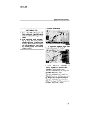
...a map of the map screen. While driving, the current vehicle position mark is automatically corrected after the vehicle receives signals from the GPS, the correct current position is displayed first. If the current position is not correct, it is fixed on the screen and the map...screen, depending on a new vehicle, the current position may not be viewed. The current position is automatically set as the system receives signals from the GPS. 1U5057F : : To view the previous page. 10 05.28 BASIC FUNCTIONS Function help Explanations for the functions of the map ( 2 ). Map screen...
...a map of the map screen. While driving, the current vehicle position mark is automatically corrected after the vehicle receives signals from the GPS, the correct current position is displayed first. If the current position is not correct, it is fixed on the screen and the map...screen, depending on a new vehicle, the current position may not be viewed. The current position is automatically set as the system receives signals from the GPS. 1U5057F : : To view the previous page. 10 05.28 BASIC FUNCTIONS Function help Explanations for the functions of the map ( 2 ). Map screen...
Navigation Manual
Page 393
..., touch "3 Routes". 2U5064F 2. This route is indicated by ferry, the current vehicle position may be incorrect. "Info.": To display the following information about each of GPS signals, it is indicated by a green line. 10 05.28 DESTINATION SEARCH 3 ROUTES SELECTION INFORMATION D Even if the "Allow Freeway" indicator is dimmed, the route...
..., touch "3 Routes". 2U5064F 2. This route is indicated by ferry, the current vehicle position may be incorrect. "Info.": To display the following information about each of GPS signals, it is indicated by a green line. 10 05.28 DESTINATION SEARCH 3 ROUTES SELECTION INFORMATION D Even if the "Allow Freeway" indicator is dimmed, the route...

Navigation Manual
Page 400
... of a mile, make a legal U−turn if the distance between two one−way roads (of opposite directions) is now finished." 1 "In half of poor GPS signal reception), the voice guidance may be made early or delayed. "You have arrived at your destination. 10 05.28 ROUTE GUIDANCE One −way...
... of a mile, make a legal U−turn if the distance between two one−way roads (of opposite directions) is now finished." 1 "In half of poor GPS signal reception), the voice guidance may be made early or delayed. "You have arrived at your destination. 10 05.28 ROUTE GUIDANCE One −way...

Navigation Manual
Page 445
Touch "Position/Direction". 4. Touch either or to the desired point on the map. 117 Touch the eight directional touch screen button to move the cursor to adjust the direction of the current vehicle position mark. 5. The map screen will be displayed. 4U5082F 2. Touch "Enter". 4U5083F 4U5081F 1. Touch "Enter". If GPS reception is poor due to location, you can manually adjust the current vehicle position mark. 3. 10 05.28 ADVANCED FUNCTIONS POSITION/DIRECTION CALIBRATION When driving, the current vehicle position mark will be automatically corrected by GPS signals.
Touch "Position/Direction". 4. Touch either or to the desired point on the map. 117 Touch the eight directional touch screen button to move the cursor to adjust the direction of the current vehicle position mark. 5. The map screen will be displayed. 4U5082F 2. Touch "Enter". 4U5083F 4U5081F 1. Touch "Enter". If GPS reception is poor due to location, you can manually adjust the current vehicle position mark. 3. 10 05.28 ADVANCED FUNCTIONS POSITION/DIRECTION CALIBRATION When driving, the current vehicle position mark will be automatically corrected by GPS signals.

Navigation Manual
Page 510
...level of the antenna in the instrument panel. Tunnels, tall buildings, trucks, or even the placement of objects on the map display. The GPS satellites may not be expected. However, the accurate position may not send signals due to repairs or improvements being made to 300 feet (100... m) can and should be shown depending on vehicles equipped with GPS signal reception of inaccuracy. 10 05.28 APPENDIX Limitations of the navigation system This navigation system calculates the current vehicle position using 4 ...
...level of the antenna in the instrument panel. Tunnels, tall buildings, trucks, or even the placement of objects on the map display. The GPS satellites may not be expected. However, the accurate position may not send signals due to repairs or improvements being made to 300 feet (100... m) can and should be shown depending on vehicles equipped with GPS signal reception of inaccuracy. 10 05.28 APPENDIX Limitations of the navigation system This navigation system calculates the current vehicle position using 4 ...

Navigation Manual
Page 511
... the system will display a route returning to the right or left. D When driving on a small angled Y− shaped road. INFORMATION If your vehicle cannot receive GPS signals, you set more . In auto reroute, a detour route may not be changed. D After auto reroute, the route may be shown. D When using tires that...
... the system will display a route returning to the right or left. D When driving on a small angled Y− shaped road. INFORMATION If your vehicle cannot receive GPS signals, you set more . In auto reroute, a detour route may not be changed. D After auto reroute, the route may be shown. D When using tires that...

Navigation Manual
Page 523
... indicates your eyes on the road and are timed to provide enough time to allow you to select efficient routes from the Global Positioning System (GPS) operated by the U.S. These voice instructions will provide both a visual map and audio instructions. The navigation system is not in approaching an intersection. The navigation...
... indicates your eyes on the road and are timed to provide enough time to allow you to select efficient routes from the Global Positioning System (GPS) operated by the U.S. These voice instructions will provide both a visual map and audio instructions. The navigation system is not in approaching an intersection. The navigation...

Navigation Manual
Page 528
Touch this mark is received. Touch this button to magnify the map scale. Touch this button to obtain a broader view. XMr NavTraffic mark "GPS" mark (Global Positioning System) This mark is displayed when XMr NavTraffic information is displayed. 73 118 17 18 182 6 Touch this button ... register the current position or the cursor position as a memory point. They are not displayed. Whenever the vehicle is receiving signals from the GPS, this button to browse information about guidance route, to set the Points of the buttons on the screen, or to destination estimated arrival time...
Touch this mark is received. Touch this button to magnify the map scale. Touch this button to obtain a broader view. XMr NavTraffic mark "GPS" mark (Global Positioning System) This mark is displayed when XMr NavTraffic information is displayed. 73 118 17 18 182 6 Touch this button ... register the current position or the cursor position as a memory point. They are not displayed. Whenever the vehicle is receiving signals from the GPS, this button to browse information about guidance route, to set the Points of the buttons on the screen, or to destination estimated arrival time...